NASA Goddard Space Flight Center · 航天照片图库

NASA Goddard Space Flight Center · 航天照片图库,仅列出本次快照中实际生成且可访问的资料。

资料最后更新时间:

集合条目总数
122
当前页码
2
NASA Goddard Space Flight Center · 航天照片图库:共收录 122 项实际生成的公开资料,本页为第 2 页,共 3 页。
航天图片资料 · 5e016eec3a4606df
航天图片资料 · DALI
航天图片资料 · 6175e9fafb0fb17b
航天图片资料 · 624168a2481d0157
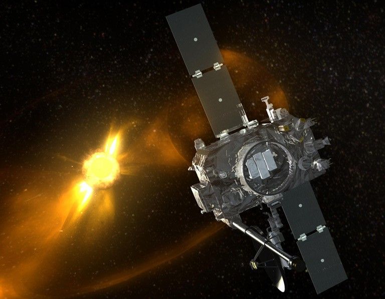
航天图片资料 · STEREO spacecraft in orbit at the Sun.
航天图片资料 · 63f15fbc0624e329
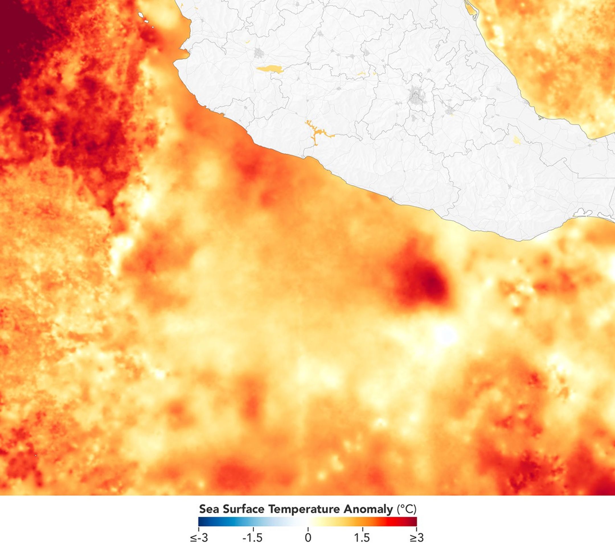
航天图片资料 · A map depicts sea surface temperature anomalies off Mexico's Pacific coast on September 23. Deep red areas highlight areas 3°C above the norm for that date. A dotted line traces the storm's path from September 20 to September 23 as it moved through the unusually warm waters.
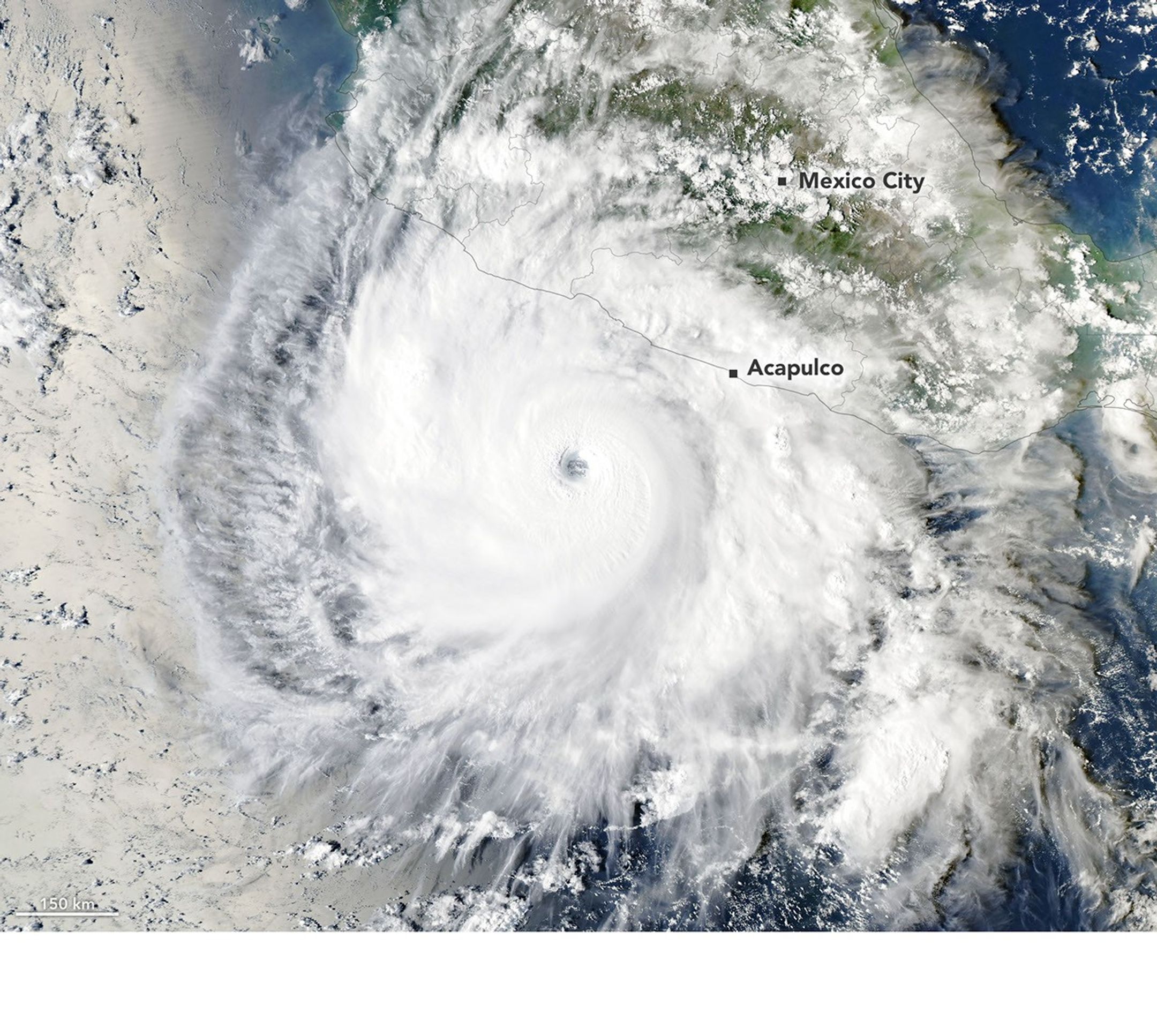
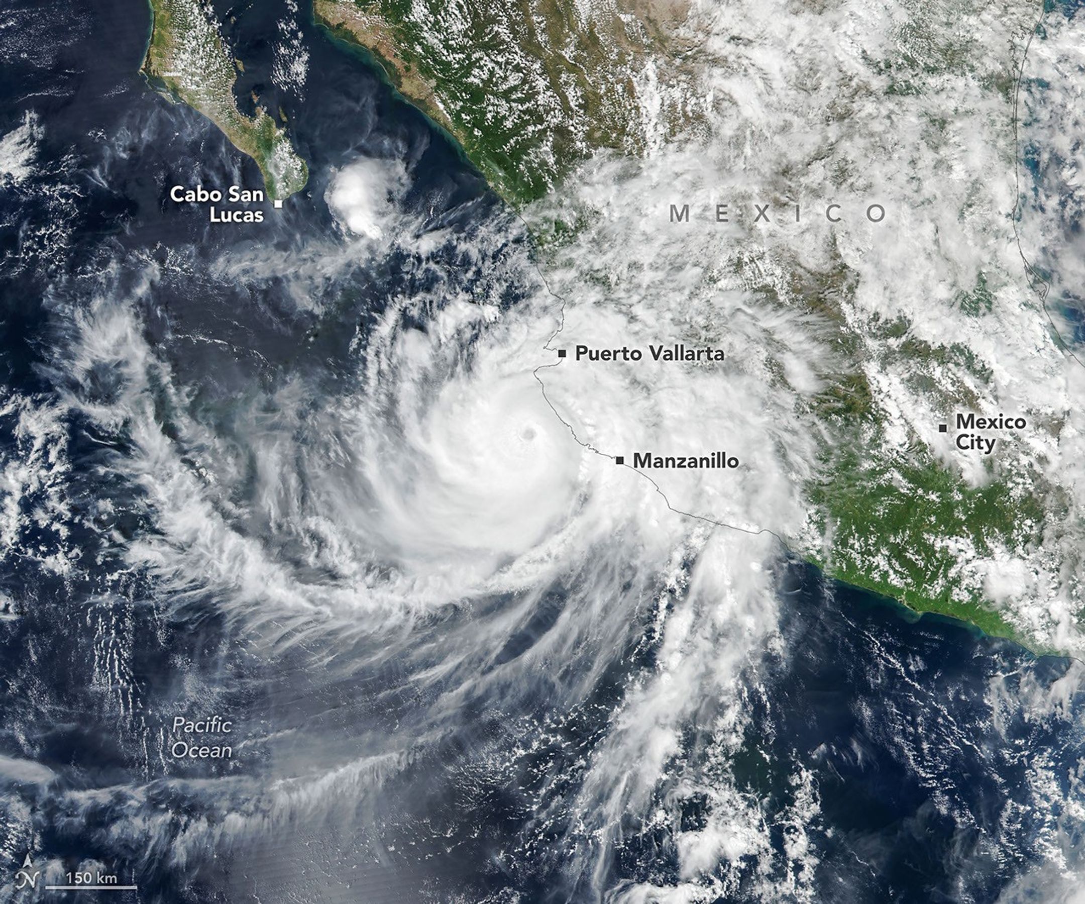
航天图片资料 · Hurricane Polo, with a well-defined eye, swirls over the Pacific Ocean off the coast of Mexico. The storm was positioned just south of Acapulco, with its outer cloud bands extending inland toward Mexico City.
航天图片资料 · 66c5ab1667c4c031
航天图片资料 · 672ef759fa65f29c
航天图片资料 · The well-defined eye of Hurricane Simon lies just off Mexico’s Pacific coast. Some outer cloud bands of the spiraling storm extend over land.
航天图片资料 · Nancy Grace Roman, shown here at NASA's Goddard Space Flight Center in approximately 1972, was the first female executive and the first Chief of Astronomy at NASA. Image: NASA
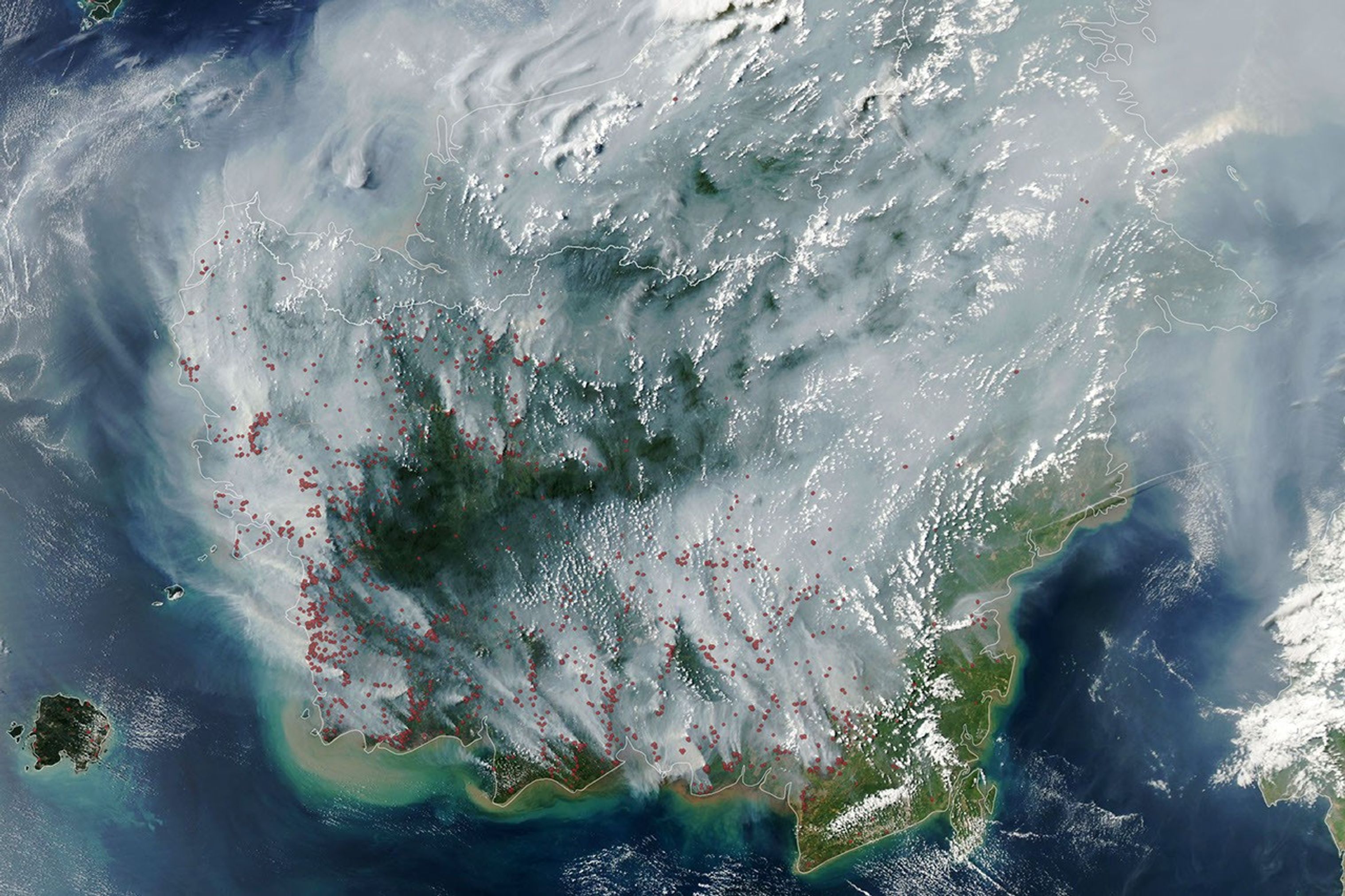
航天图片资料 · The locations of MODIS fire detections are depicted with small red circles. Most are visible on the southern side of the island.
航天图片资料 · 7454752309f6577d
航天图片资料 · 79bb2f8d3176f3dd
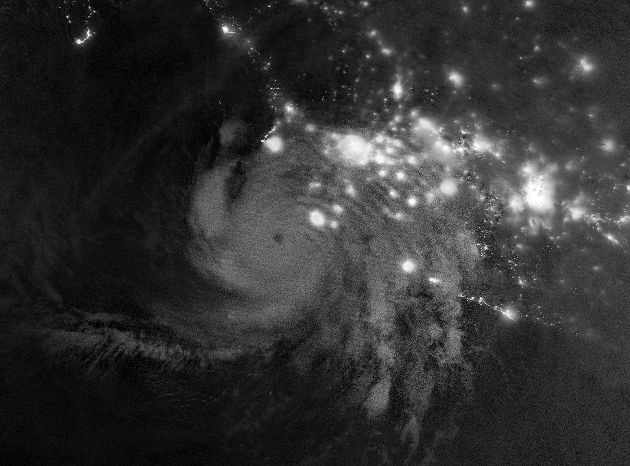
航天图片资料 · Gravity waves in the upper atmosphere appear as a semicircle of ripples in a nighttime, grayscale satellite image. Hurricane clouds and city lights in Mexico are also visible.
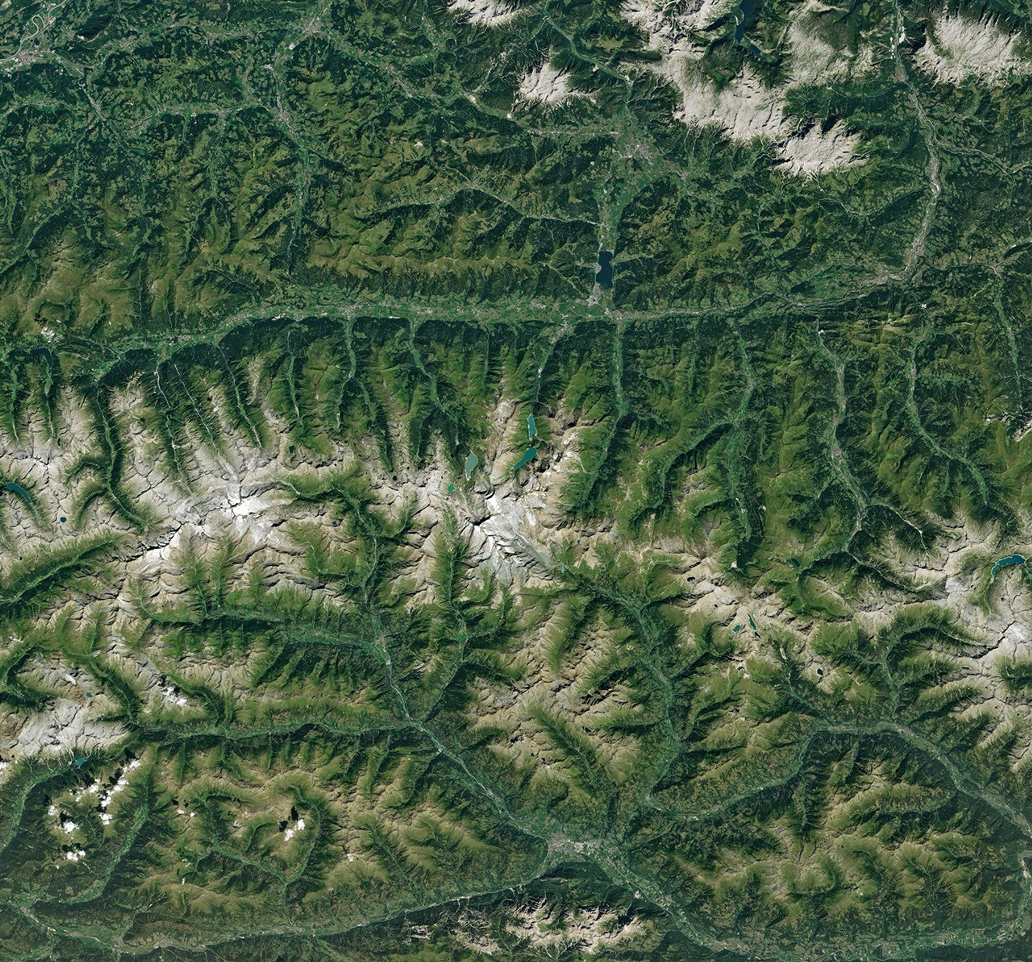
航天图片资料 · Ice in a broad Alpine basin connects with a short, narrow stretch of glacial ice in the valley below through one small icefall. Lakes fill much of the valley beyond the glacier’s terminus.
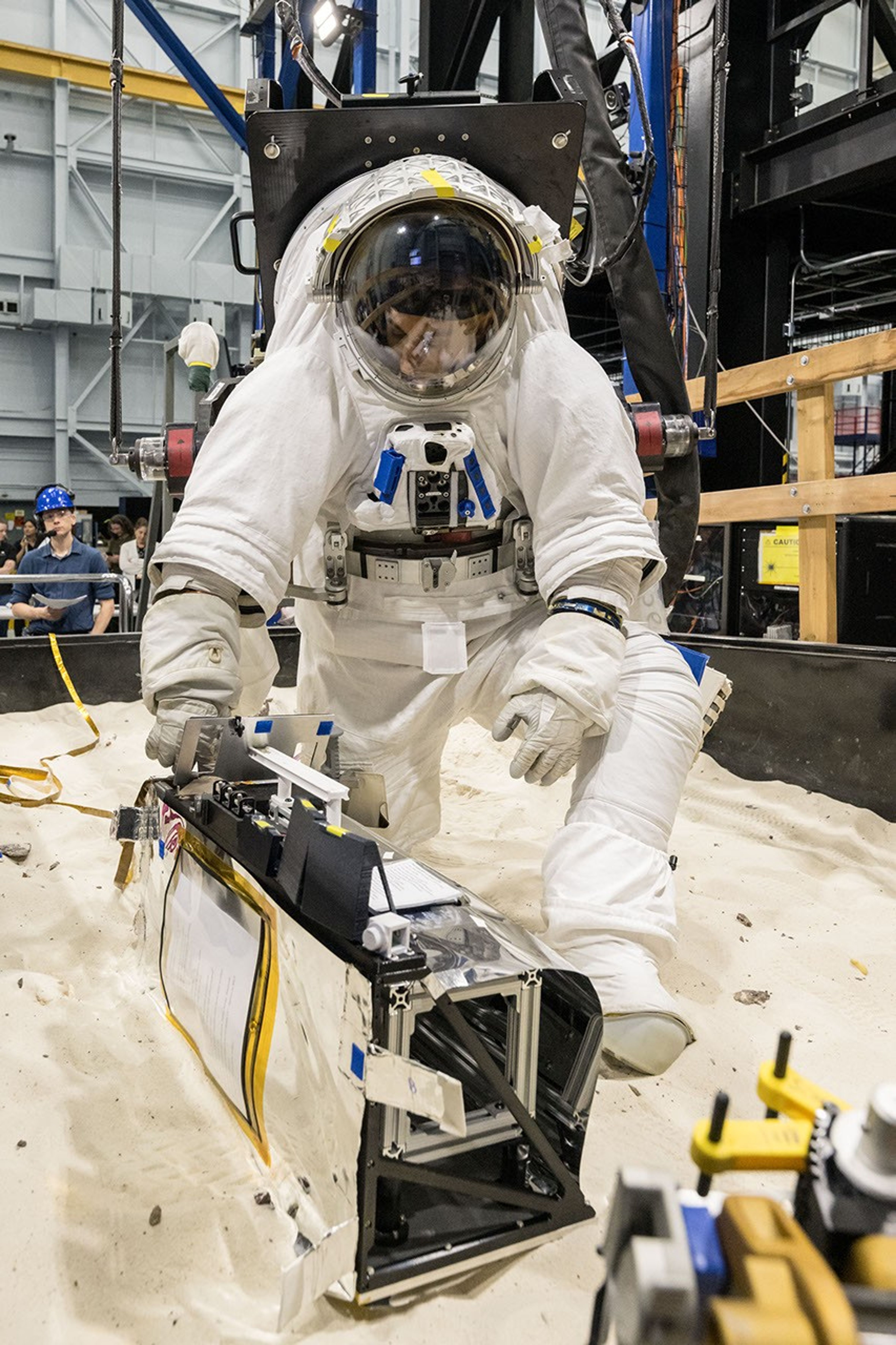
航天图片资料 · An astronaut in a white spacesuit kneels in simulated lunar soil while working with scientific equipment in a large testing facility. Staff members and support structures are visible in the background.
航天图片资料 · 86ad2250f833782a
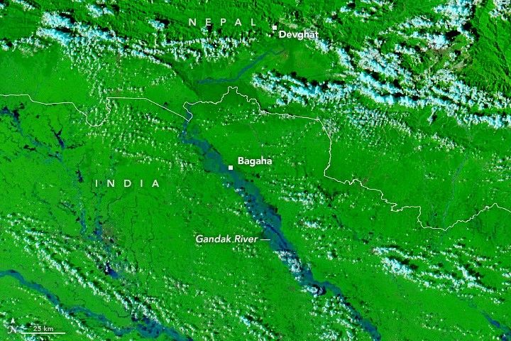
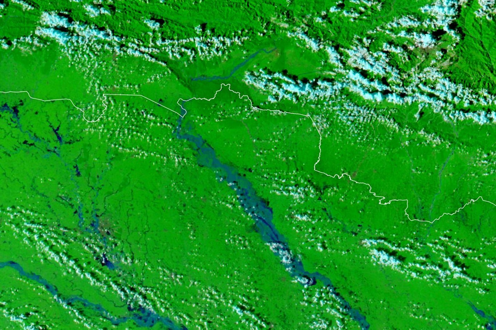
航天图片资料 · A false-color satellite image shows the same area during the flooding on September 29, 2026. The river appears much wider.
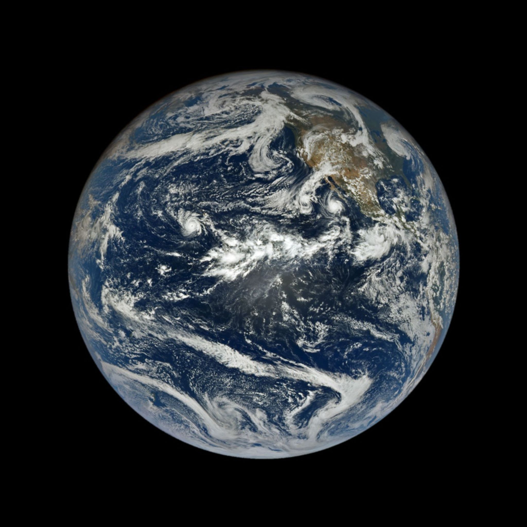
航天图片资料 · In a full-disk satellite view of Earth, several tropical cyclones swirl above the blue waters of the Pacific Ocean.
航天图片资料 · 8d7099b2a0120061
航天图片资料 · 8e017635e8a38bd4
航天图片资料 · 90105af6e5c859bf
航天图片资料 · 98bf17c7542ae8b1
航天图片资料 · 999c50f219c38c44
航天图片资料 · 9bed40ad169adfe7
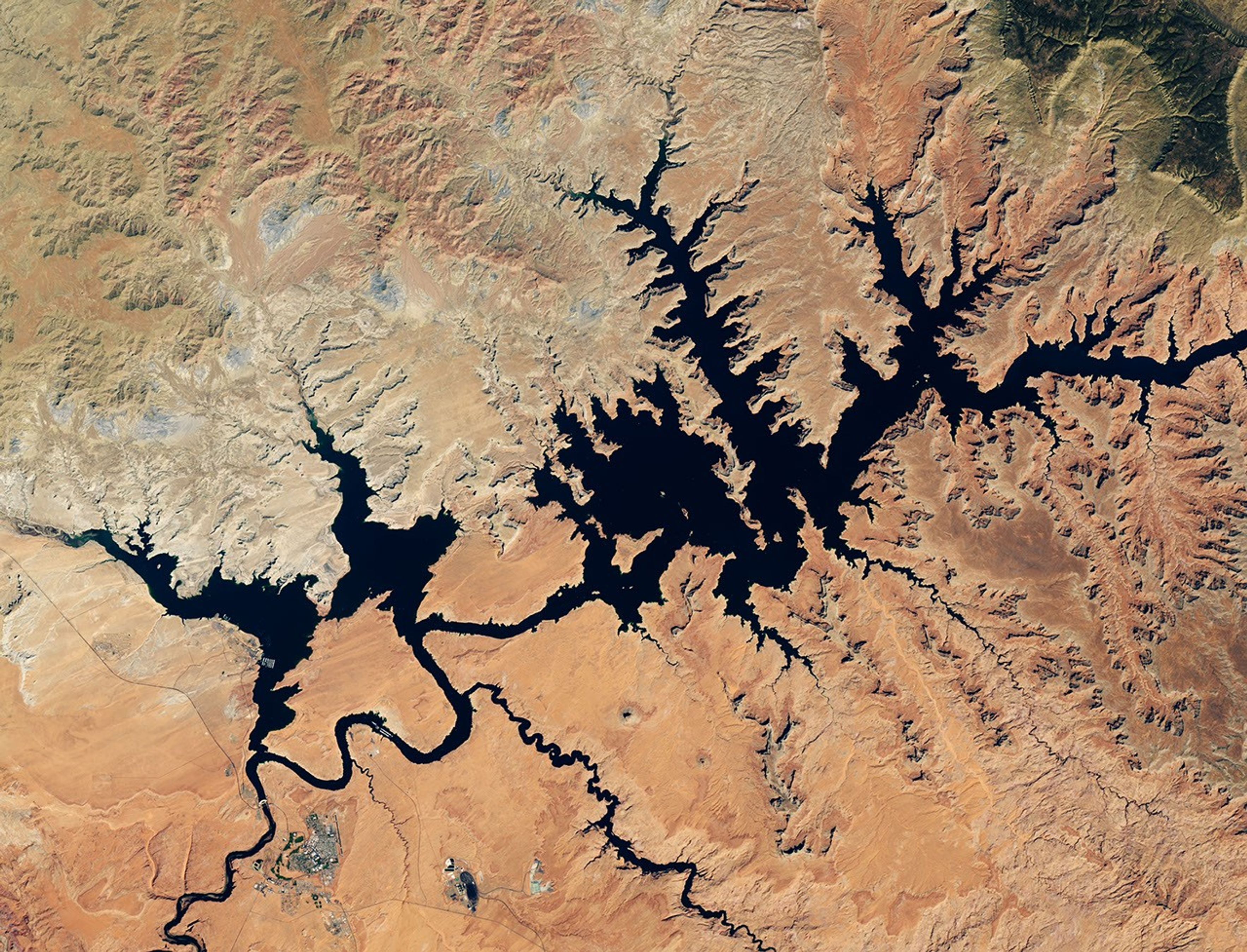
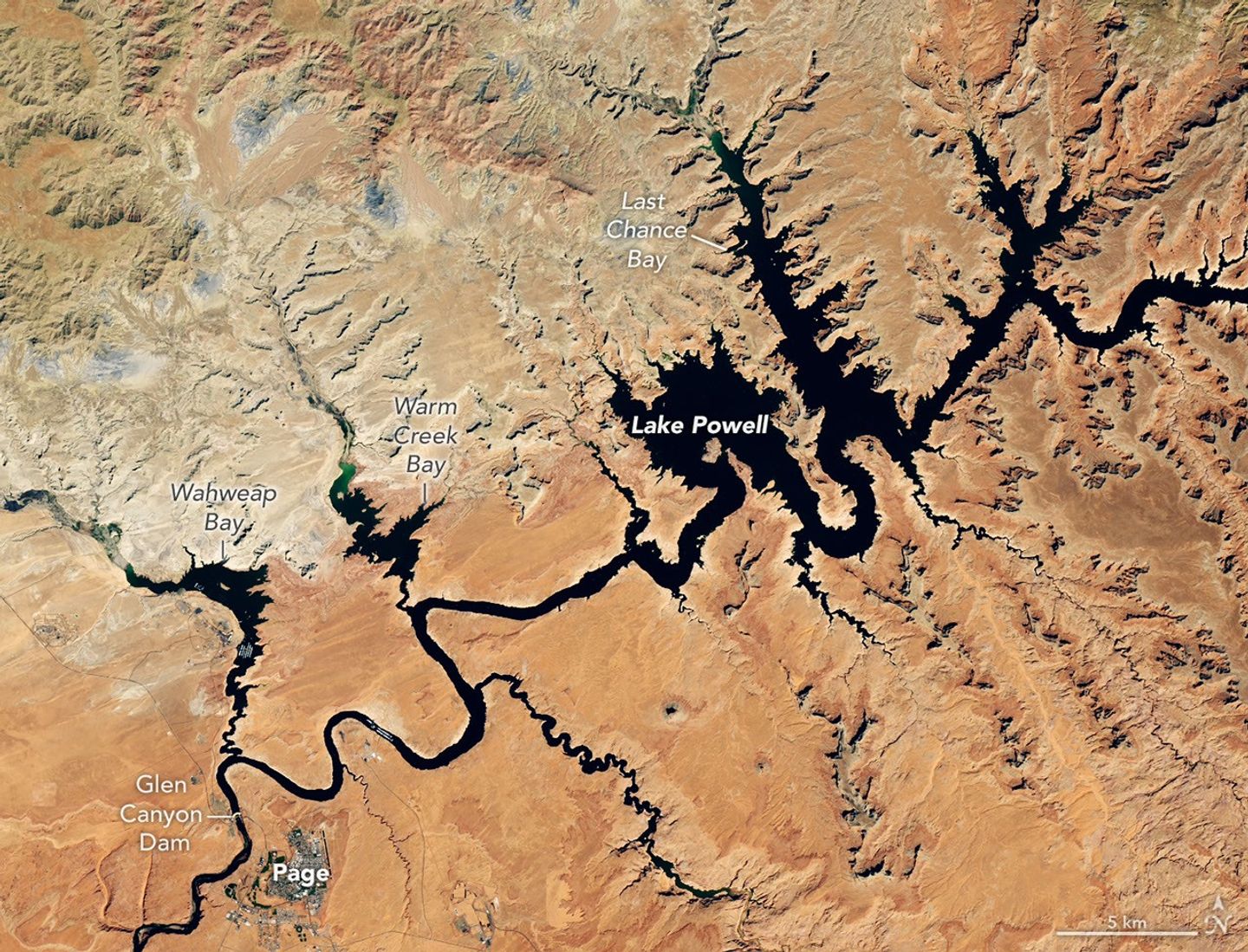
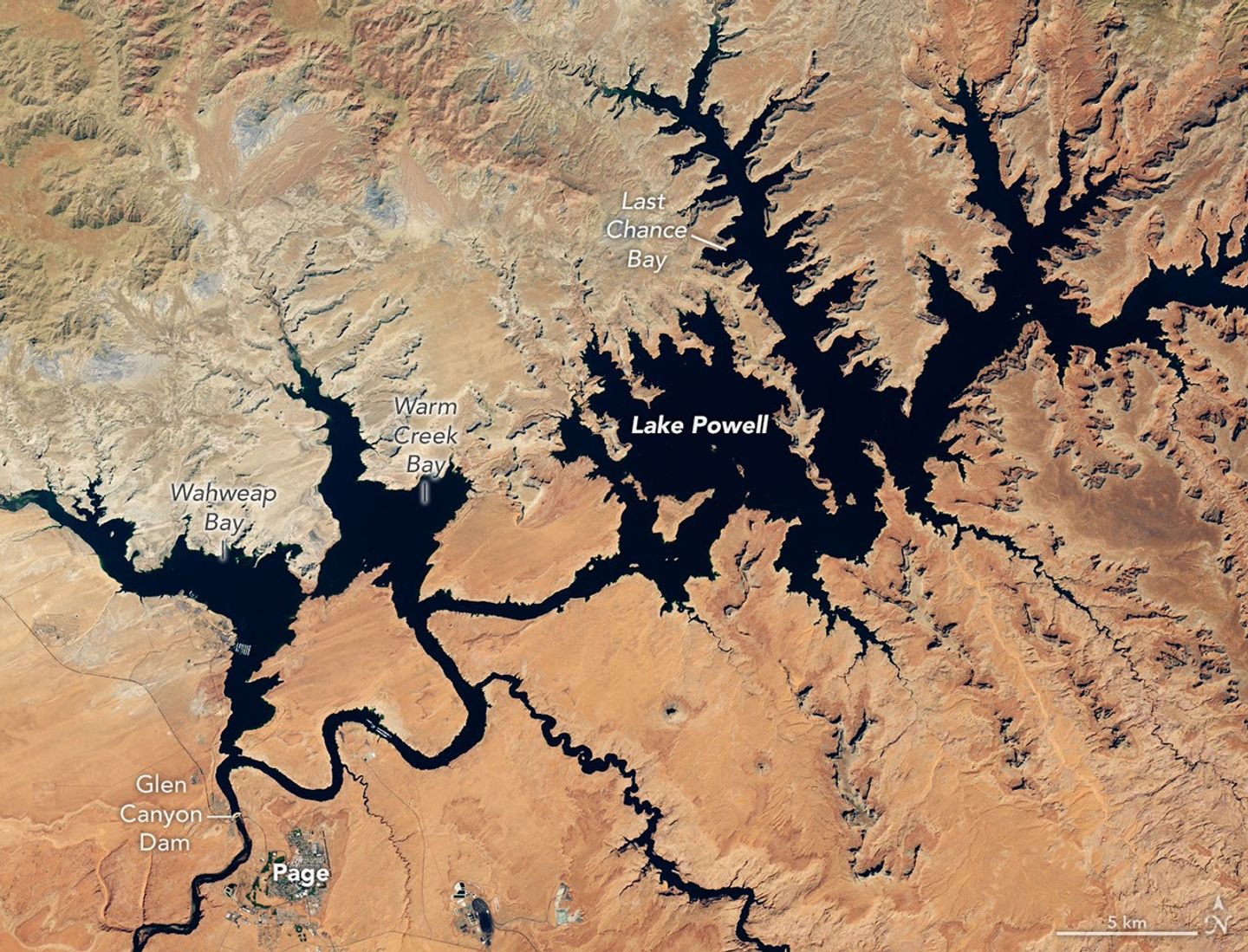
航天图片资料 · Dark blue water in Lake Powell fills several bays and branching canyons amid a light orange desert landscape. The Glen Canyon Dam and the town of Page, Arizona, are visible in the lower left.
航天图片资料 · a027f59158f70fee
航天图片资料 · a241118acb3cb514
航天图片资料 · a293d4042f5550fc
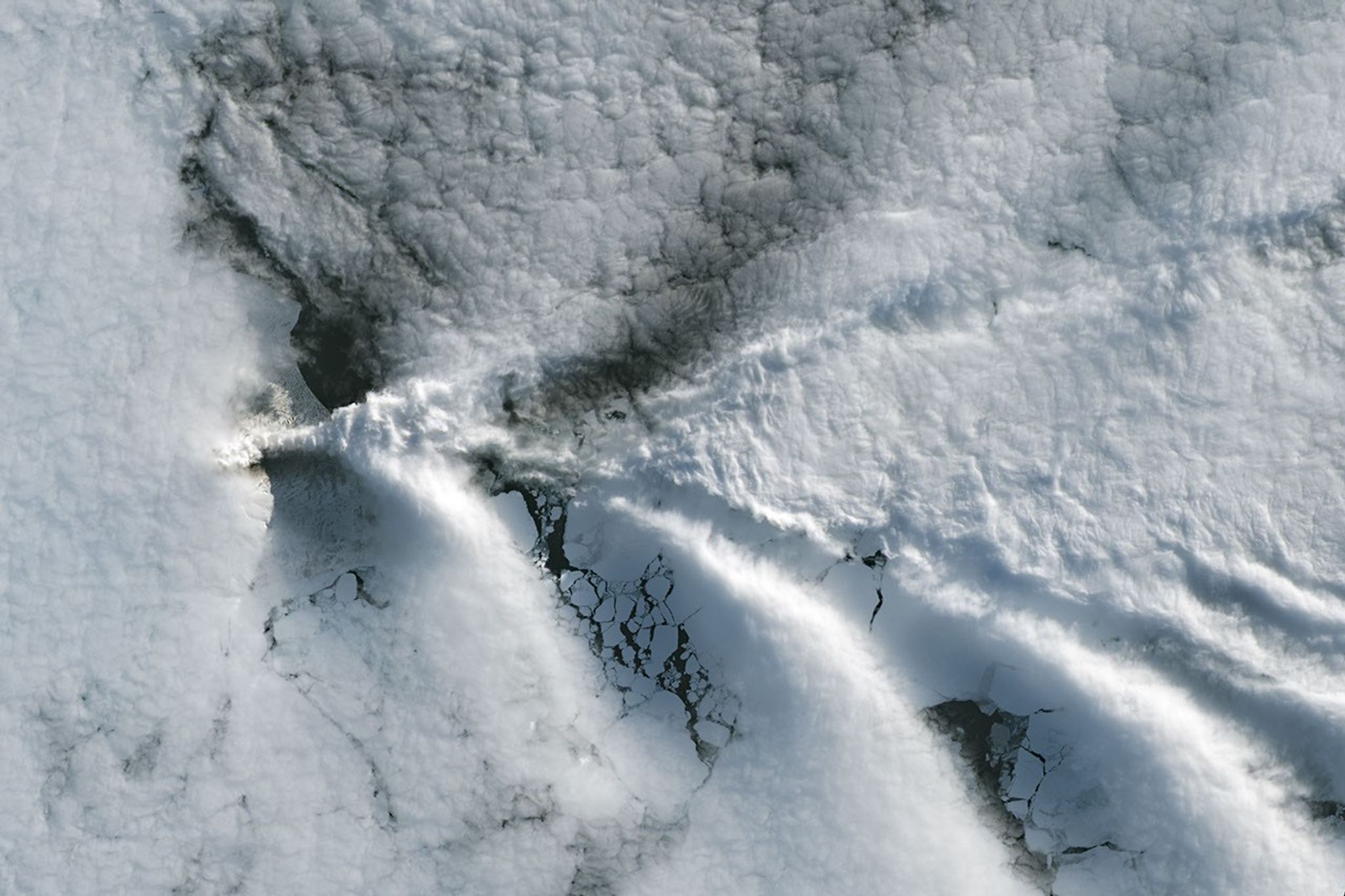
航天图片资料 · A series of V-shaped wave clouds appears over an ocean filled with pieces of sea ice.
航天图片资料 · A technician in a white clean-room suit and blue gloves uses a small flashlight to inspect a spacecraft instrument inside a dark testing chamber. Colorful wires and metallic components surround the instrument.
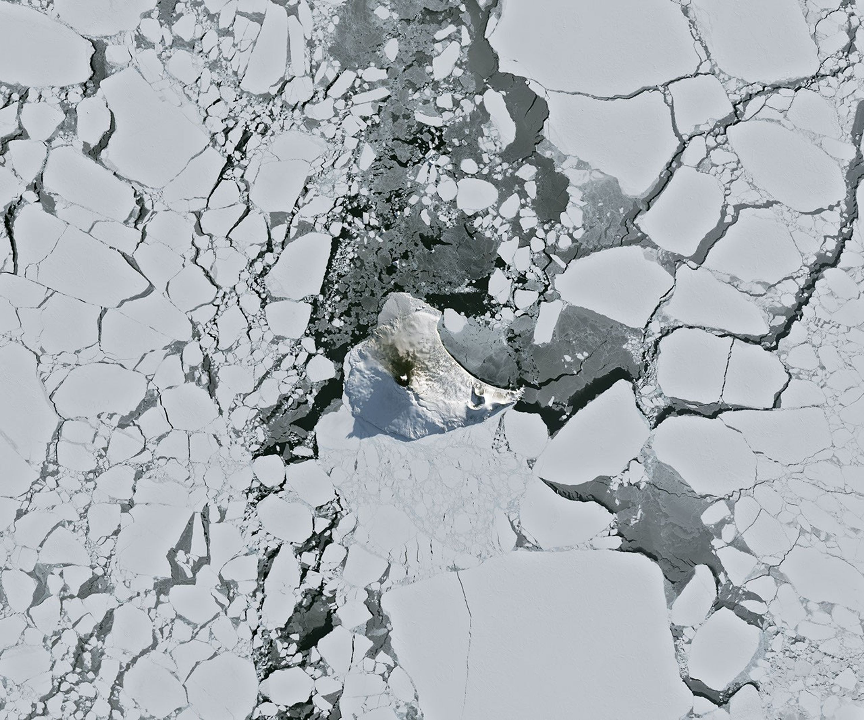
航天图片资料 · A small ice- and snow-covered island with an active volcanic crater at its center is surrounded by drifting pieces of sea ice. A thermal signal and small plume appear in the crater, and ash darkens the snow on the volcano’s northern slopes.
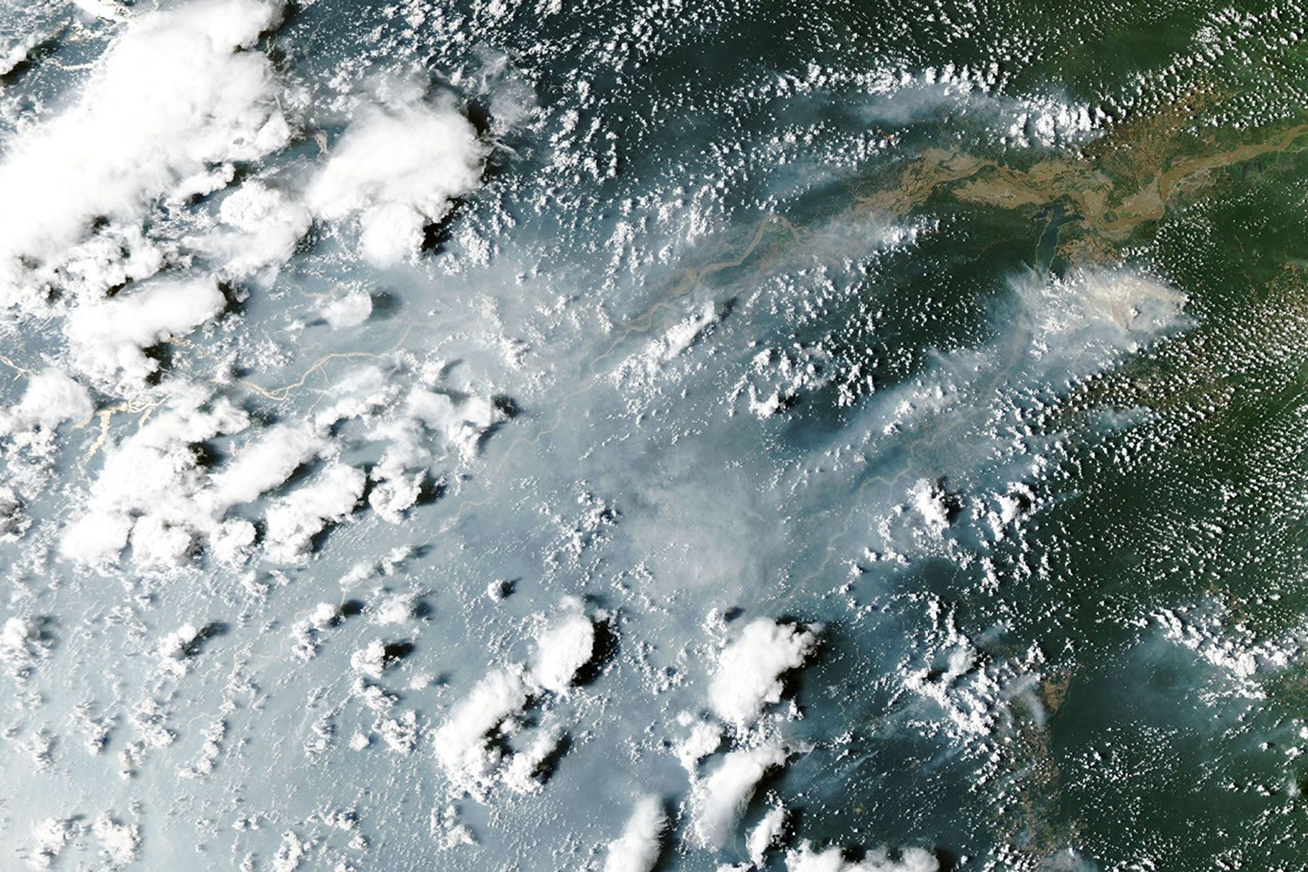
航天图片资料 · Thick gray smoke partially obscures the Amazon River and surrounding rainforest near the cities of Manaus and Santarém. Puffy white clouds rise above the smoke on the left side of the image.
航天图片资料 · aaf79c1b870fe2db
航天图片资料 · ad65596ecb45a270
航天图片资料 · adabd3a7b1226267
航天图片资料 · A false-color satellite image shows the same area during the flooding on September 29, 2026. The river appears much wider.
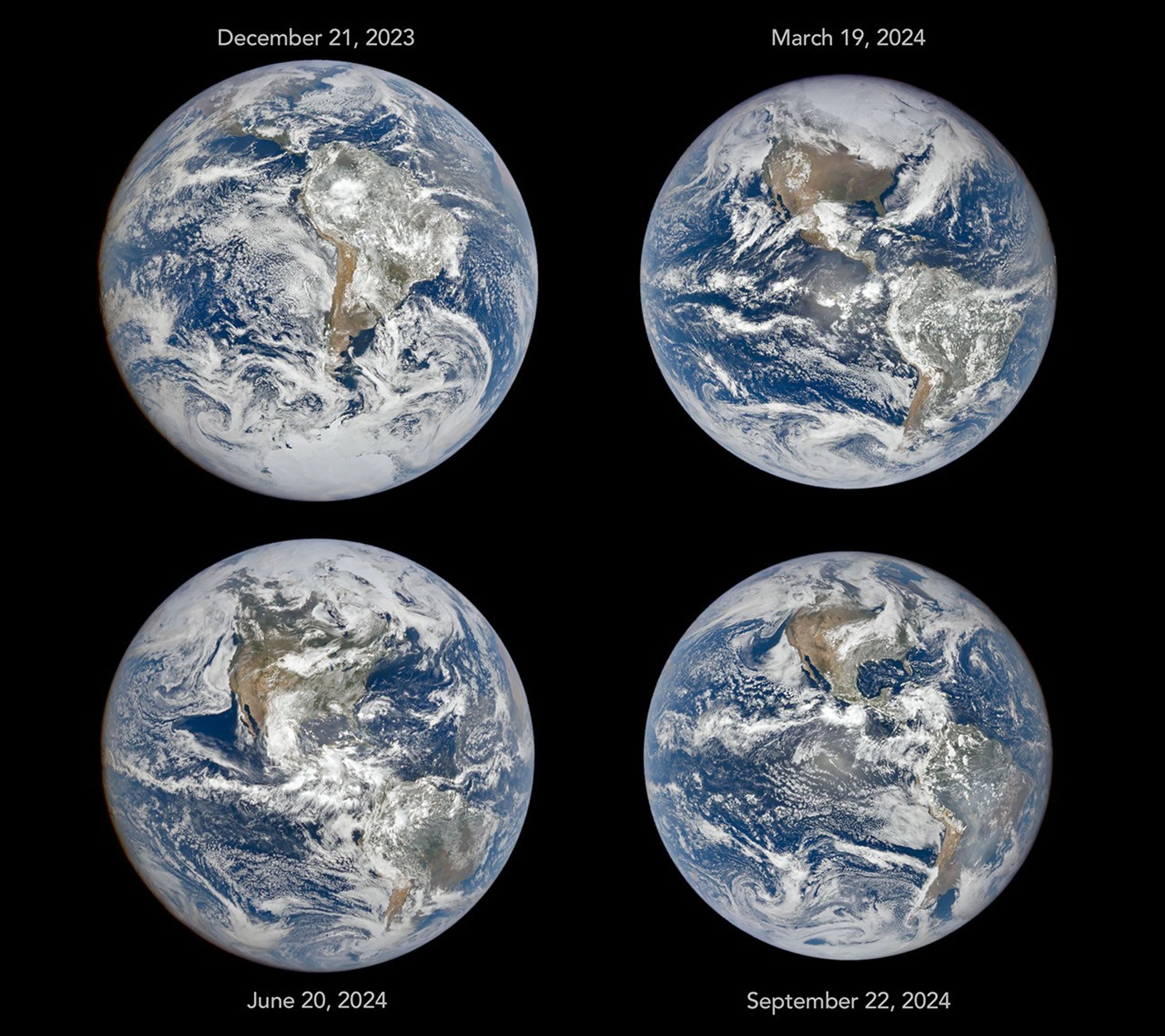
航天图片资料 · Four full-disk images of Earth are arranged in a two-by-two grid. The December image on the upper left shows the South America centered with Antarctica visible. The June image features parts of North America and Arctic sea ice that were not visible in December. The March and September images have South America and North America in more intermediate positions.
航天图片资料 · Water in Lake Powell is at record-low levels and looks like a wide river winding through a light orange desert landscape. The Glen Canyon Dam and the town of Page, Arizona, are visible in the lower left.
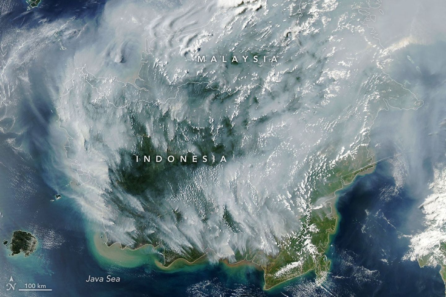
航天图片资料 · Thick gray plumes of smoke stream from large numbers of fires scattered across the island of Borneo.
航天图片资料 · b4c4845dcda162db
航天图片资料 · b622fe482d557493
航天图片资料 · b99391953fc39521
航天图片资料 · Dark blue water in Lake Powell fills several bays and branching canyons amid a light orange desert landscape. The Glen Canyon Dam and the town of Page, Arizona, are visible in the lower left.
航天图片资料 · b9a74e0dd9fdbdbe
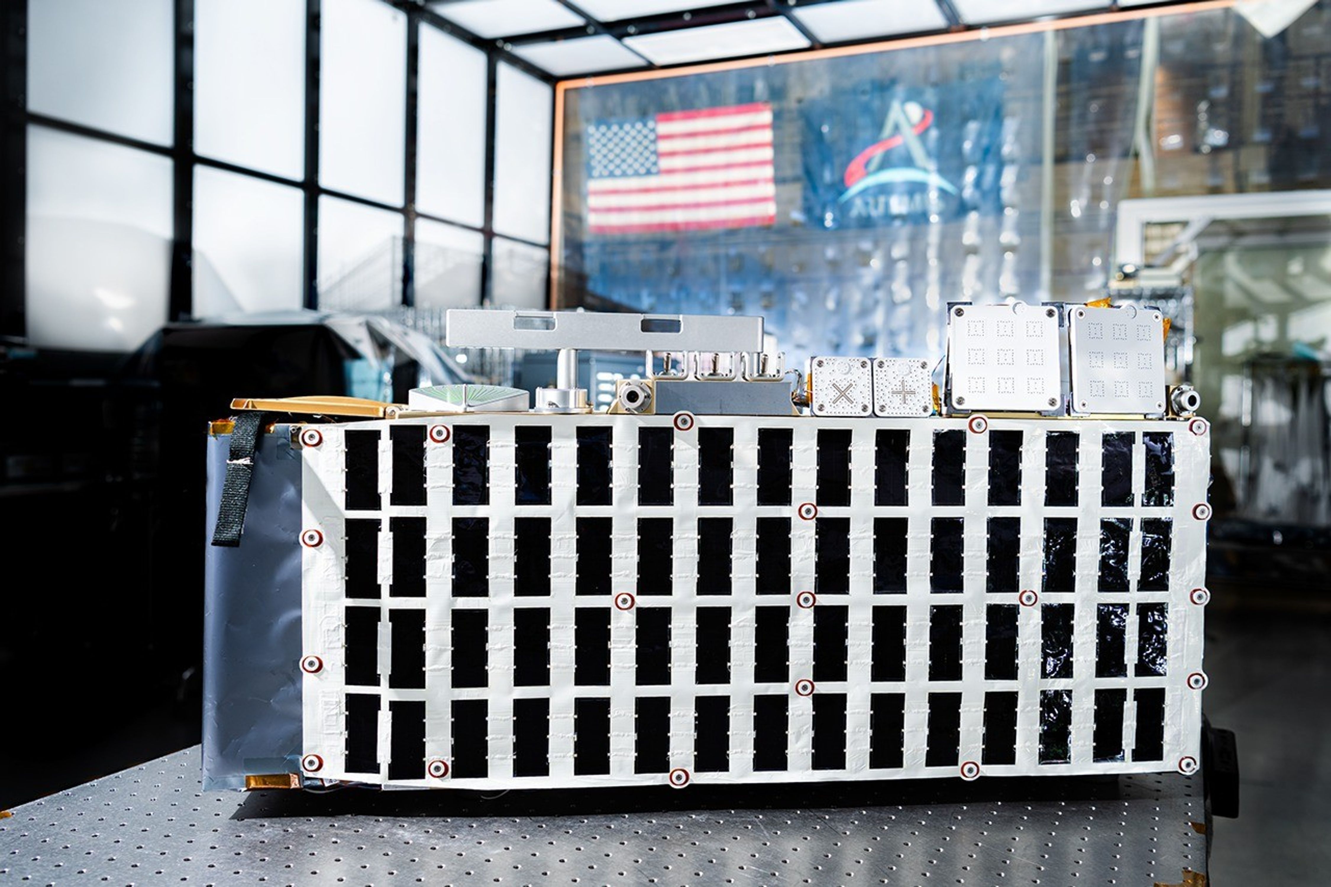
航天图片资料 · Rectangular box-shaped device resting on a metal table. The front face is covered with a grid of many small black rectangular panels bordered in white. Metal components, brackets, and small box units are mounted along the top. The background shows a large windowed wall with a blurred American flag and an Artemis flag visible behind the device.
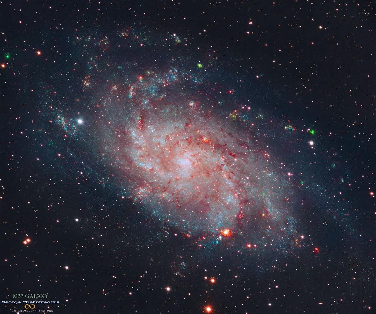
航天图片资料 · 5e016eec3a4606df
航天图片资料 · 5e016eec3a4606df · 来源署名:NASA · 原始许可标注:NASA Image and Media Guidelines
航天图片资料 · DALI
航天图片资料 · DALI · 来源署名:NASA · 原始许可标注:NASA Image and Media Guidelines
航天图片资料 · 6175e9fafb0fb17b
航天图片资料 · 6175e9fafb0fb17b · 来源署名:NASA · 原始许可标注:NASA Image and Media Guidelines
航天图片资料 · 624168a2481d0157
航天图片资料 · 624168a2481d0157 · 来源署名:NASA · 原始许可标注:NASA Image and Media Guidelines
航天图片资料 · STEREO spacecraft in orbit at the Sun.
航天图片资料 · STEREO spacecraft in orbit at the Sun. · 来源署名:NASA · 原始许可标注:NASA Image and Media Guidelines
航天图片资料 · 63f15fbc0624e329
航天图片资料 · 63f15fbc0624e329 · 来源署名:NASA · 原始许可标注:NASA Image and Media Guidelines
航天图片资料 · A map depicts sea surface temperature anomalies off Mexico's Pacific coast on September 23. Deep red areas highlight areas 3°C above the norm for that date. A dotted line traces the storm's path from September 20 to September 23 as it moved through the unusually warm waters.
航天图片资料 · A map depicts sea surface temperature anomalies off Mexico's Pacific coast on September 23. Deep red areas highlight areas 3°C above the norm for that date. A dotted line traces the storm's path from September 20 to September 23 as it moved through the unusually warm waters. · 来源署名:NASA · 原始许可标注:NASA Image and Media Guidelines
航天图片资料 · Hurricane Polo, with a well-defined eye, swirls over the Pacific Ocean off the coast of Mexico. The storm was positioned just south of Acapulco, with its outer cloud bands extending inland toward Mexico City.
航天图片资料 · Hurricane Polo, with a well-defined eye, swirls over the Pacific Ocean off the coast of Mexico. The storm was positioned just south of Acapulco, with its outer cloud bands extending inland toward Mexico City. · 来源署名:NASA · 原始许可标注:NASA Image and Media Guidelines
航天图片资料 · 66c5ab1667c4c031
航天图片资料 · 66c5ab1667c4c031 · 来源署名:NASA · 原始许可标注:NASA Image and Media Guidelines
航天图片资料 · 672ef759fa65f29c
航天图片资料 · 672ef759fa65f29c · 来源署名:NASA · 原始许可标注:NASA Image and Media Guidelines
航天图片资料 · The well-defined eye of Hurricane Simon lies just off Mexico’s Pacific coast. Some outer cloud bands of the spiraling storm extend over land.
航天图片资料 · The well-defined eye of Hurricane Simon lies just off Mexico’s Pacific coast. Some outer cloud bands of the spiraling storm extend over land. · 来源署名:NASA · 原始许可标注:NASA Image and Media Guidelines
航天图片资料 · Nancy Grace Roman, shown here at NASA's Goddard Space Flight Center in approximately 1972, was the first female executive and the first Chief of Astronomy at NASA. Image: NASA
航天图片资料 · Nancy Grace Roman, shown here at NASA's Goddard Space Flight Center in approximately 1972, was the first female executive and the first Chief of Astronomy at NASA. Image: NASA · 来源署名:popsci.com · 原始许可标注:许可未标注,不构成转载授权
航天图片资料 · The locations of MODIS fire detections are depicted with small red circles. Most are visible on the southern side of the island.
航天图片资料 · The locations of MODIS fire detections are depicted with small red circles. Most are visible on the southern side of the island. · 来源署名:NASA · 原始许可标注:NASA Image and Media Guidelines
航天图片资料 · 7454752309f6577d
航天图片资料 · 7454752309f6577d · 来源署名:NASA · 原始许可标注:NASA Image and Media Guidelines
航天图片资料 · 79bb2f8d3176f3dd
航天图片资料 · 79bb2f8d3176f3dd · 来源署名:NASA · 原始许可标注:NASA Image and Media Guidelines
航天图片资料 · Gravity waves in the upper atmosphere appear as a semicircle of ripples in a nighttime, grayscale satellite image. Hurricane clouds and city lights in Mexico are also visible.
航天图片资料 · Gravity waves in the upper atmosphere appear as a semicircle of ripples in a nighttime, grayscale satellite image. Hurricane clouds and city lights in Mexico are also visible. · 来源署名:NASA · 原始许可标注:NASA Image and Media Guidelines
航天图片资料 · Ice in a broad Alpine basin connects with a short, narrow stretch of glacial ice in the valley below through one small icefall. Lakes fill much of the valley beyond the glacier’s terminus.
航天图片资料 · Ice in a broad Alpine basin connects with a short, narrow stretch of glacial ice in the valley below through one small icefall. Lakes fill much of the valley beyond the glacier’s terminus. · 来源署名:NASA · 原始许可标注:NASA Image and Media Guidelines
航天图片资料 · An astronaut in a white spacesuit kneels in simulated lunar soil while working with scientific equipment in a large testing facility. Staff members and support structures are visible in the background.
航天图片资料 · An astronaut in a white spacesuit kneels in simulated lunar soil while working with scientific equipment in a large testing facility. Staff members and support structures are visible in the background. · 来源署名:NASA · 原始许可标注:NASA Image and Media Guidelines
航天图片资料 · 86ad2250f833782a
航天图片资料 · 86ad2250f833782a · 来源署名:NASA · 原始许可标注:NASA Image and Media Guidelines
航天图片资料 · A false-color satellite image shows the same area during the flooding on September 29, 2026. The river appears much wider.
航天图片资料 · A false-color satellite image shows the same area during the flooding on September 29, 2026. The river appears much wider. · 来源署名:NASA · 原始许可标注:NASA Image and Media Guidelines
航天图片资料 · In a full-disk satellite view of Earth, several tropical cyclones swirl above the blue waters of the Pacific Ocean.
航天图片资料 · In a full-disk satellite view of Earth, several tropical cyclones swirl above the blue waters of the Pacific Ocean. · 来源署名:NASA · 原始许可标注:NASA Image and Media Guidelines
航天图片资料 · 8d7099b2a0120061
航天图片资料 · 8d7099b2a0120061 · 来源署名:NASA · 原始许可标注:NASA Image and Media Guidelines
航天图片资料 · 8e017635e8a38bd4
航天图片资料 · 8e017635e8a38bd4 · 来源署名:NASA · 原始许可标注:NASA Image and Media Guidelines
航天图片资料 · 90105af6e5c859bf
航天图片资料 · 90105af6e5c859bf · 来源署名:NASA · 原始许可标注:NASA Image and Media Guidelines
航天图片资料 · 98bf17c7542ae8b1
航天图片资料 · 98bf17c7542ae8b1 · 来源署名:NASA · 原始许可标注:NASA Image and Media Guidelines
航天图片资料 · 999c50f219c38c44
航天图片资料 · 999c50f219c38c44 · 来源署名:NASA · 原始许可标注:NASA Image and Media Guidelines
航天图片资料 · 9bed40ad169adfe7
航天图片资料 · 9bed40ad169adfe7 · 来源署名:NASA · 原始许可标注:NASA Image and Media Guidelines
航天图片资料 · Dark blue water in Lake Powell fills several bays and branching canyons amid a light orange desert landscape. The Glen Canyon Dam and the town of Page, Arizona, are visible in the lower left.
航天图片资料 · Dark blue water in Lake Powell fills several bays and branching canyons amid a light orange desert landscape. The Glen Canyon Dam and the town of Page, Arizona, are visible in the lower left. · 来源署名:NASA · 原始许可标注:NASA Image and Media Guidelines
航天图片资料 · a027f59158f70fee
航天图片资料 · a027f59158f70fee · 来源署名:NASA · 原始许可标注:NASA Image and Media Guidelines
航天图片资料 · a241118acb3cb514
航天图片资料 · a241118acb3cb514 · 来源署名:NASA · 原始许可标注:NASA Image and Media Guidelines
航天图片资料 · a293d4042f5550fc
航天图片资料 · a293d4042f5550fc · 来源署名:NASA · 原始许可标注:NASA Image and Media Guidelines
航天图片资料 · A series of V-shaped wave clouds appears over an ocean filled with pieces of sea ice.
航天图片资料 · A series of V-shaped wave clouds appears over an ocean filled with pieces of sea ice. · 来源署名:NASA · 原始许可标注:NASA Image and Media Guidelines
航天图片资料 · A technician in a white clean-room suit and blue gloves uses a small flashlight to inspect a spacecraft instrument inside a dark testing chamber. Colorful wires and metallic components surround the instrument.
航天图片资料 · A technician in a white clean-room suit and blue gloves uses a small flashlight to inspect a spacecraft instrument inside a dark testing chamber. Colorful wires and metallic components surround the instrument. · 来源署名:NASA · 原始许可标注:NASA Image and Media Guidelines
航天图片资料 · A small ice- and snow-covered island with an active volcanic crater at its center is surrounded by drifting pieces of sea ice. A thermal signal and small plume appear in the crater, and ash darkens the snow on the volcano’s northern slopes.
航天图片资料 · A small ice- and snow-covered island with an active volcanic crater at its center is surrounded by drifting pieces of sea ice. A thermal signal and small plume appear in the crater, and ash darkens the snow on the volcano’s northern slopes. · 来源署名:NASA · 原始许可标注:NASA Image and Media Guidelines
航天图片资料 · Thick gray smoke partially obscures the Amazon River and surrounding rainforest near the cities of Manaus and Santarém. Puffy white clouds rise above the smoke on the left side of the image.
航天图片资料 · Thick gray smoke partially obscures the Amazon River and surrounding rainforest near the cities of Manaus and Santarém. Puffy white clouds rise above the smoke on the left side of the image. · 来源署名:NASA · 原始许可标注:NASA Image and Media Guidelines
航天图片资料 · aaf79c1b870fe2db
航天图片资料 · aaf79c1b870fe2db · 来源署名:NASA · 原始许可标注:NASA Image and Media Guidelines
航天图片资料 · ad65596ecb45a270
航天图片资料 · ad65596ecb45a270 · 来源署名:NASA · 原始许可标注:NASA Image and Media Guidelines
航天图片资料 · adabd3a7b1226267
航天图片资料 · adabd3a7b1226267 · 来源署名:NASA · 原始许可标注:NASA Image and Media Guidelines
航天图片资料 · A false-color satellite image shows the same area during the flooding on September 29, 2026. The river appears much wider.
航天图片资料 · A false-color satellite image shows the same area during the flooding on September 29, 2026. The river appears much wider. · 来源署名:NASA · 原始许可标注:NASA Image and Media Guidelines
航天图片资料 · Four full-disk images of Earth are arranged in a two-by-two grid. The December image on the upper left shows the South America centered with Antarctica visible. The June image features parts of North America and Arctic sea ice that were not visible in December. The March and September images have South America and North America in more intermediate positions.
航天图片资料 · Four full-disk images of Earth are arranged in a two-by-two grid. The December image on the upper left shows the South America centered with Antarctica visible. The June image features parts of North America and Arctic sea ice that were not visible in December. The March and September images have South America and North America in more intermediate positions. · 来源署名:NASA · 原始许可标注:NASA Image and Media Guidelines
航天图片资料 · Water in Lake Powell is at record-low levels and looks like a wide river winding through a light orange desert landscape. The Glen Canyon Dam and the town of Page, Arizona, are visible in the lower left.
航天图片资料 · Water in Lake Powell is at record-low levels and looks like a wide river winding through a light orange desert landscape. The Glen Canyon Dam and the town of Page, Arizona, are visible in the lower left. · 来源署名:NASA · 原始许可标注:NASA Image and Media Guidelines
航天图片资料 · Thick gray plumes of smoke stream from large numbers of fires scattered across the island of Borneo.
航天图片资料 · Thick gray plumes of smoke stream from large numbers of fires scattered across the island of Borneo. · 来源署名:NASA · 原始许可标注:NASA Image and Media Guidelines
航天图片资料 · b4c4845dcda162db
航天图片资料 · b4c4845dcda162db · 来源署名:popsci.com · 原始许可标注:许可未标注,不构成转载授权
航天图片资料 · b622fe482d557493
航天图片资料 · b622fe482d557493 · 来源署名:NASA · 原始许可标注:NASA Image and Media Guidelines
航天图片资料 · b99391953fc39521
航天图片资料 · b99391953fc39521 · 来源署名:NASA · 原始许可标注:NASA Image and Media Guidelines
航天图片资料 · Dark blue water in Lake Powell fills several bays and branching canyons amid a light orange desert landscape. The Glen Canyon Dam and the town of Page, Arizona, are visible in the lower left.
航天图片资料 · Dark blue water in Lake Powell fills several bays and branching canyons amid a light orange desert landscape. The Glen Canyon Dam and the town of Page, Arizona, are visible in the lower left. · 来源署名:NASA · 原始许可标注:NASA Image and Media Guidelines
航天图片资料 · b9a74e0dd9fdbdbe
航天图片资料 · b9a74e0dd9fdbdbe · 来源署名:NASA · 原始许可标注:NASA Image and Media Guidelines
航天图片资料 · Rectangular box-shaped device resting on a metal table. The front face is covered with a grid of many small black rectangular panels bordered in white. Metal components, brackets, and small box units are mounted along the top. The background shows a large windowed wall with a blurred American flag and an Artemis flag visible behind the device.
航天图片资料 · Rectangular box-shaped device resting on a metal table. The front face is covered with a grid of many small black rectangular panels bordered in white. Metal components, brackets, and small box units are mounted along the top. The background shows a large windowed wall with a blurred American flag and an Artemis flag visible behind the device. · 来源署名:NASA · 原始许可标注:NASA Image and Media Guidelines