NASA Goddard Space Flight Center · 航天照片图库

NASA Goddard Space Flight Center · 航天照片图库,仅列出本次快照中实际生成且可访问的资料。

资料最后更新时间:

集合条目总数
122
当前页码
1
NASA Goddard Space Flight Center · 航天照片图库:共收录 122 项实际生成的公开资料,本页为第 1 页,共 3 页。
航天图片资料 · 01bd53b22c97480e
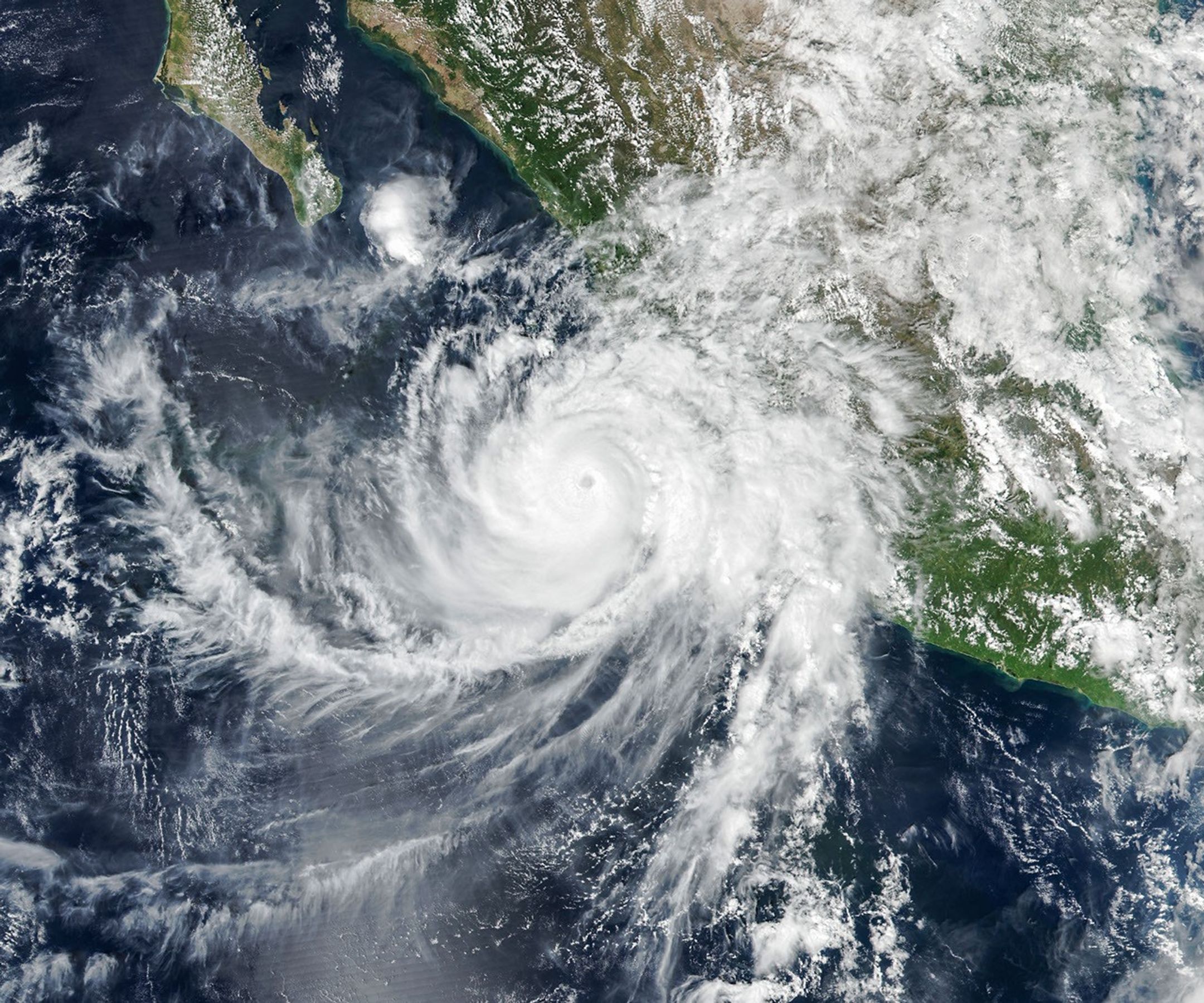
航天图片资料 · Hurricane Polo, with a well-defined eye, swirls over the Pacific Ocean off the coast of Mexico. The storm was positioned just south of Acapulco, with its outer cloud bands extending inland toward Mexico City.
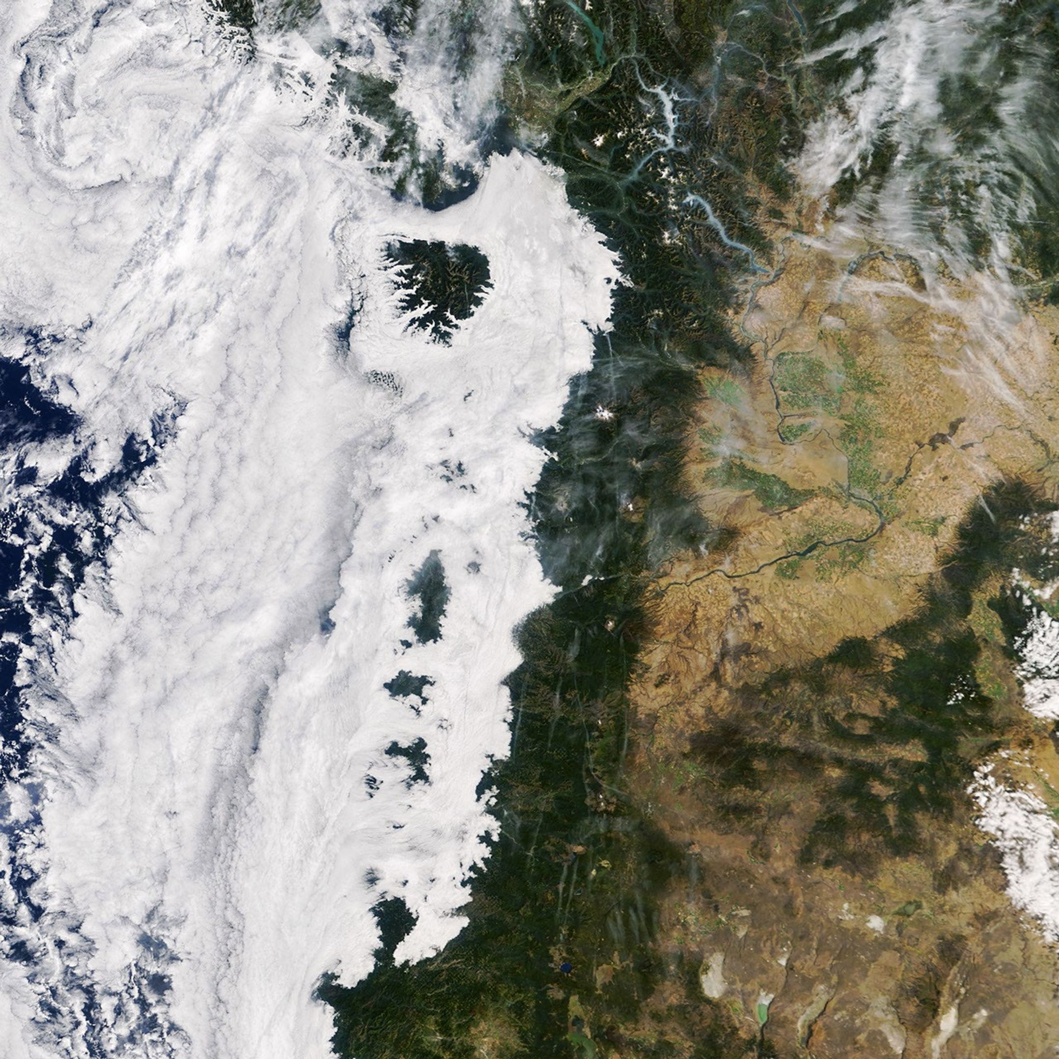
航天图片资料 · Low-lying clouds cover western Washington and Oregon between the Pacific coast and the foothills of the Cascade Range. Parts of the Olympic Mountains and Oregon Coast Range are visible above the clouds.
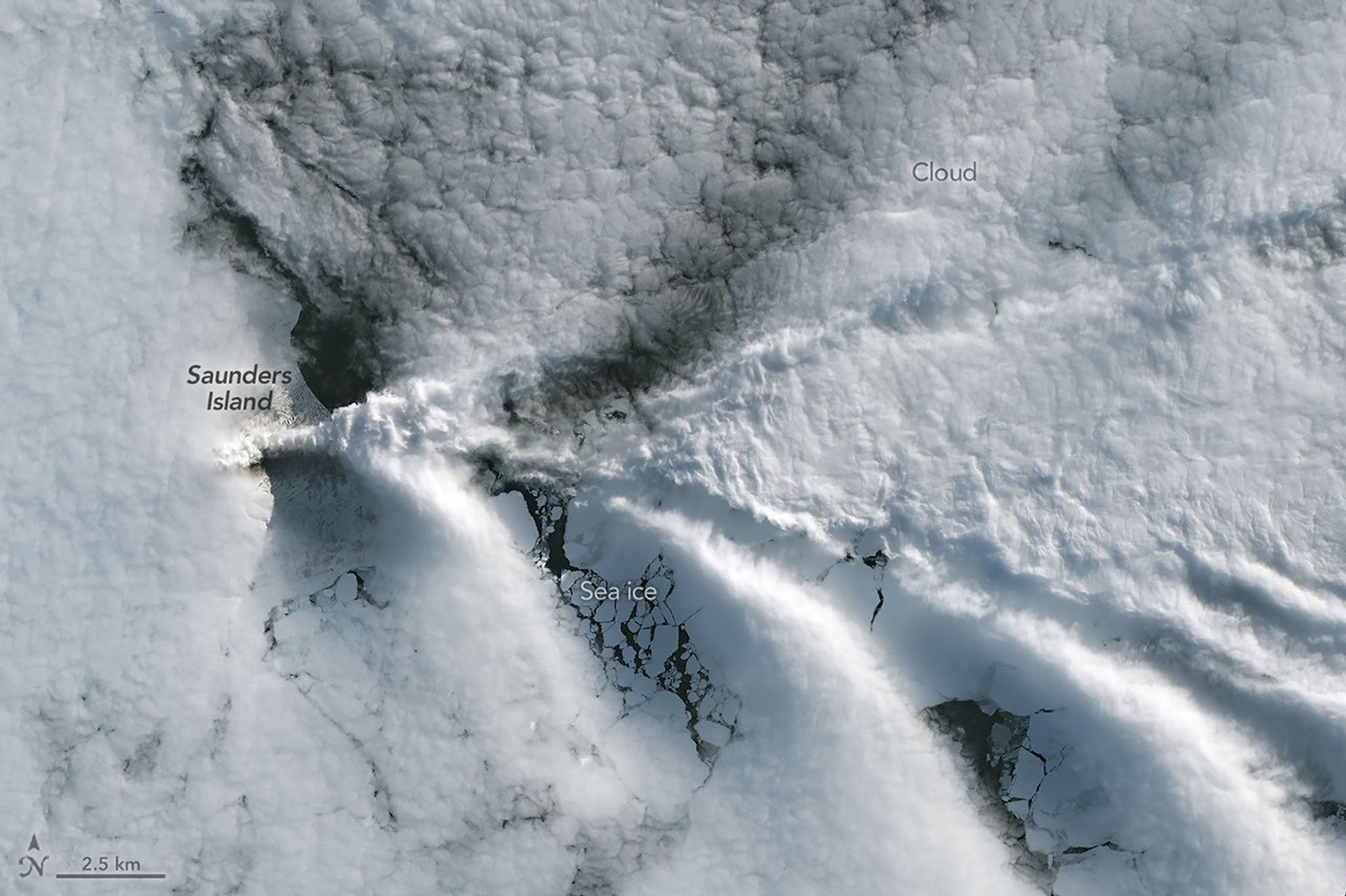
航天图片资料 · A series of V-shaped wave clouds appears over an ocean filled with pieces of sea ice.
航天图片资料 · 058145b7ab9554d9
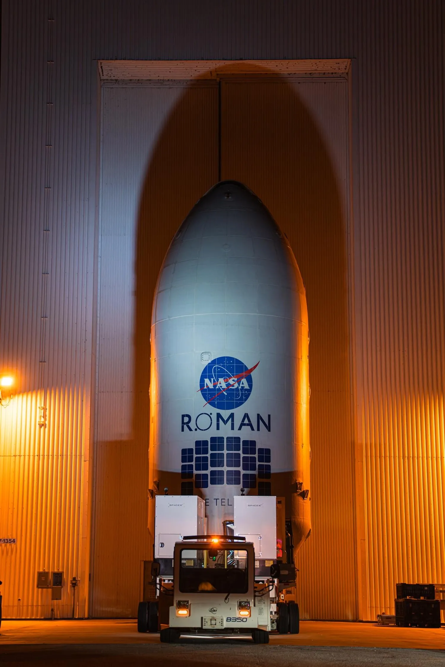
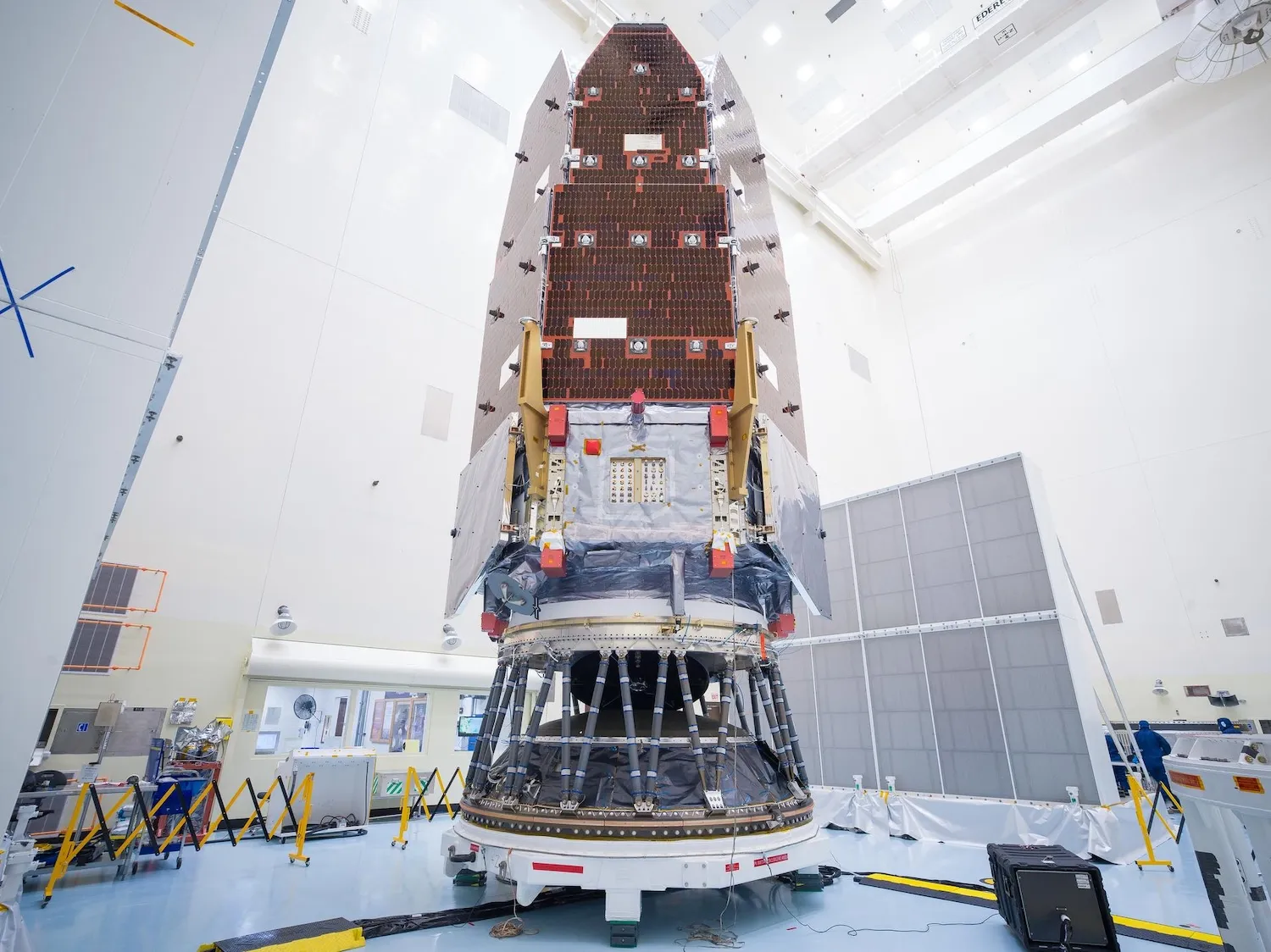
航天图片资料 · Teams inside the Payload Hazardous Servicing Facility at NASA’s Kennedy Space Center in Florida encapsulate the agency’s Nancy Grace Roman Space Telescope within the payload fairing on Friday, August 21, 2026, ahead of mating to a SpaceX Falcon Heavy rocket. Encapsulation shields the spacecraft during rollout, ascent, and the early phases of flight. Image: Kennedy Space Center / NASA
航天图片资料 · 0993a29674da9a17
航天图片资料 · 0baa8a4e4b3fdd0d
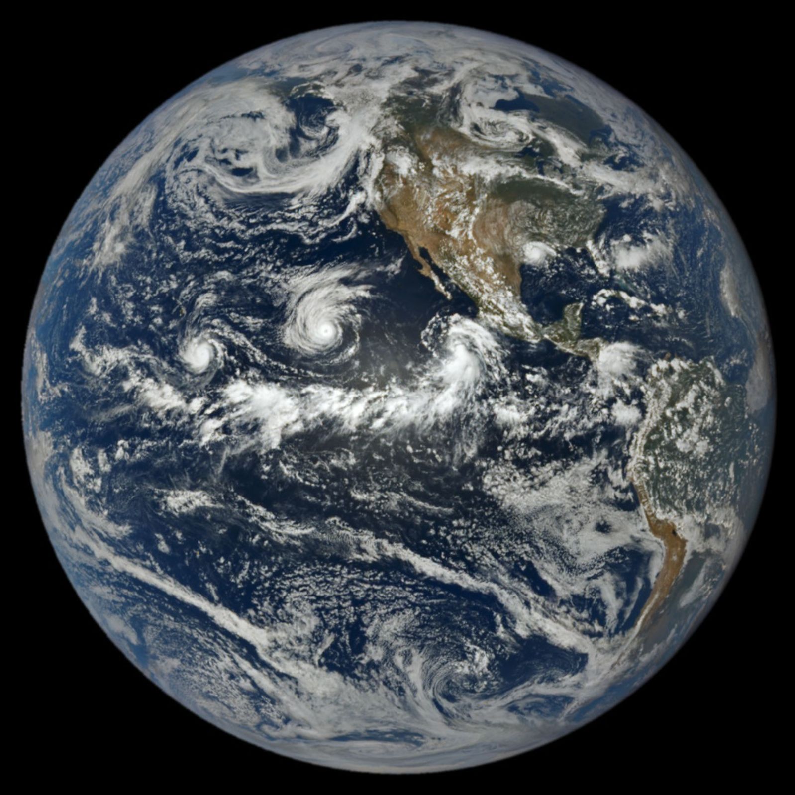
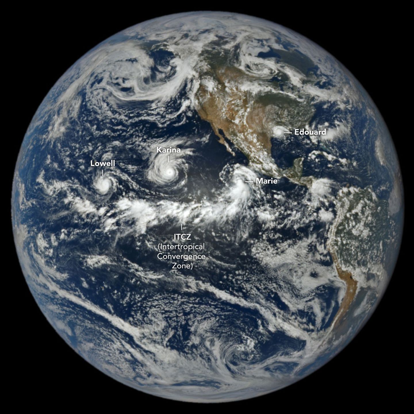
航天图片资料 · In a full-disk satellite view of Earth, three tropical cyclones—named Lowell, Karina, and Marie—swirl above the blue waters of the Pacific Ocean and to the west of Central America.
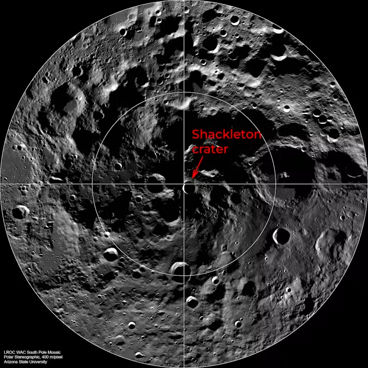
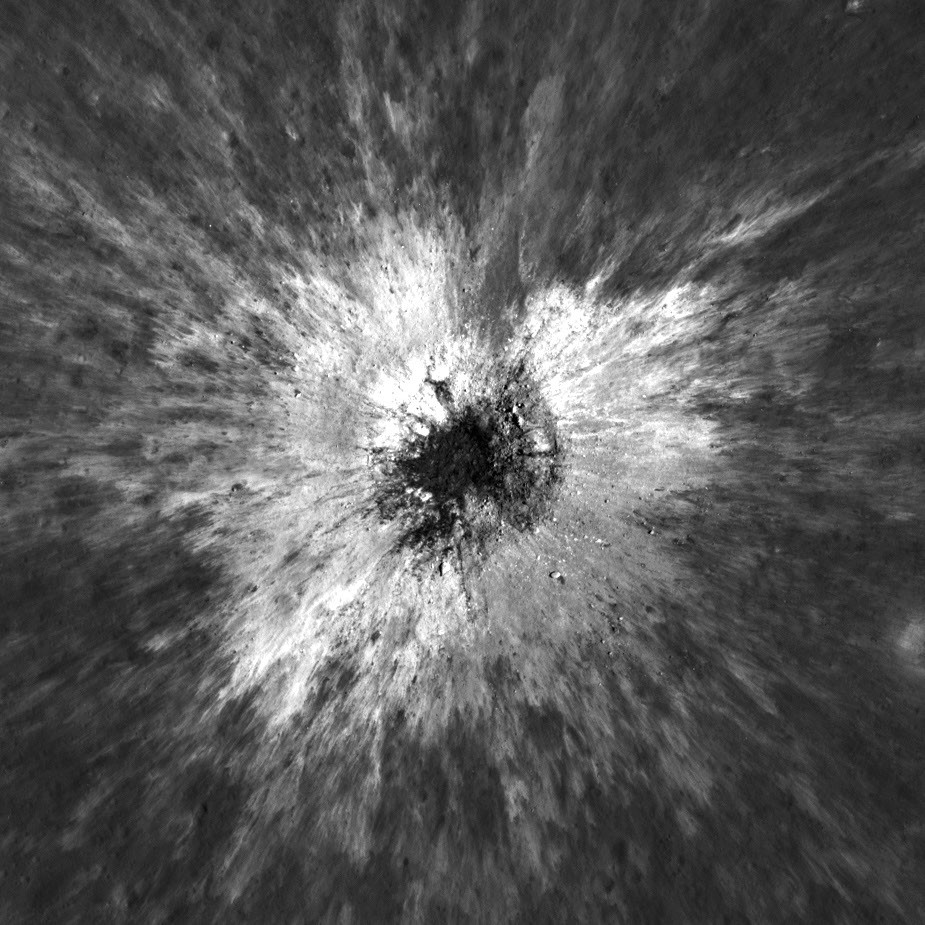
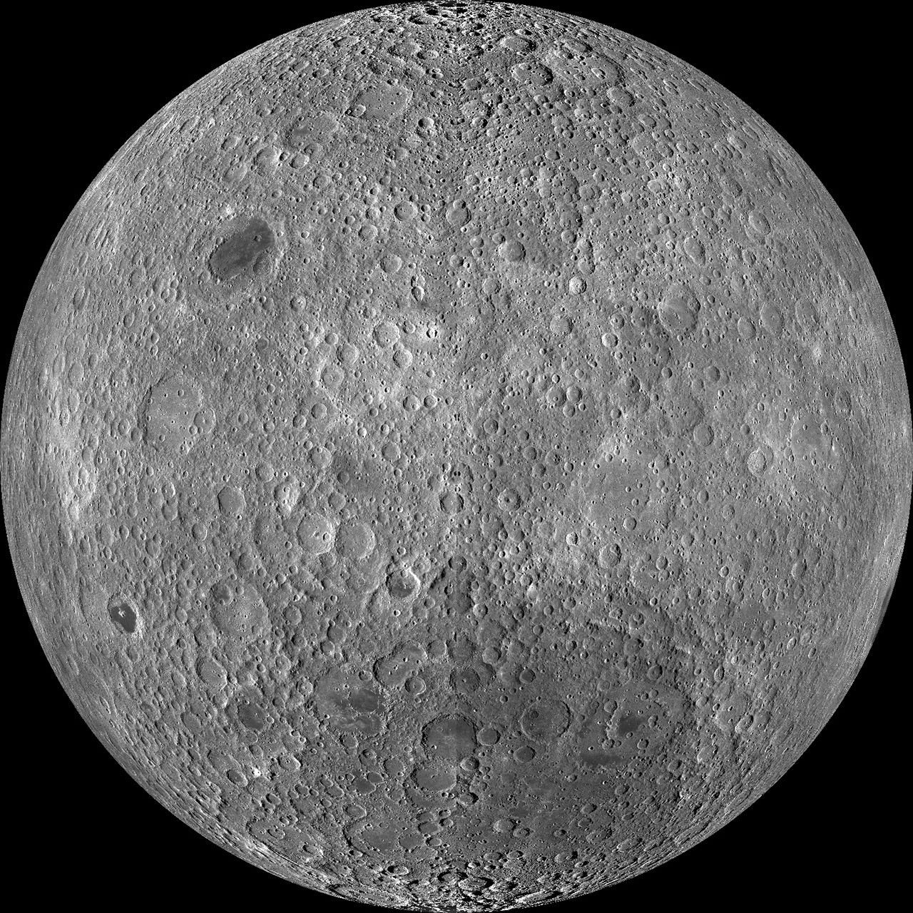
航天图片资料 · A circle view of a grey pockmarked surface showing the Shackleton crater next to the centre.
航天图片资料 · 10e51d1951db8010
航天图片资料 · 17a916b763e9f9db
航天图片资料 · 183fd461e8d75666
航天图片资料 · 19780fe2da646bb1
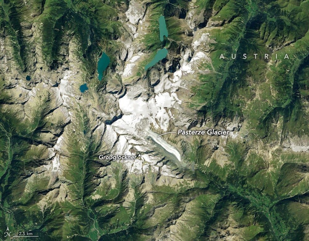
航天图片资料 · Ice in a broad Alpine basin feeds debris-covered glacial ice several kilometers long in the valley below.
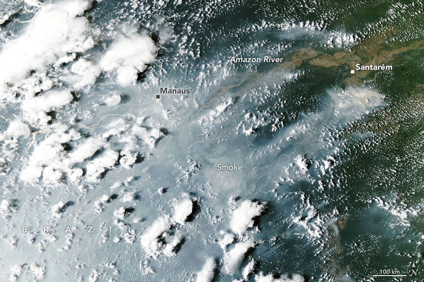
航天图片资料 · Thick gray smoke partially obscures the Amazon River and surrounding rainforest near the cities of Manaus and Santarém. Puffy white clouds rise above the smoke on the left side of the image.
航天图片资料 · 264a1bb859345389
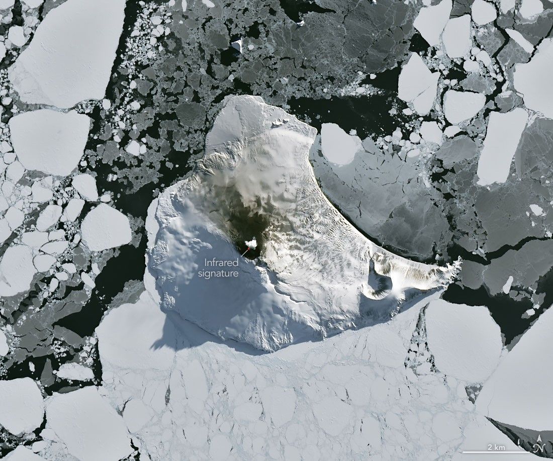
航天图片资料 · A small ice- and snow-covered island with an active volcanic crater at its center is surrounded by drifting pieces of sea ice. A thermal signal and small plume appear in the crater, and ash darkens the snow on the volcano’s northern slopes.
航天图片资料 · MatISSE
航天图片资料 · 2b04f6c5797b8d11
航天图片资料 · 2c0e0b160e9f78a0
航天图片资料 · 2e4dcb0f2a8d4c43
航天图片资料 · 2ebed04c06d571a1
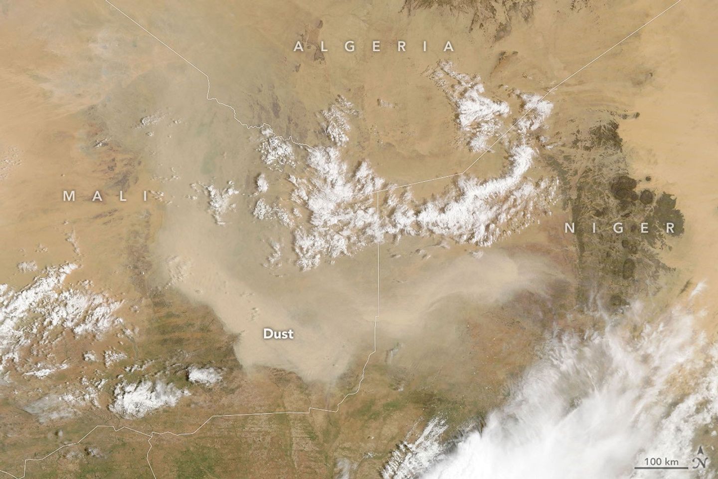
航天图片资料 · A light brown dust plume, dense at its center and more diffuse toward its edges, extends horizontally across an orange-brown and green landscape. Scattered white clouds cover some of the scene.
航天图片资料 · 30cb0061f8ad3f46
航天图片资料 · 31ccbcf2e5792171
航天图片资料 · 3647b924c803dbbf
航天图片资料 · 3a4cafdacdd4467d
航天图片资料 · 3b13ce309d93f1f0
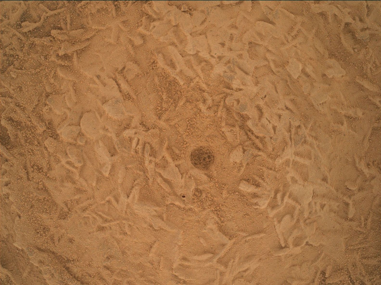
航天图片资料 · A close-up view of a dusty, reddish-brown Martian rock surface taken by the Curiosity rover. The surface is highly textured, covered with a complex network of small, raised, intersecting ridges that resemble tiny blades or crystals buried under a fine layer of sand. Right in the center of the frame is a small, distinct, dark circular hole.
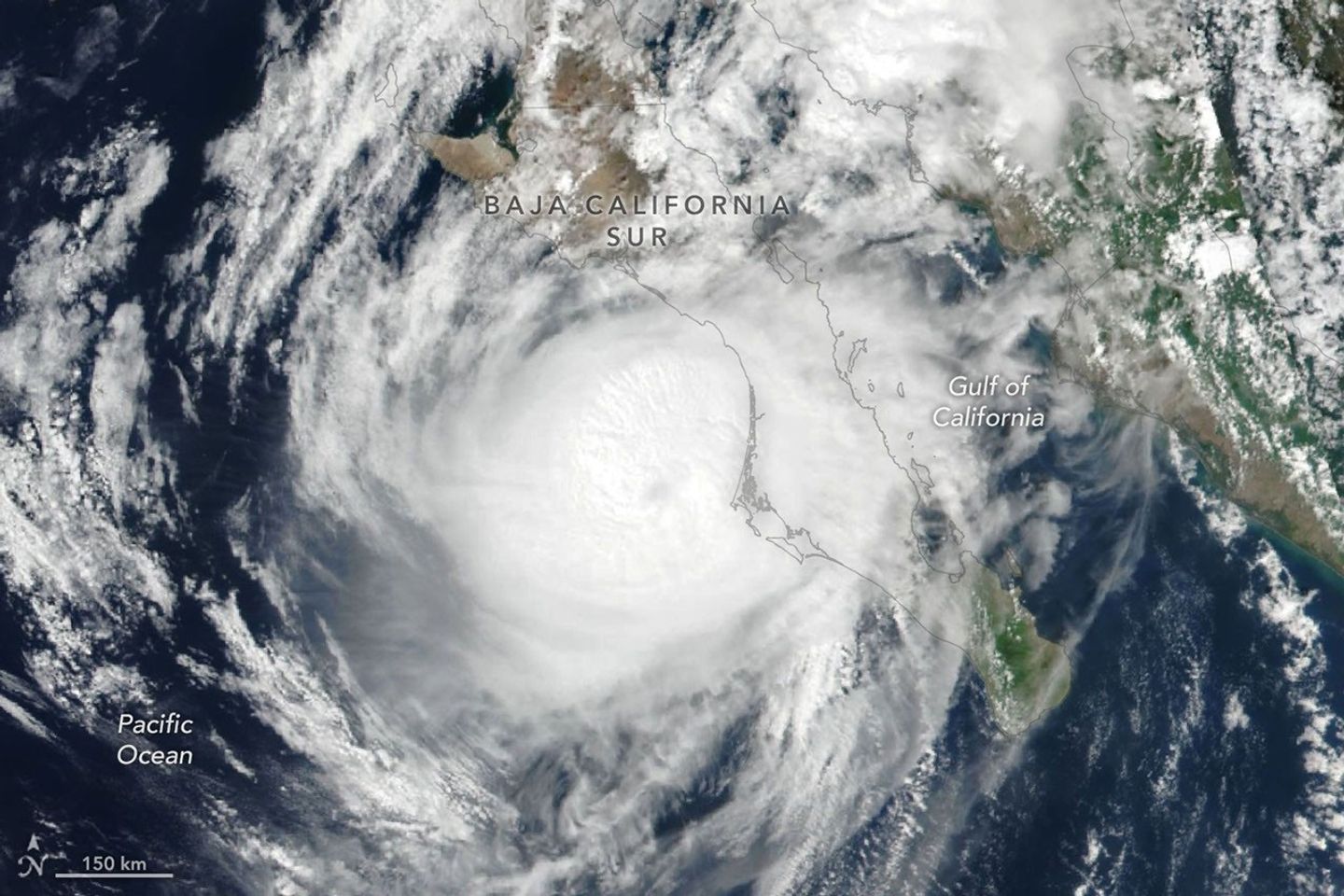
航天图片资料 · Hurricane Polo’s clouds spiral over the Pacific Ocean and the Baja California peninsula. The storm’s faint eye is just off the west coast of the peninsula.
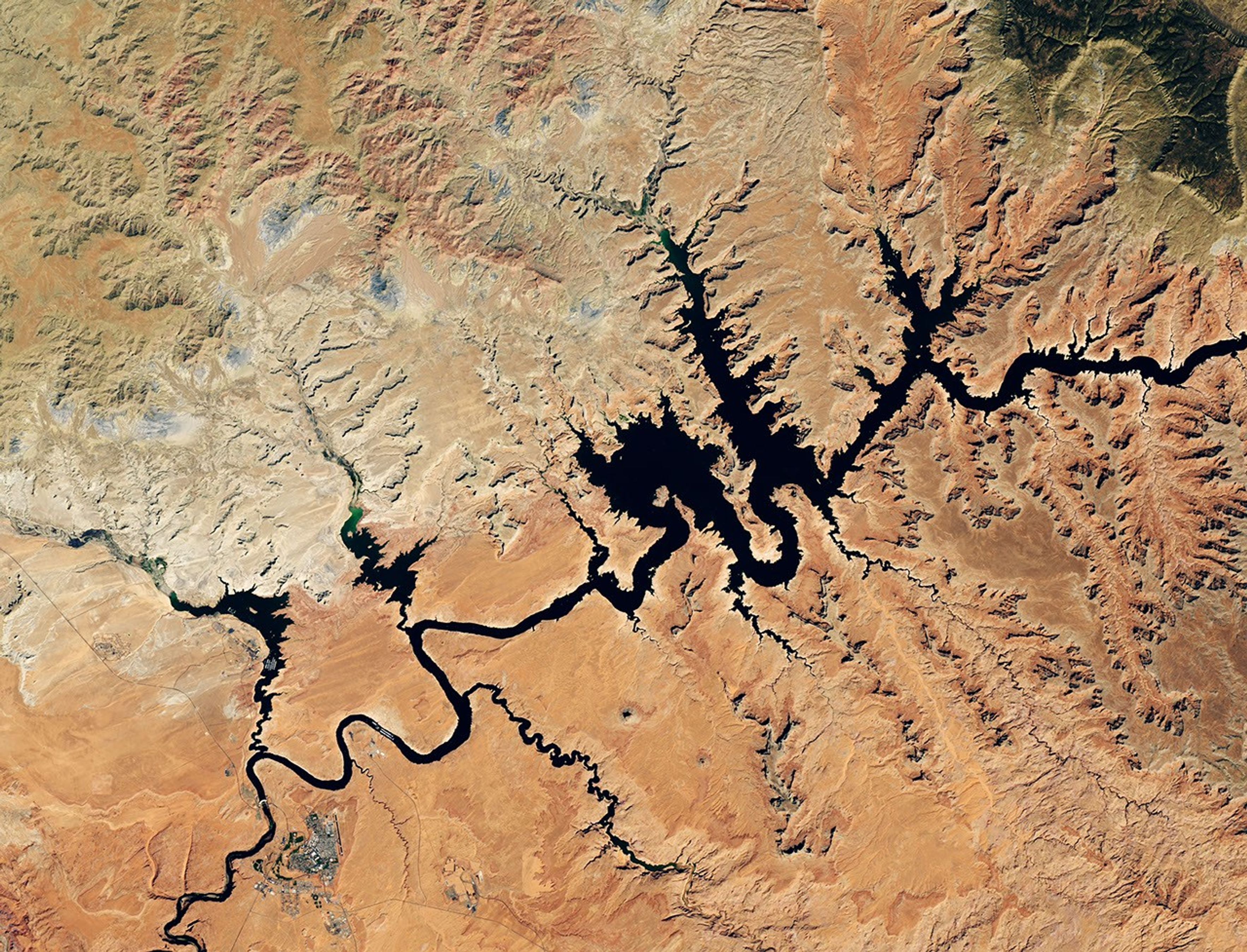
航天图片资料 · Water in Lake Powell is at record-low levels and looks like a wide river winding through a light orange desert landscape. The Glen Canyon Dam and the town of Page, Arizona, are visible in the lower left.
航天图片资料 · 426cadeae80f5774
航天图片资料 · 497c6b5195db259b
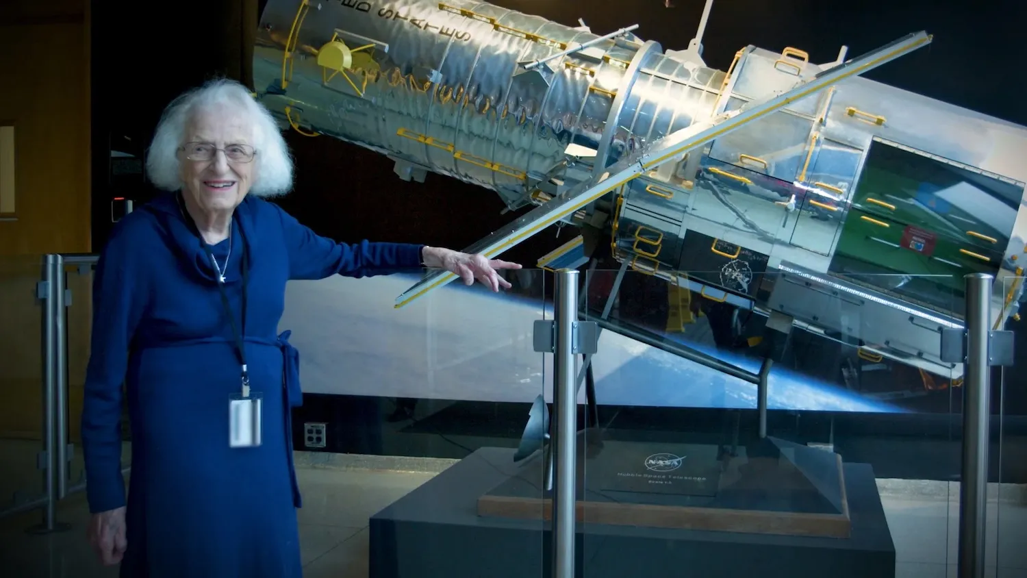
航天图片资料 · Nancy Grace Roman stands next to a scale model of the Hubble Space Telescope outside the Hubble control center at NASA’s Goddard Space Flight Center in Greenbelt, Maryland. Roman is known as the “Mother of Hubble.” Image: NASA
航天图片资料 · 4eae502f2d14b79a
航天图片资料 · 4f8203a7d277617d
航天图片资料 · 502913f10e512e76
航天图片资料 · In a full-disk satellite view of Earth, three tropical cyclones—named Lowell, Karina, and Marie—swirl above the blue waters of the Pacific Ocean and to the west of Central America.
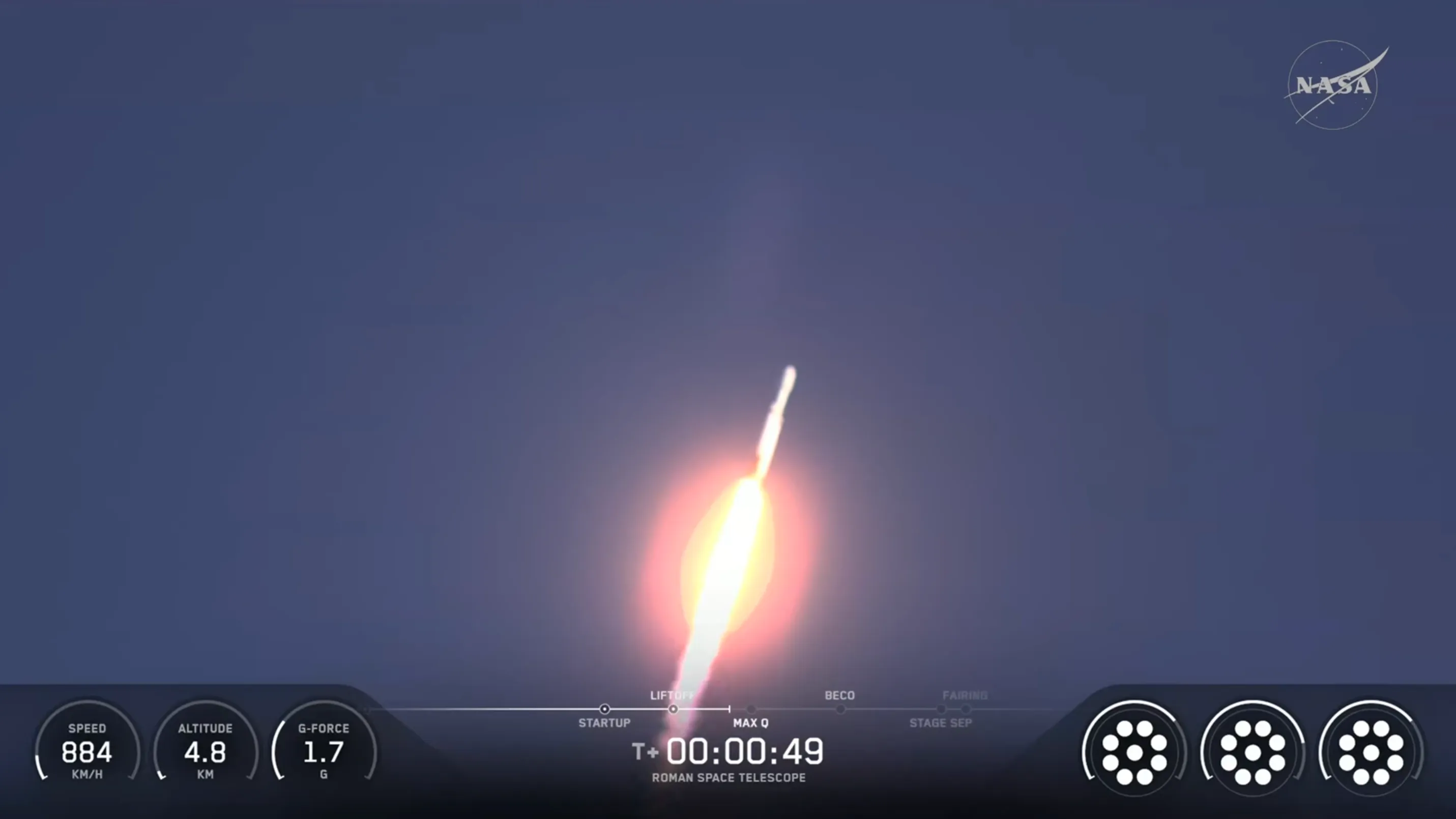
航天图片资料 · a white rocket launching a
航天图片资料 · 55834d77b3843b69
航天图片资料 · 567f2e915f2fe2f8
航天图片资料 · 578ed622b3d7a98b
航天图片资料 · 57976c364dd80728
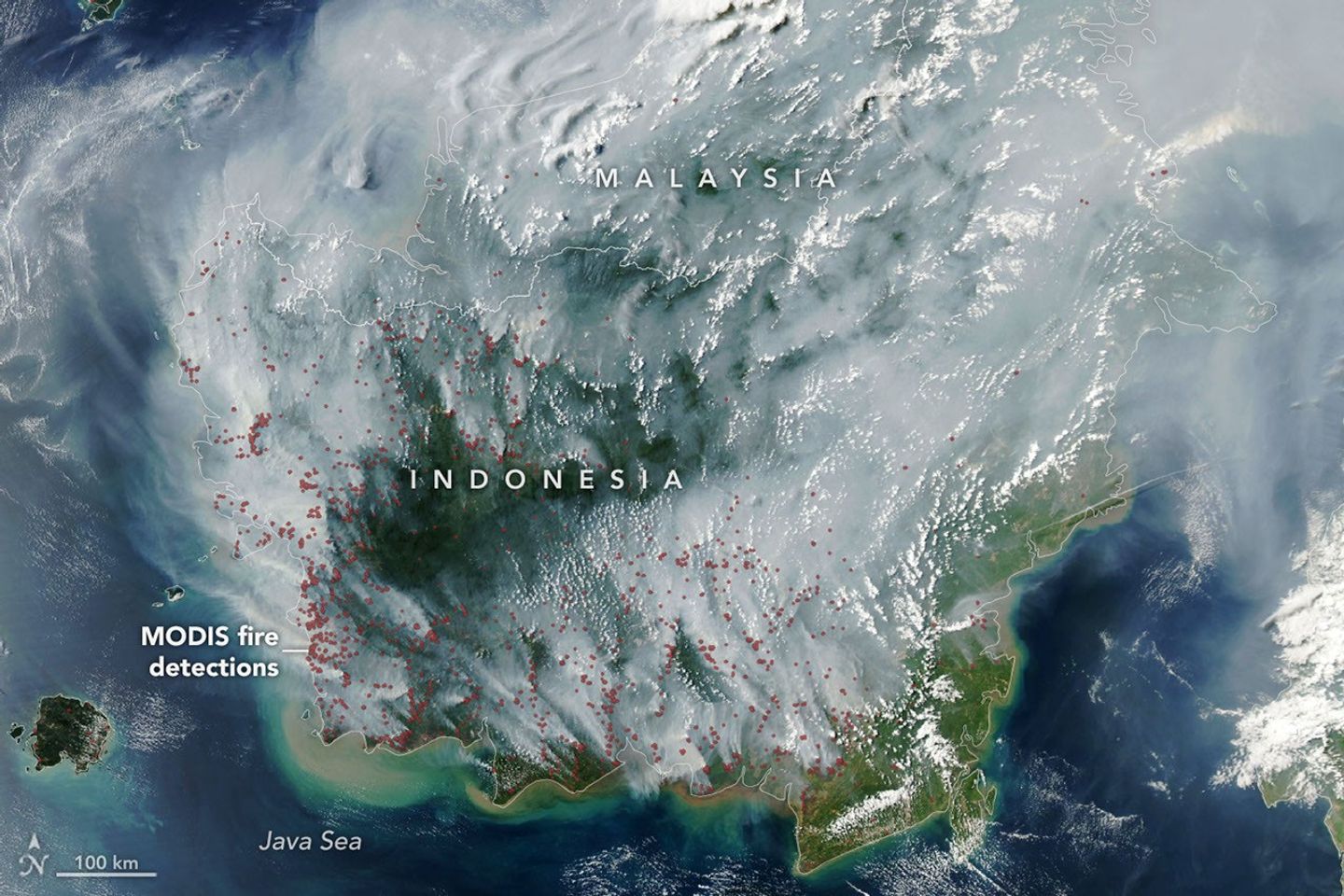
航天图片资料 · The locations of MODIS fire detections are depicted with small red circles. Most are visible on the southern side of the island.
航天图片资料 · 585925f47474355e
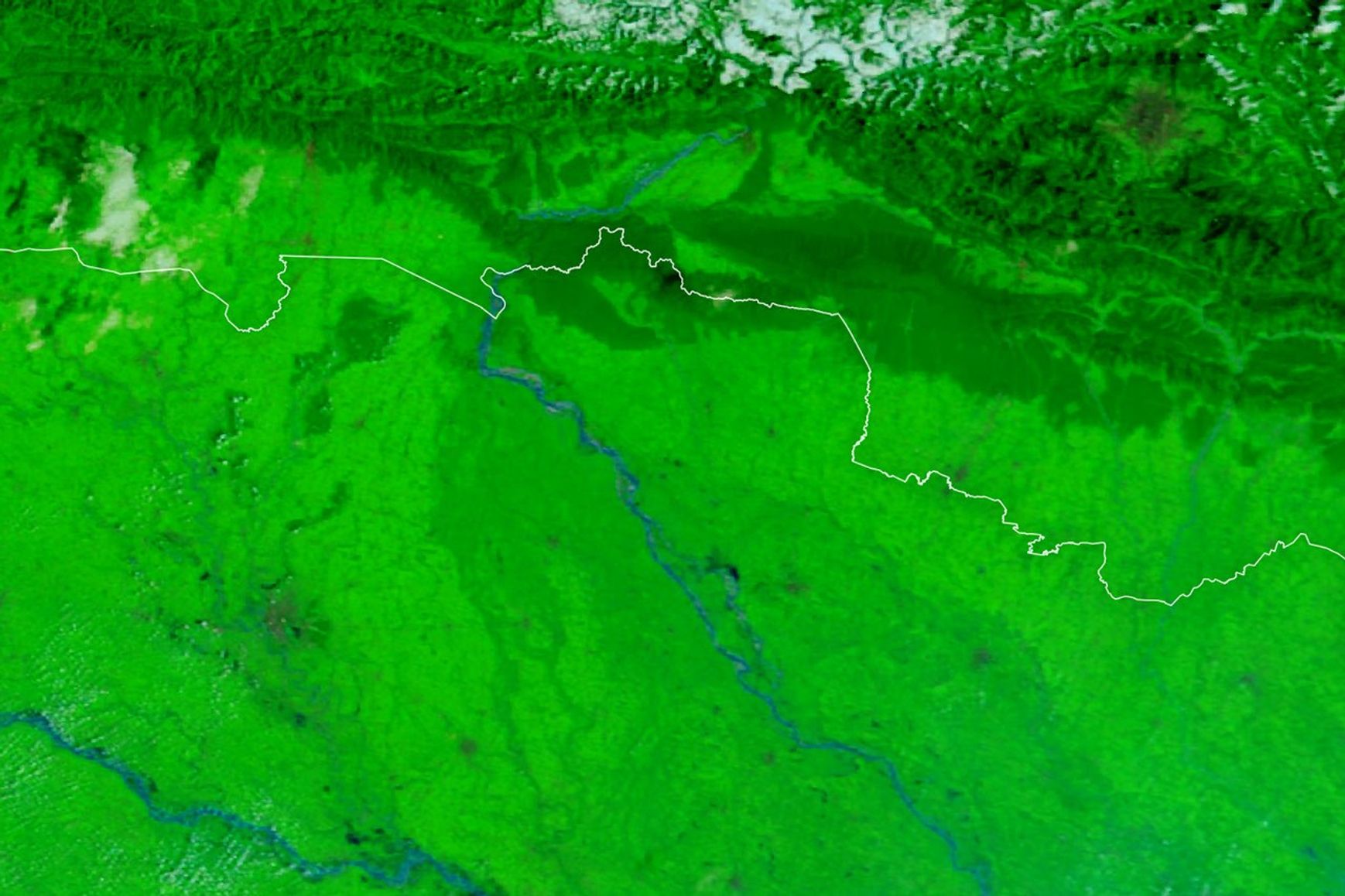
航天图片资料 · A false-color satellite image shows the Gandak River before the flooding on September 20, 2026.
航天图片资料 · The well-defined eye of Hurricane Simon lies just off Mexico’s Pacific coast. Some outer cloud bands of the spiraling storm extend over land.
航天图片资料 · 01bd53b22c97480e
航天图片资料 · 01bd53b22c97480e · 来源署名:NASA · 原始许可标注:NASA Image and Media Guidelines
航天图片资料 · Hurricane Polo, with a well-defined eye, swirls over the Pacific Ocean off the coast of Mexico. The storm was positioned just south of Acapulco, with its outer cloud bands extending inland toward Mexico City.
航天图片资料 · Hurricane Polo, with a well-defined eye, swirls over the Pacific Ocean off the coast of Mexico. The storm was positioned just south of Acapulco, with its outer cloud bands extending inland toward Mexico City. · 来源署名:NASA · 原始许可标注:NASA Image and Media Guidelines
航天图片资料 · Low-lying clouds cover western Washington and Oregon between the Pacific coast and the foothills of the Cascade Range. Parts of the Olympic Mountains and Oregon Coast Range are visible above the clouds.
航天图片资料 · Low-lying clouds cover western Washington and Oregon between the Pacific coast and the foothills of the Cascade Range. Parts of the Olympic Mountains and Oregon Coast Range are visible above the clouds. · 来源署名:NASA · 原始许可标注:NASA Image and Media Guidelines
航天图片资料 · A series of V-shaped wave clouds appears over an ocean filled with pieces of sea ice.
航天图片资料 · A series of V-shaped wave clouds appears over an ocean filled with pieces of sea ice. · 来源署名:NASA · 原始许可标注:NASA Image and Media Guidelines
航天图片资料 · 058145b7ab9554d9
航天图片资料 · 058145b7ab9554d9 · 来源署名:NASA · 原始许可标注:NASA Image and Media Guidelines
航天图片资料 · Teams inside the Payload Hazardous Servicing Facility at NASA’s Kennedy Space Center in Florida encapsulate the agency’s Nancy Grace Roman Space Telescope within the payload fairing on Friday, August 21, 2026, ahead of mating to a SpaceX Falcon Heavy rocket. Encapsulation shields the spacecraft during rollout, ascent, and the early phases of flight. Image: Kennedy Space Center / NASA
航天图片资料 · Teams inside the Payload Hazardous Servicing Facility at NASA’s Kennedy Space Center in Florida encapsulate the agency’s Nancy Grace Roman Space Telescope within the payload fairing on Friday, August 21, 2026, ahead of mating to a SpaceX Falcon Heavy rocket. Encapsulation shields the spacecraft during rollout, ascent, and the early phases of flight. Image: Kennedy Space Center / NASA · 来源署名:popsci.com · 原始许可标注:许可未标注,不构成转载授权
航天图片资料 · 0993a29674da9a17
航天图片资料 · 0993a29674da9a17 · 来源署名:NASA · 原始许可标注:NASA Image and Media Guidelines
航天图片资料 · 0baa8a4e4b3fdd0d
航天图片资料 · 0baa8a4e4b3fdd0d · 来源署名:NASA · 原始许可标注:NASA Image and Media Guidelines
航天图片资料 · In a full-disk satellite view of Earth, three tropical cyclones—named Lowell, Karina, and Marie—swirl above the blue waters of the Pacific Ocean and to the west of Central America.
航天图片资料 · In a full-disk satellite view of Earth, three tropical cyclones—named Lowell, Karina, and Marie—swirl above the blue waters of the Pacific Ocean and to the west of Central America. · 来源署名:NASA · 原始许可标注:NASA Image and Media Guidelines
航天图片资料 · A circle view of a grey pockmarked surface showing the Shackleton crater next to the centre.
航天图片资料 · A circle view of a grey pockmarked surface showing the Shackleton crater next to the centre. · 来源署名:images.theconversation.com · 原始许可标注:许可未标注,不构成转载授权
航天图片资料 · 10e51d1951db8010
航天图片资料 · 10e51d1951db8010 · 来源署名:NASA · 原始许可标注:NASA Image and Media Guidelines
航天图片资料 · 17a916b763e9f9db
航天图片资料 · 17a916b763e9f9db · 来源署名:NASA · 原始许可标注:NASA Image and Media Guidelines
航天图片资料 · 183fd461e8d75666
航天图片资料 · 183fd461e8d75666 · 来源署名:NASA · 原始许可标注:NASA Image and Media Guidelines
航天图片资料 · 19780fe2da646bb1
航天图片资料 · 19780fe2da646bb1 · 来源署名:NASA · 原始许可标注:NASA Image and Media Guidelines
航天图片资料 · Ice in a broad Alpine basin feeds debris-covered glacial ice several kilometers long in the valley below.
航天图片资料 · Ice in a broad Alpine basin feeds debris-covered glacial ice several kilometers long in the valley below. · 来源署名:NASA · 原始许可标注:NASA Image and Media Guidelines
航天图片资料 · Thick gray smoke partially obscures the Amazon River and surrounding rainforest near the cities of Manaus and Santarém. Puffy white clouds rise above the smoke on the left side of the image.
航天图片资料 · Thick gray smoke partially obscures the Amazon River and surrounding rainforest near the cities of Manaus and Santarém. Puffy white clouds rise above the smoke on the left side of the image. · 来源署名:NASA · 原始许可标注:NASA Image and Media Guidelines
航天图片资料 · 264a1bb859345389
航天图片资料 · 264a1bb859345389 · 来源署名:NASA · 原始许可标注:NASA Image and Media Guidelines
航天图片资料 · A small ice- and snow-covered island with an active volcanic crater at its center is surrounded by drifting pieces of sea ice. A thermal signal and small plume appear in the crater, and ash darkens the snow on the volcano’s northern slopes.
航天图片资料 · A small ice- and snow-covered island with an active volcanic crater at its center is surrounded by drifting pieces of sea ice. A thermal signal and small plume appear in the crater, and ash darkens the snow on the volcano’s northern slopes. · 来源署名:NASA · 原始许可标注:NASA Image and Media Guidelines
航天图片资料 · MatISSE
航天图片资料 · MatISSE · 来源署名:NASA · 原始许可标注:NASA Image and Media Guidelines
航天图片资料 · 2b04f6c5797b8d11
航天图片资料 · 2b04f6c5797b8d11 · 来源署名:NASA · 原始许可标注:NASA Image and Media Guidelines
航天图片资料 · 2c0e0b160e9f78a0
航天图片资料 · 2c0e0b160e9f78a0 · 来源署名:NASA · 原始许可标注:NASA Image and Media Guidelines
航天图片资料 · 2e4dcb0f2a8d4c43
航天图片资料 · 2e4dcb0f2a8d4c43 · 来源署名:NASA · 原始许可标注:NASA Image and Media Guidelines
航天图片资料 · 2ebed04c06d571a1
航天图片资料 · 2ebed04c06d571a1 · 来源署名:NASA · 原始许可标注:NASA Image and Media Guidelines
航天图片资料 · A light brown dust plume, dense at its center and more diffuse toward its edges, extends horizontally across an orange-brown and green landscape. Scattered white clouds cover some of the scene.
航天图片资料 · A light brown dust plume, dense at its center and more diffuse toward its edges, extends horizontally across an orange-brown and green landscape. Scattered white clouds cover some of the scene. · 来源署名:NASA · 原始许可标注:NASA Image and Media Guidelines
航天图片资料 · 30cb0061f8ad3f46
航天图片资料 · 30cb0061f8ad3f46 · 来源署名:NASA · 原始许可标注:NASA Image and Media Guidelines
航天图片资料 · 31ccbcf2e5792171
航天图片资料 · 31ccbcf2e5792171 · 来源署名:NASA · 原始许可标注:NASA Image and Media Guidelines
航天图片资料 · 3647b924c803dbbf
航天图片资料 · 3647b924c803dbbf · 来源署名:popsci.com · 原始许可标注:许可未标注,不构成转载授权
航天图片资料 · 3a4cafdacdd4467d
航天图片资料 · 3a4cafdacdd4467d · 来源署名:NASA · 原始许可标注:NASA Image and Media Guidelines
航天图片资料 · 3b13ce309d93f1f0
航天图片资料 · 3b13ce309d93f1f0 · 来源署名:NASA · 原始许可标注:NASA Image and Media Guidelines
航天图片资料 · A close-up view of a dusty, reddish-brown Martian rock surface taken by the Curiosity rover. The surface is highly textured, covered with a complex network of small, raised, intersecting ridges that resemble tiny blades or crystals buried under a fine layer of sand. Right in the center of the frame is a small, distinct, dark circular hole.
航天图片资料 · A close-up view of a dusty, reddish-brown Martian rock surface taken by the Curiosity rover. The surface is highly textured, covered with a complex network of small, raised, intersecting ridges that resemble tiny blades or crystals buried under a fine layer of sand. Right in the center of the frame is a small, distinct, dark circular hole. · 来源署名:NASA · 原始许可标注:NASA Image and Media Guidelines
航天图片资料 · Hurricane Polo’s clouds spiral over the Pacific Ocean and the Baja California peninsula. The storm’s faint eye is just off the west coast of the peninsula.
航天图片资料 · Hurricane Polo’s clouds spiral over the Pacific Ocean and the Baja California peninsula. The storm’s faint eye is just off the west coast of the peninsula. · 来源署名:NASA · 原始许可标注:NASA Image and Media Guidelines
航天图片资料 · Water in Lake Powell is at record-low levels and looks like a wide river winding through a light orange desert landscape. The Glen Canyon Dam and the town of Page, Arizona, are visible in the lower left.
航天图片资料 · Water in Lake Powell is at record-low levels and looks like a wide river winding through a light orange desert landscape. The Glen Canyon Dam and the town of Page, Arizona, are visible in the lower left. · 来源署名:NASA · 原始许可标注:NASA Image and Media Guidelines
航天图片资料 · 426cadeae80f5774
航天图片资料 · 426cadeae80f5774 · 来源署名:NASA · 原始许可标注:NASA Image and Media Guidelines
航天图片资料 · 497c6b5195db259b
航天图片资料 · 497c6b5195db259b · 来源署名:NASA · 原始许可标注:NASA Image and Media Guidelines
航天图片资料 · Nancy Grace Roman stands next to a scale model of the Hubble Space Telescope outside the Hubble control center at NASA’s Goddard Space Flight Center in Greenbelt, Maryland. Roman is known as the “Mother of Hubble.” Image: NASA
航天图片资料 · Nancy Grace Roman stands next to a scale model of the Hubble Space Telescope outside the Hubble control center at NASA’s Goddard Space Flight Center in Greenbelt, Maryland. Roman is known as the “Mother of Hubble.” Image: NASA · 来源署名:popsci.com · 原始许可标注:许可未标注,不构成转载授权
航天图片资料 · 4eae502f2d14b79a
航天图片资料 · 4eae502f2d14b79a · 来源署名:NASA · 原始许可标注:NASA Image and Media Guidelines
航天图片资料 · 4f8203a7d277617d
航天图片资料 · 4f8203a7d277617d · 来源署名:NASA · 原始许可标注:NASA Image and Media Guidelines
航天图片资料 · 502913f10e512e76
航天图片资料 · 502913f10e512e76 · 来源署名:NASA · 原始许可标注:NASA Image and Media Guidelines
航天图片资料 · In a full-disk satellite view of Earth, three tropical cyclones—named Lowell, Karina, and Marie—swirl above the blue waters of the Pacific Ocean and to the west of Central America.
航天图片资料 · In a full-disk satellite view of Earth, three tropical cyclones—named Lowell, Karina, and Marie—swirl above the blue waters of the Pacific Ocean and to the west of Central America. · 来源署名:NASA · 原始许可标注:NASA Image and Media Guidelines
航天图片资料 · a white rocket launching a
航天图片资料 · a white rocket launching a · 来源署名:popsci.com · 原始许可标注:许可未标注,不构成转载授权
航天图片资料 · 55834d77b3843b69
航天图片资料 · 55834d77b3843b69 · 来源署名:NASA · 原始许可标注:NASA Image and Media Guidelines
航天图片资料 · 567f2e915f2fe2f8
航天图片资料 · 567f2e915f2fe2f8 · 来源署名:NASA · 原始许可标注:NASA Image and Media Guidelines
航天图片资料 · 578ed622b3d7a98b
航天图片资料 · 578ed622b3d7a98b · 来源署名:NASA · 原始许可标注:NASA Image and Media Guidelines
航天图片资料 · 57976c364dd80728
航天图片资料 · 57976c364dd80728 · 来源署名:NASA · 原始许可标注:NASA Image and Media Guidelines
航天图片资料 · The locations of MODIS fire detections are depicted with small red circles. Most are visible on the southern side of the island.
航天图片资料 · The locations of MODIS fire detections are depicted with small red circles. Most are visible on the southern side of the island. · 来源署名:NASA · 原始许可标注:NASA Image and Media Guidelines
航天图片资料 · 585925f47474355e
航天图片资料 · 585925f47474355e · 来源署名:NASA · 原始许可标注:NASA Image and Media Guidelines
航天图片资料 · A false-color satellite image shows the Gandak River before the flooding on September 20, 2026.
航天图片资料 · A false-color satellite image shows the Gandak River before the flooding on September 20, 2026. · 来源署名:NASA · 原始许可标注:NASA Image and Media Guidelines
航天图片资料 · The well-defined eye of Hurricane Simon lies just off Mexico’s Pacific coast. Some outer cloud bands of the spiraling storm extend over land.
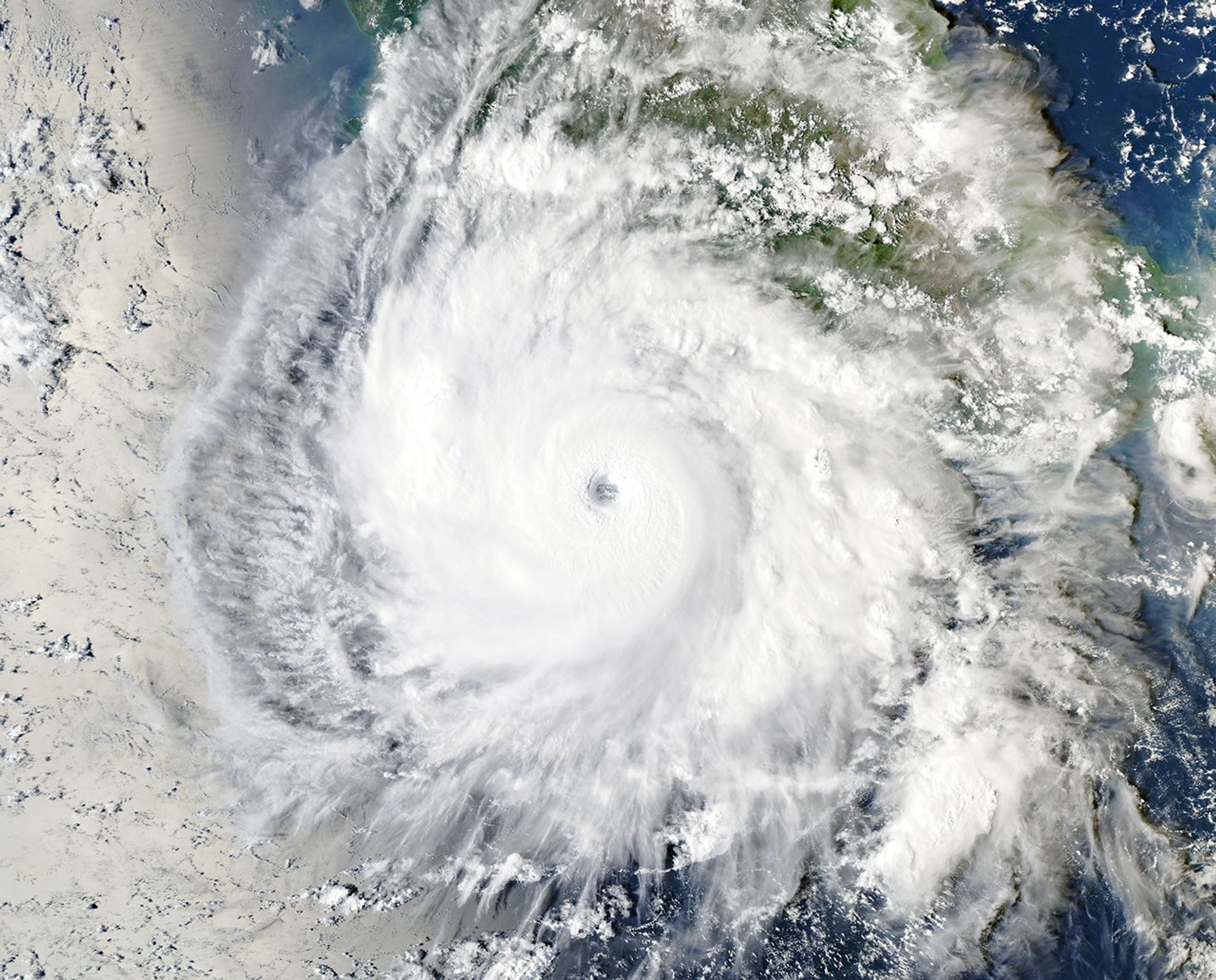
航天图片资料 · The well-defined eye of Hurricane Simon lies just off Mexico’s Pacific coast. Some outer cloud bands of the spiraling storm extend over land. · 来源署名:NASA · 原始许可标注:NASA Image and Media Guidelines