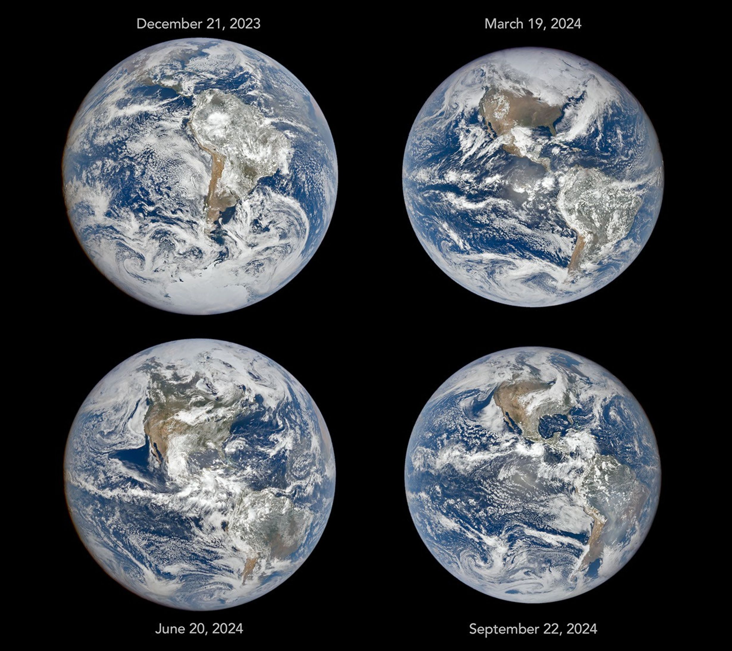
Four full-disk images of Earth are arranged in a two-by-two grid. The December image on the upper left shows the South America centered with Antarctica visible. The June image features parts of North America and Arctic sea ice that were not visible in December. The March and September images have South America and North America in more intermediate positions.图:NASA · NASA Image and Media Guidelines