National Oceanic and Atmospheric Administration · 航天照片图库
National Oceanic and Atmospheric Administration · 航天照片图库,仅列出本次快照中实际生成且可访问的资料。
资料最后更新时间:
- 集合条目总数
- 86
- 当前页码
- 1
National Oceanic and Atmospheric Administration · 航天照片图库:共收录 86 项实际生成的公开资料,本页为第 1 页,共 2 页。
航天图片资料 · 025cd25cac7fda57
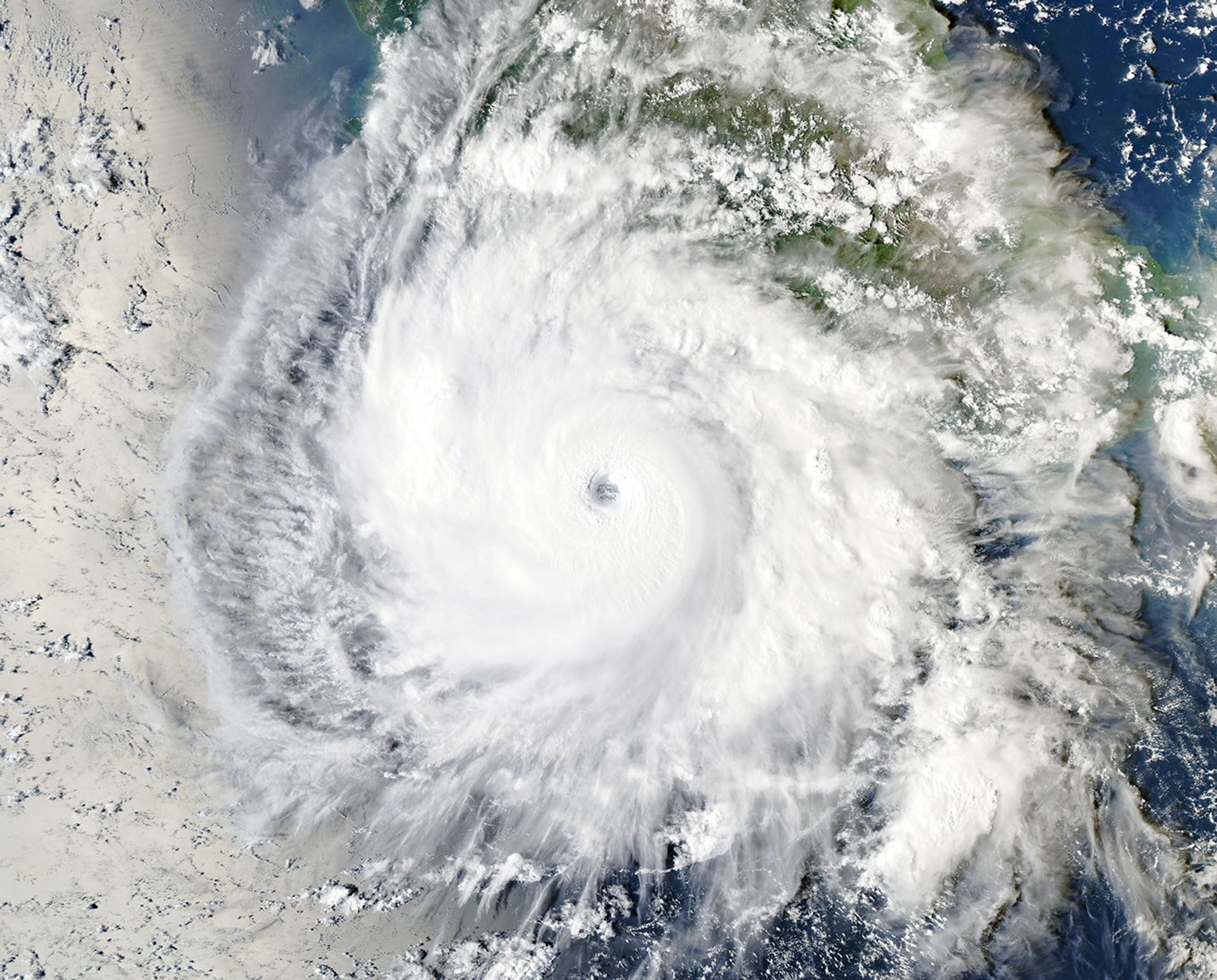
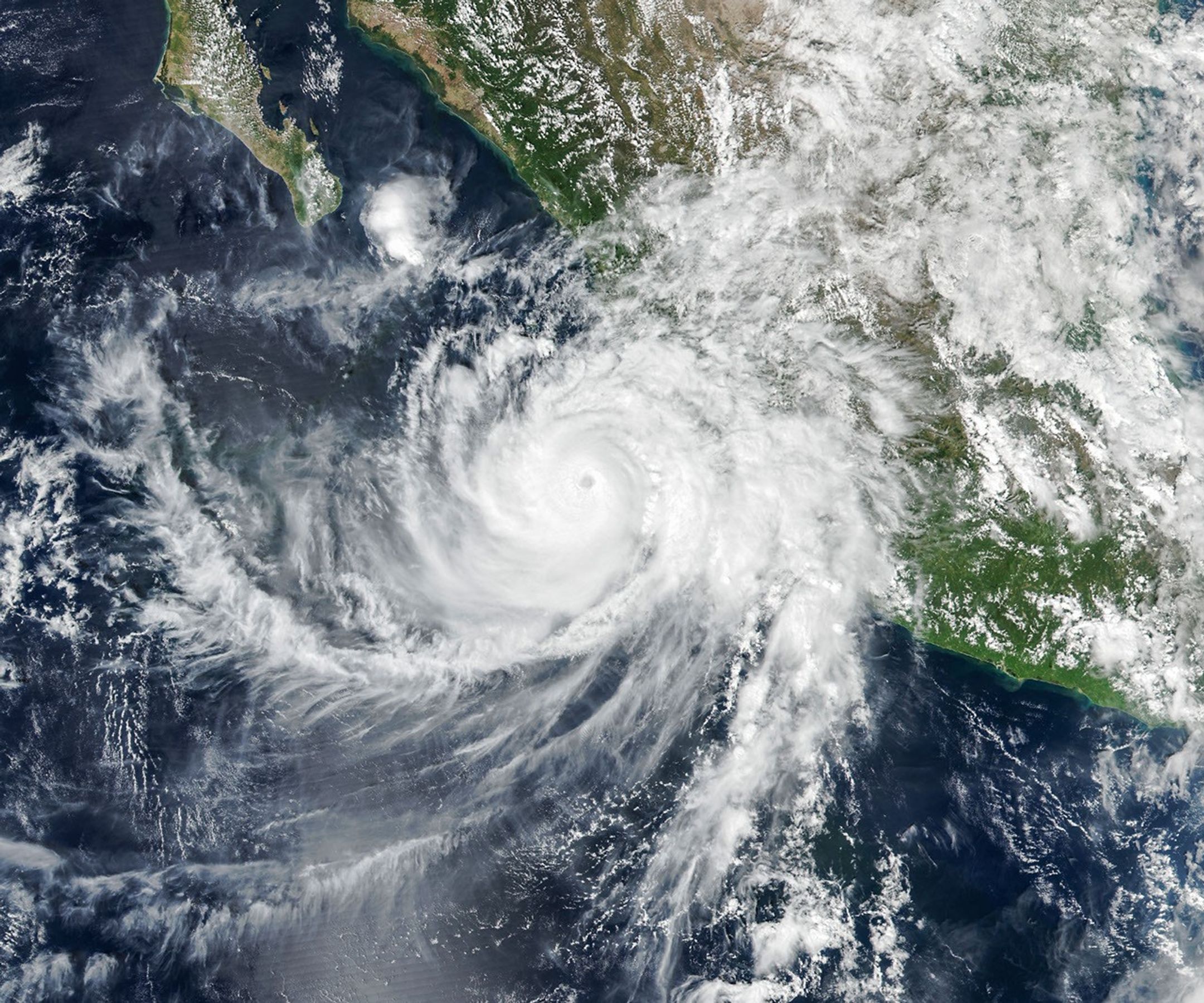
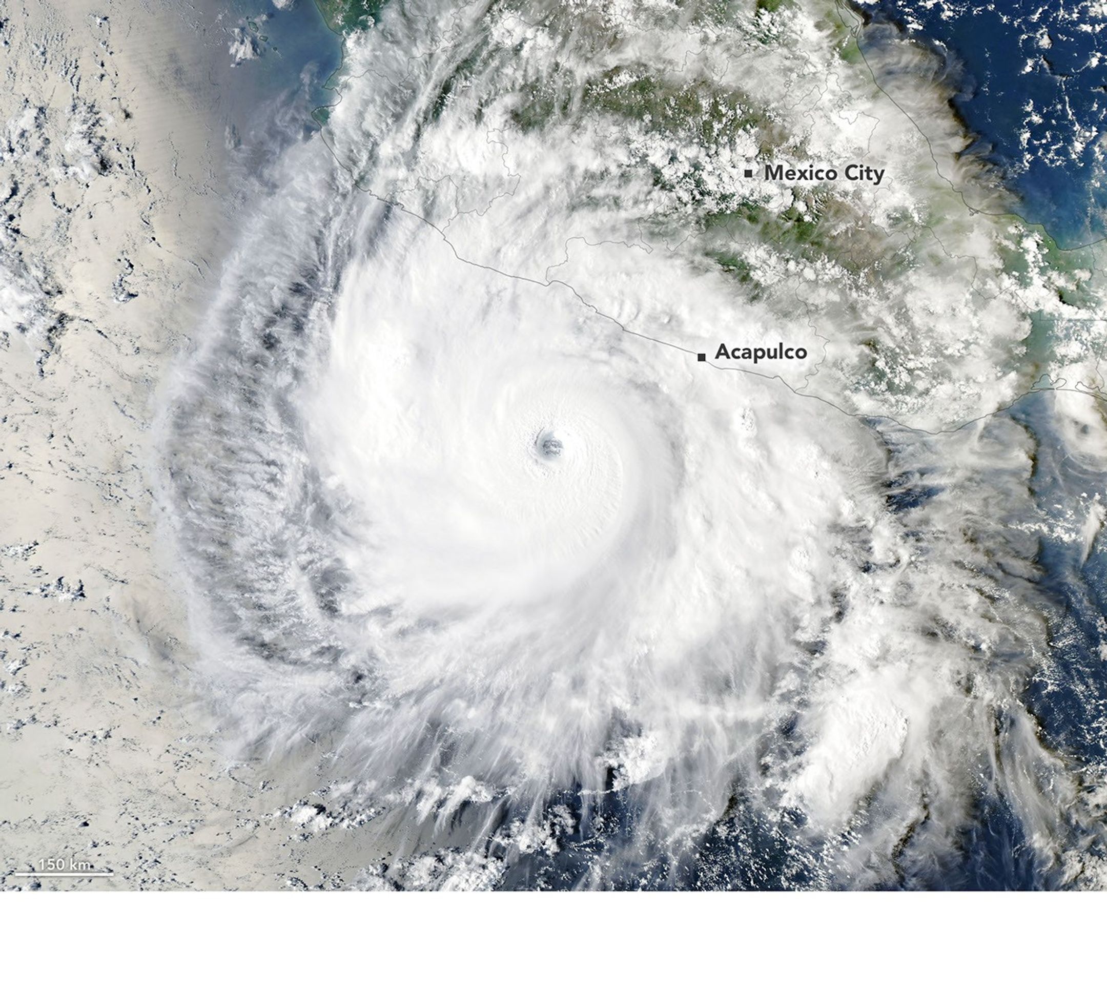
航天图片资料 · Hurricane Polo, with a well-defined eye, swirls over the Pacific Ocean off the coast of Mexico. The storm was positioned just south of Acapulco, with its outer cloud bands extending inland toward Mexico City.
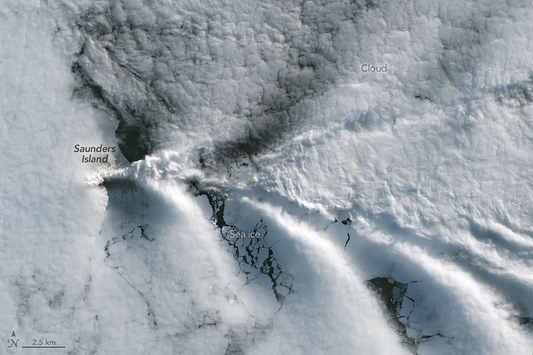
航天图片资料 · A series of V-shaped wave clouds appears over an ocean filled with pieces of sea ice.
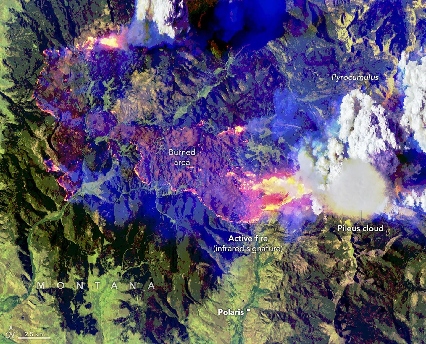
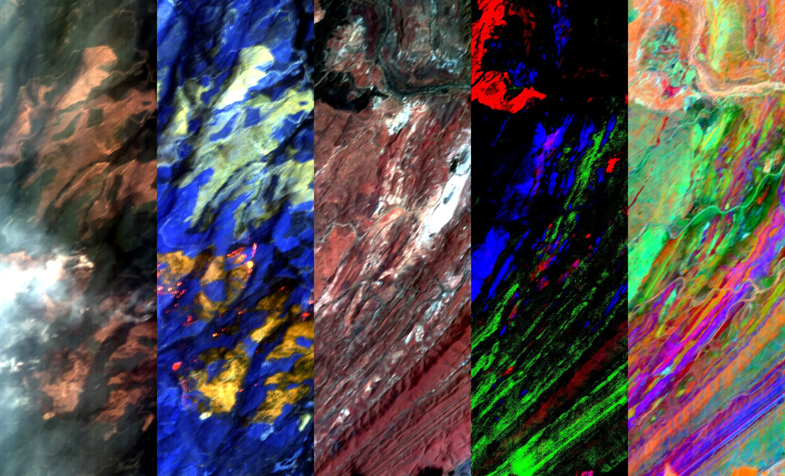
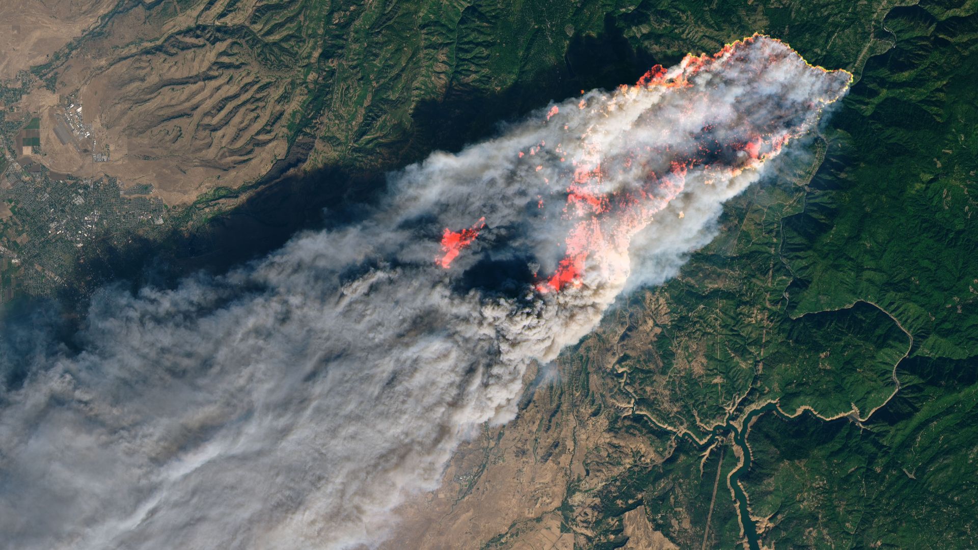
航天图片资料 · False-color aerial image of the same wildfire. Active fire fronts appear bright pink, magenta, and yellow around a large brown burned area. A towering white pyrocumulus cloud rises from the fire at right. A smooth, thin pileus cloud obscures part of its top.
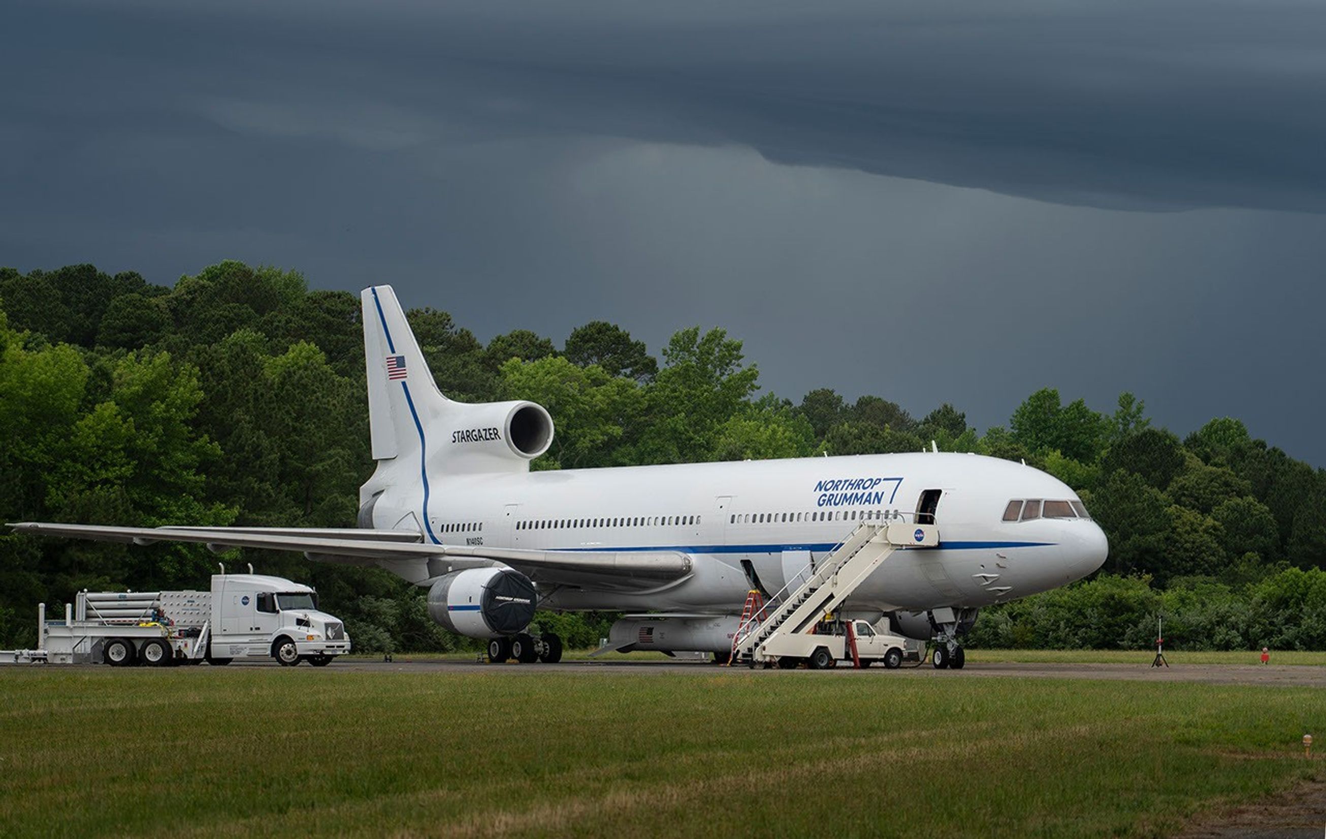
航天图片资料 · An airplane with a rocket attached to its belly
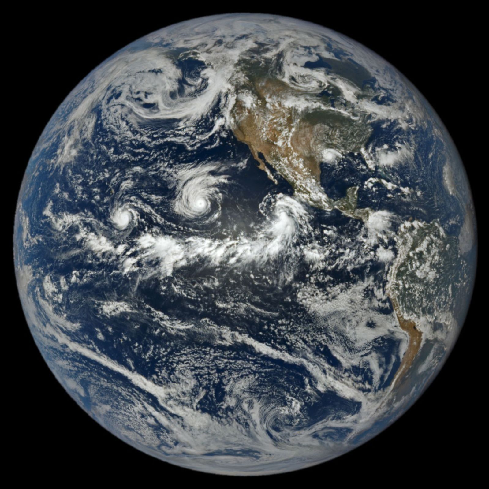
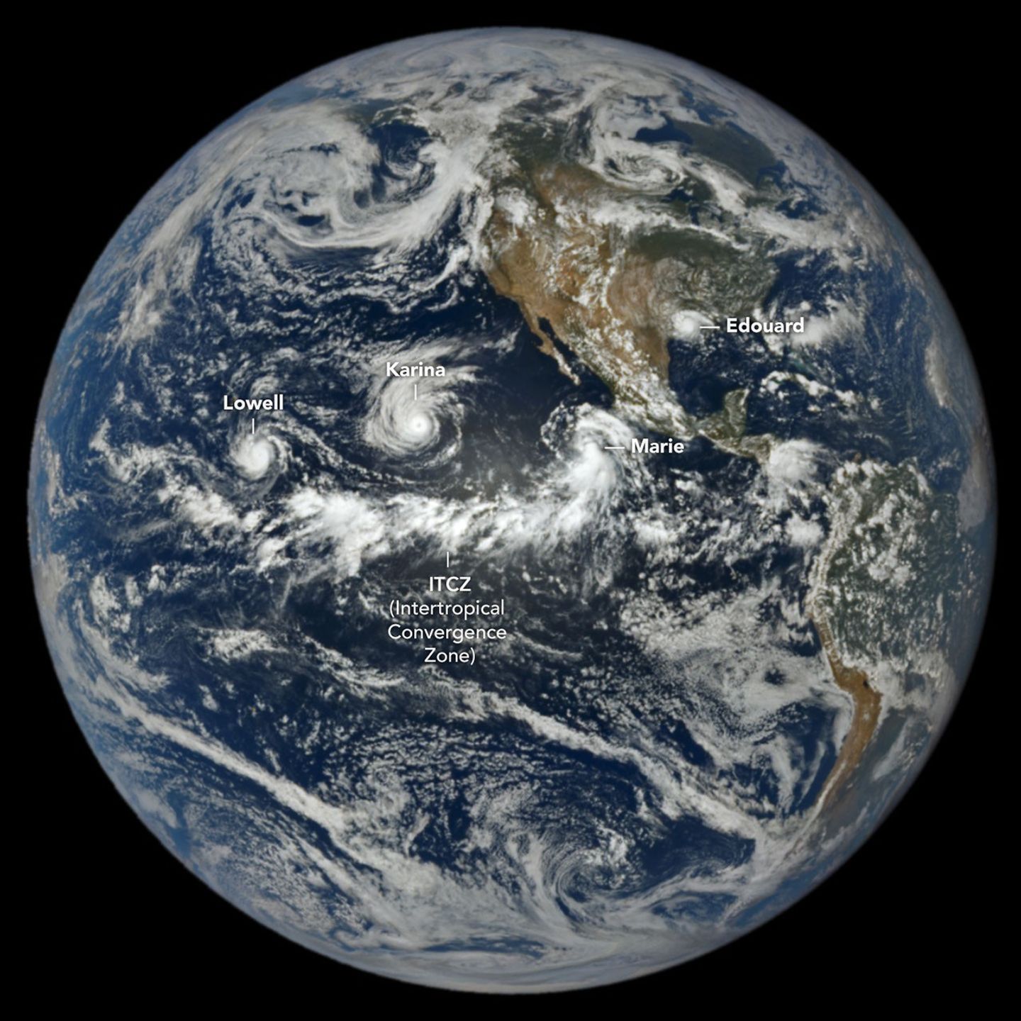
航天图片资料 · In a full-disk satellite view of Earth, three tropical cyclones—named Lowell, Karina, and Marie—swirl above the blue waters of the Pacific Ocean and to the west of Central America.
航天图片资料 · 11a73a3387a634d5
航天图片资料 · A SpaceX Falcon Heavy rocket is lifted by a yellow crane inside an industrial facility. The 27 black rocket engines stick out of the bottom or three white booster housings, some covered with soot.
航天图片资料 · A collection of the logos of the CSDA program's federal and international partners. Shown here are the logos for including the Civil Applications Committee, National Geospatial-Intelligence Agency, National Oceanic and Atmospheric Administration, National Reconnaissance Office, U.S. Department of Agriculture, U.S. Geological Survey, United States Space Force, the United States Air Force, the Joint Agency Commercial Imagery Evaluation, and the European Space Agency.
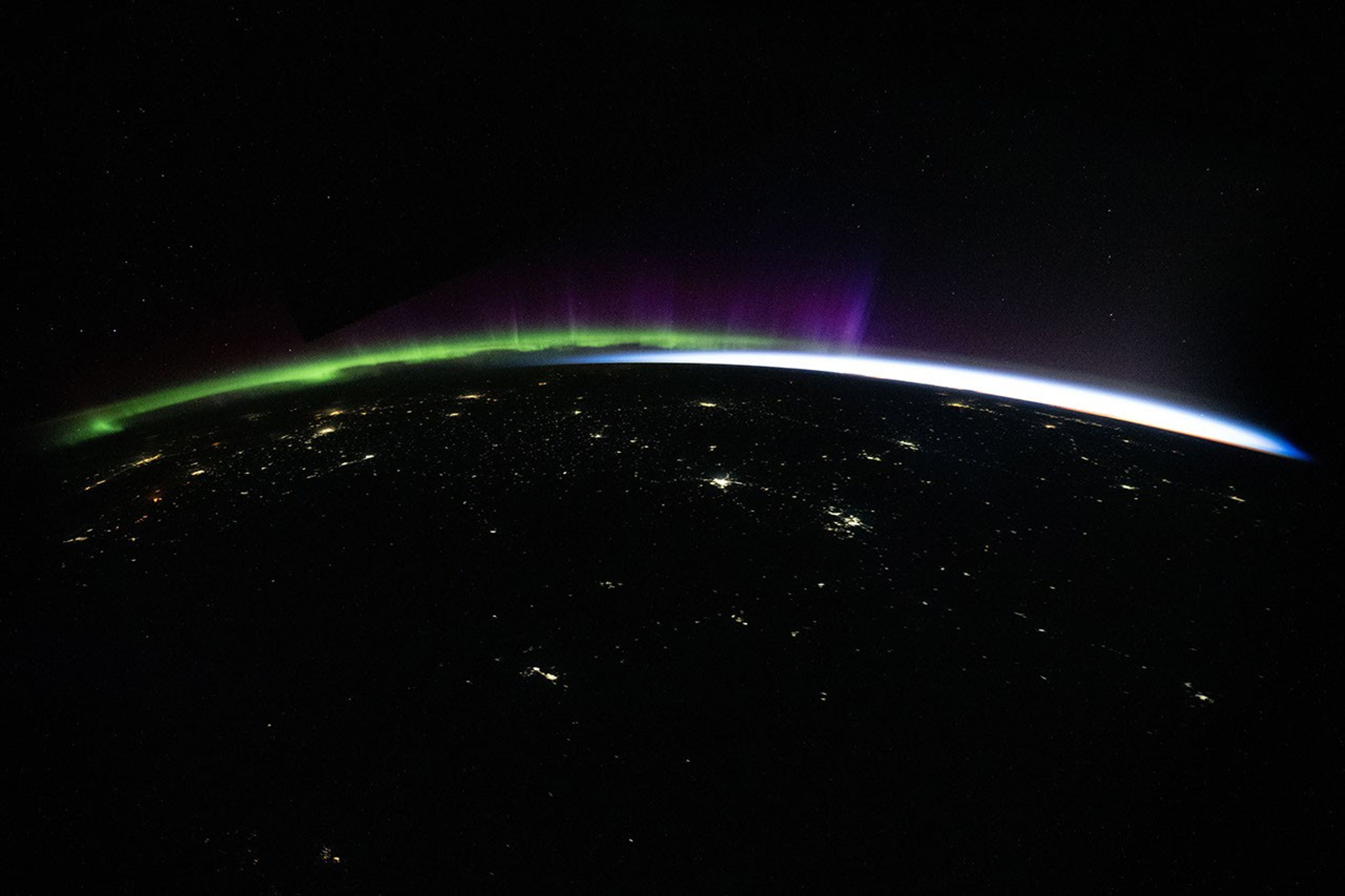
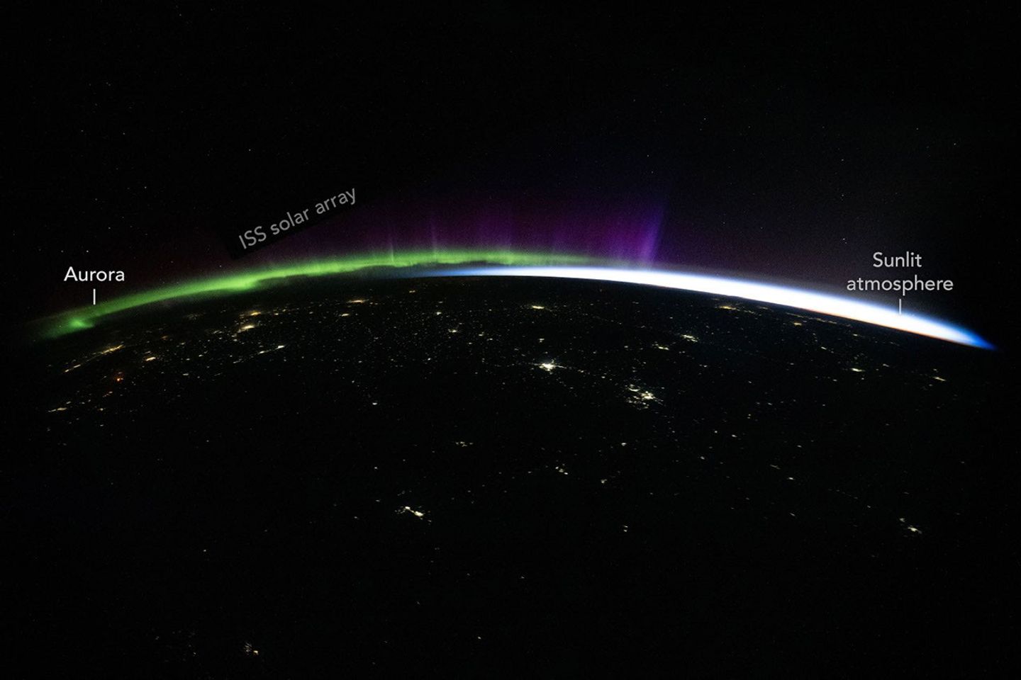
航天图片资料 · Green and purple aurora and white airglow arc above Earth’s limb and the scattered city lights of Central Asia in a nighttime photo taken from the International Space Station.
航天图片资料 · 212825ec516b244b
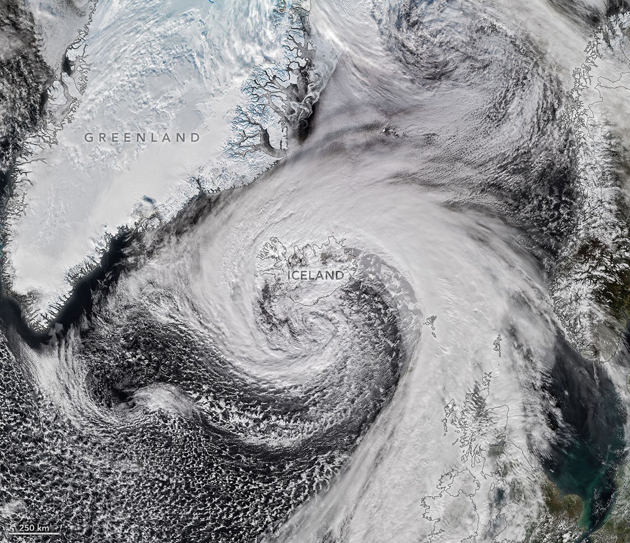
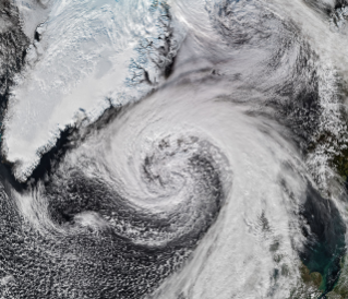
航天图片资料 · Storm clouds in an expanding spiral are centered near southern Iceland. The system extends across the North Atlantic from Greenland to the UK.
航天图片资料 · 264a1bb859345389
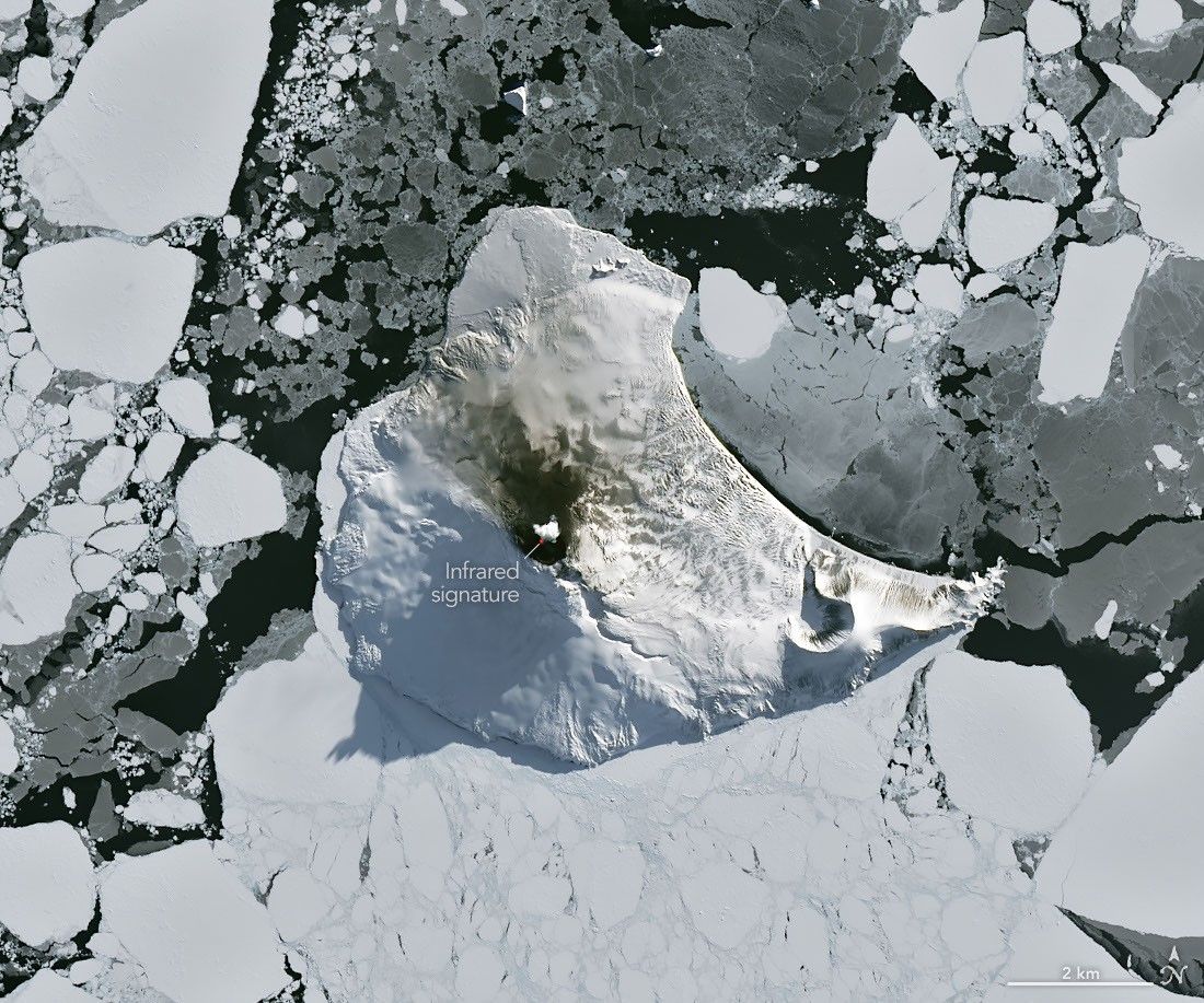
航天图片资料 · A small ice- and snow-covered island with an active volcanic crater at its center is surrounded by drifting pieces of sea ice. A thermal signal and small plume appear in the crater, and ash darkens the snow on the volcano’s northern slopes.
航天图片资料 · 2b5d4a8fe92f4f7d
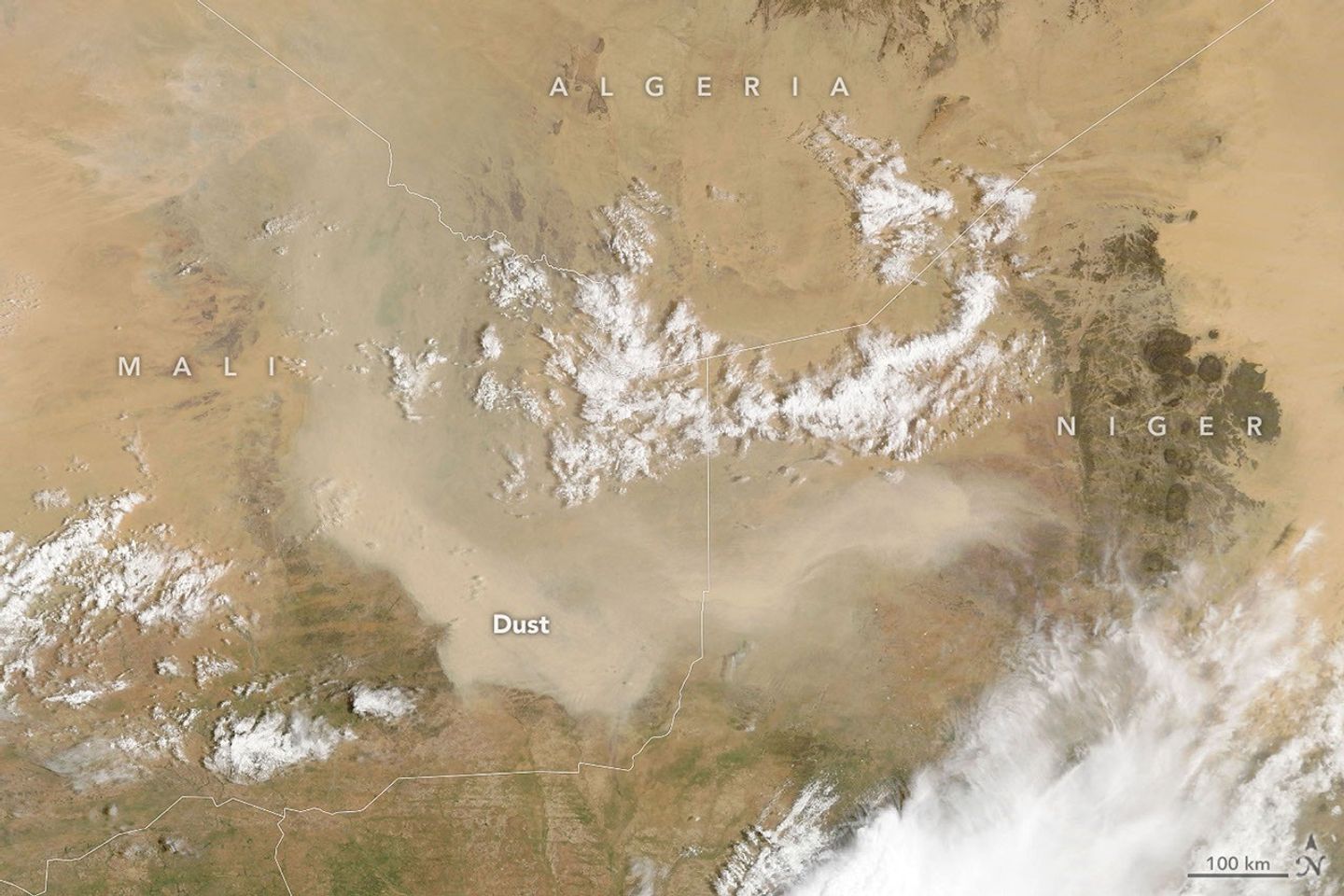
航天图片资料 · A light brown dust plume, dense at its center and more diffuse toward its edges, extends horizontally across an orange-brown and green landscape. Scattered white clouds cover some of the scene.
航天图片资料 · An artist rending of the Nancy Grace Roman space telescope. (NASA)
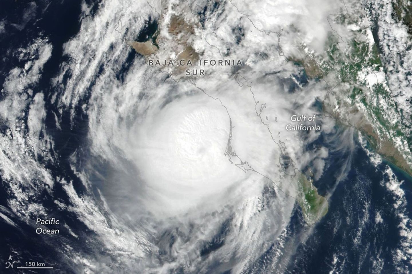
航天图片资料 · Hurricane Polo’s clouds spiral over the Pacific Ocean and the Baja California peninsula. The storm’s faint eye is just off the west coast of the peninsula.
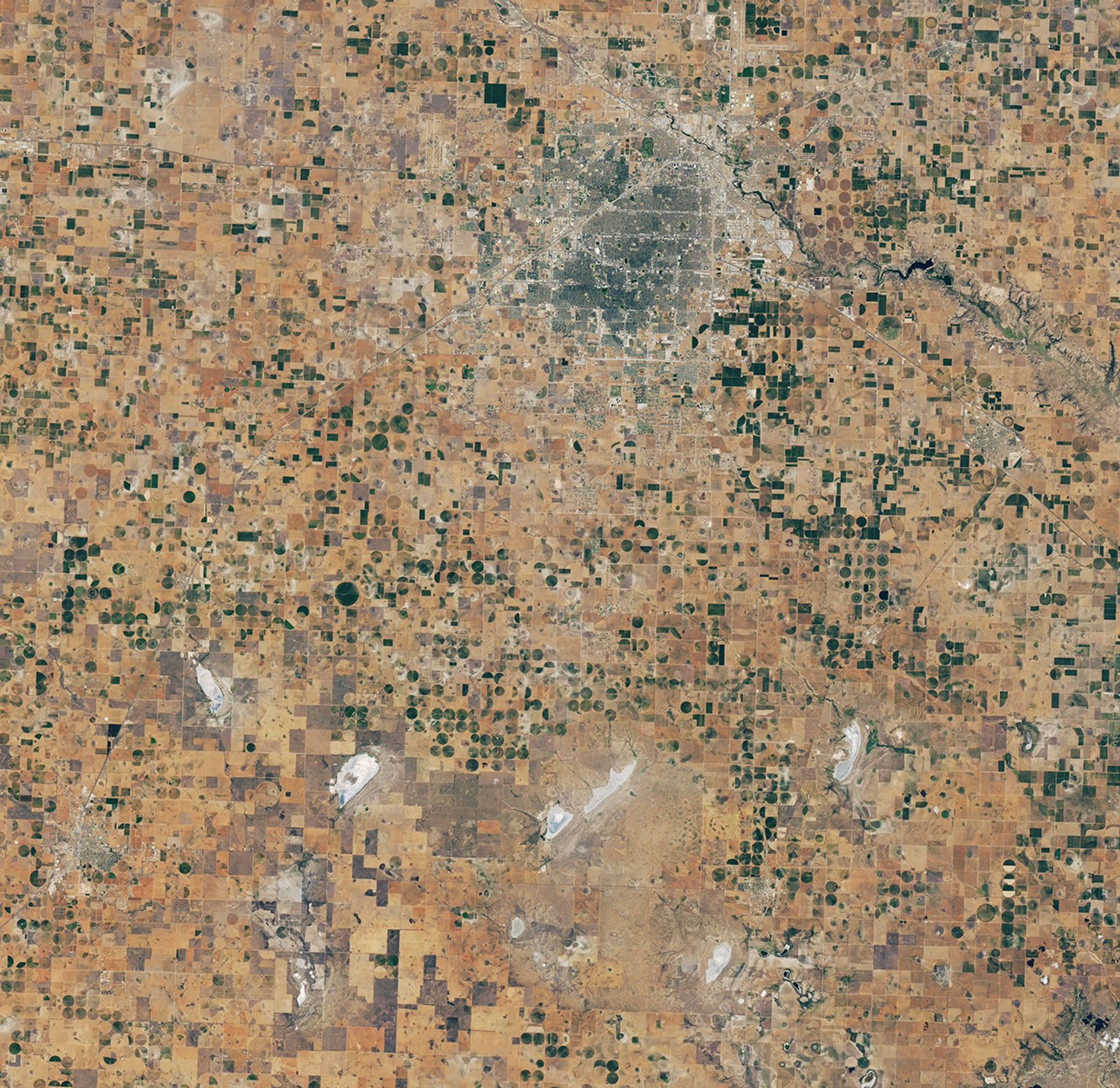
航天图片资料 · A satellite image of the same Lubbock region on September 9, 2026, appears parched, with much less green vegetation and mostly dry lakes.
航天图片资料 · 426cadeae80f5774
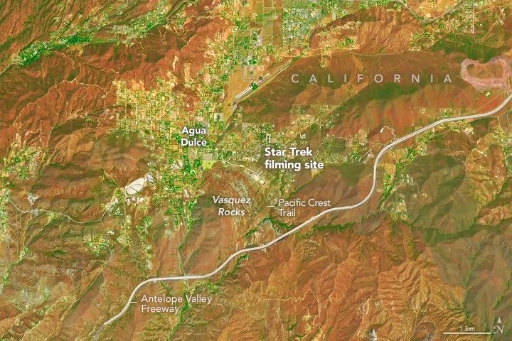
航天图片资料 · A zoomed-in view of the Vasquez Rocks part of the image highlights a sandy parking lot where Star Trek scenes were filmed, the Antelope Valley Freeway, and the nearby community of Agua Dulce.
航天图片资料 · LINK attached to the front of the Pegasus XL
航天图片资料 · Green and purple aurora and white airglow arc above Earth’s limb and the scattered city lights of Central Asia in a nighttime photo taken from the International Space Station.
航天图片资料 · NASA insignia
航天图片资料 · In a full-disk satellite view of Earth, three tropical cyclones—named Lowell, Karina, and Marie—swirl above the blue waters of the Pacific Ocean and to the west of Central America.
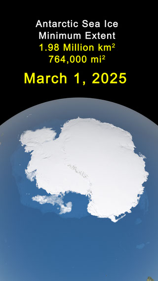
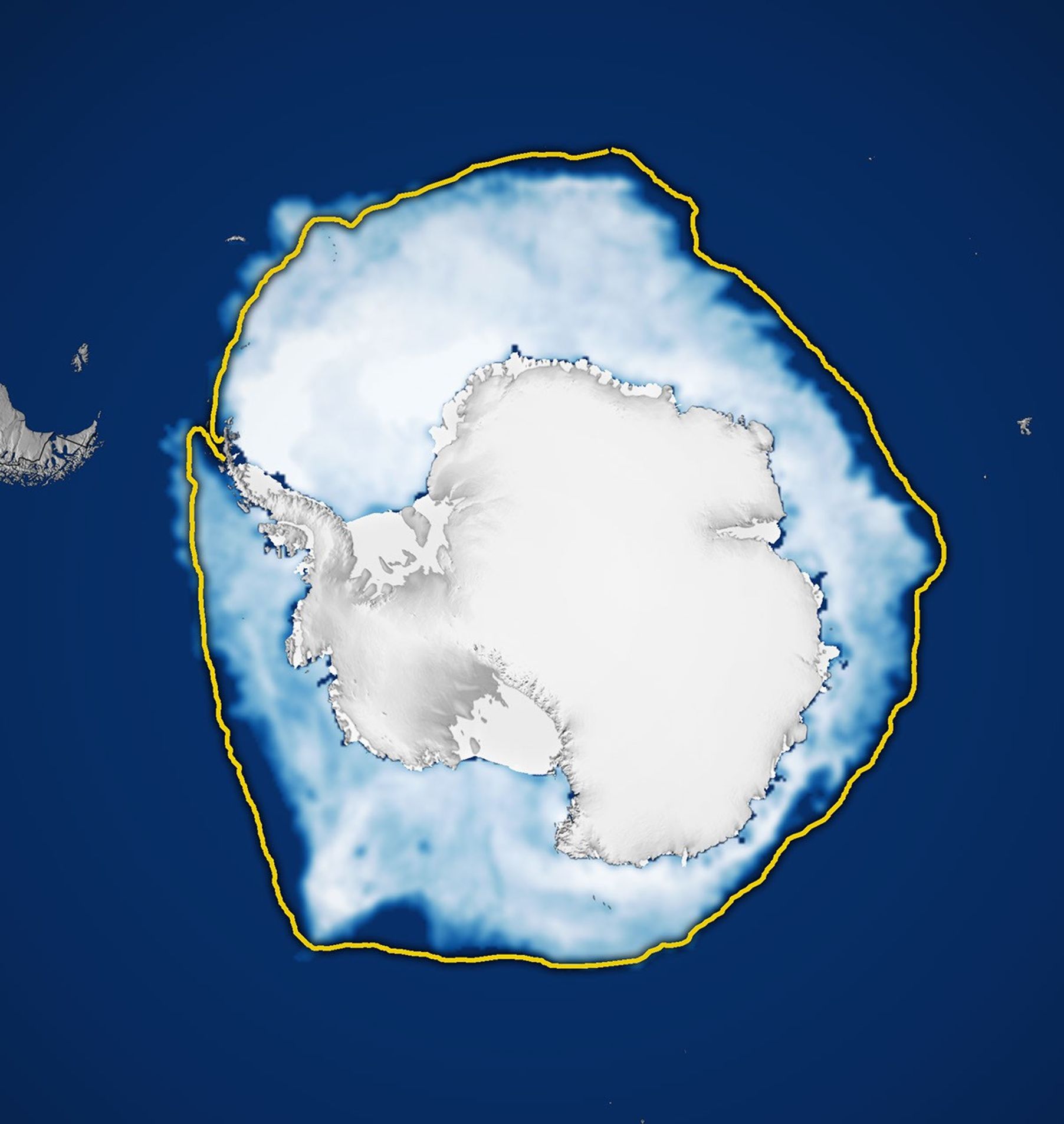
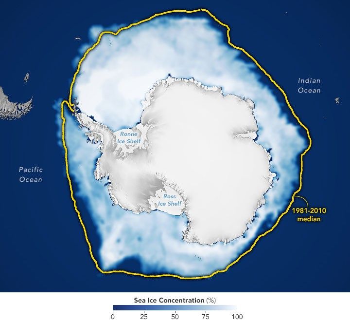
航天图片资料 · A map shows white Antarctic sea ice on September 14, 2026, the day it reached its annual maximum extent. The 1981–2010 median is outlined in yellow.
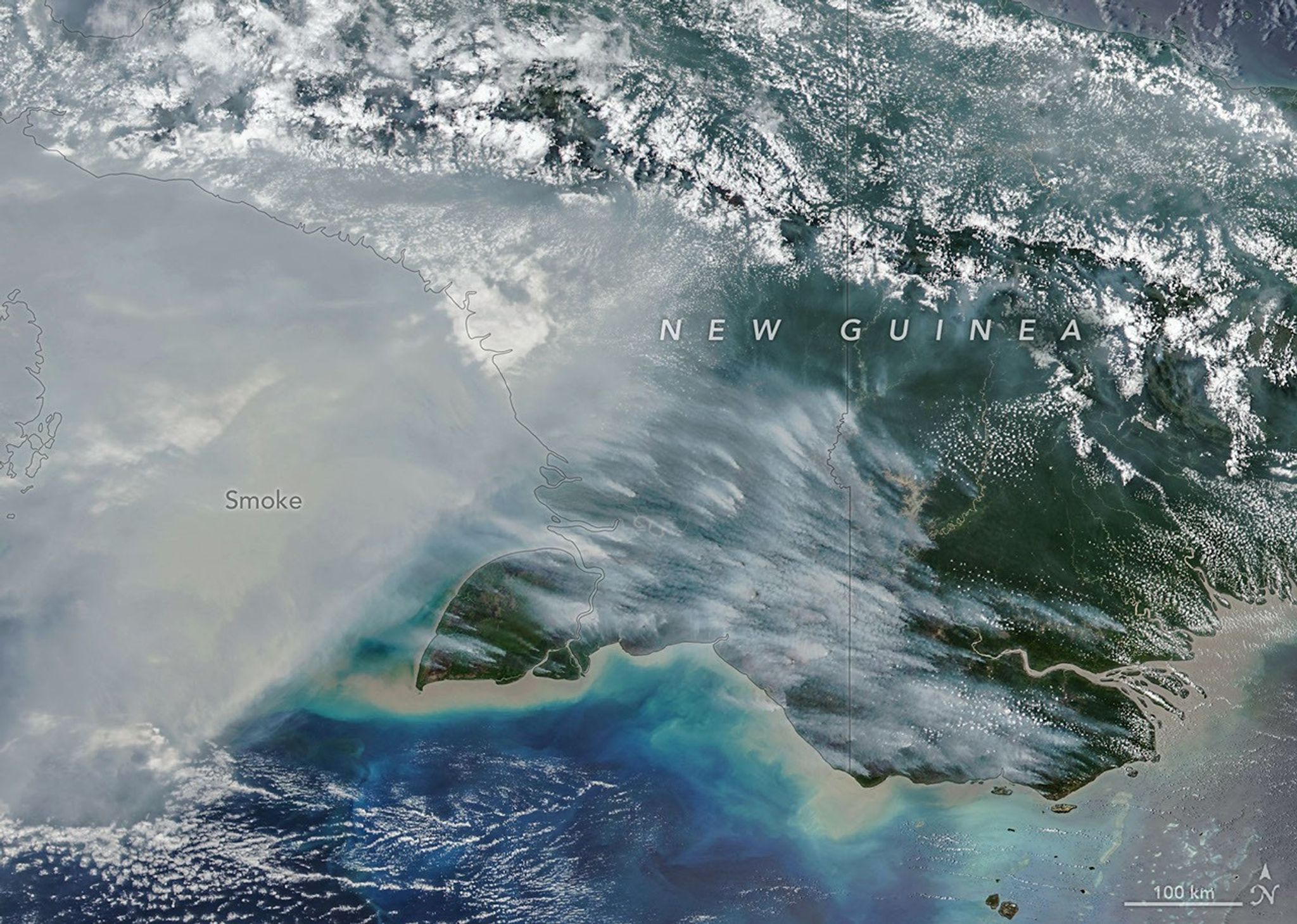
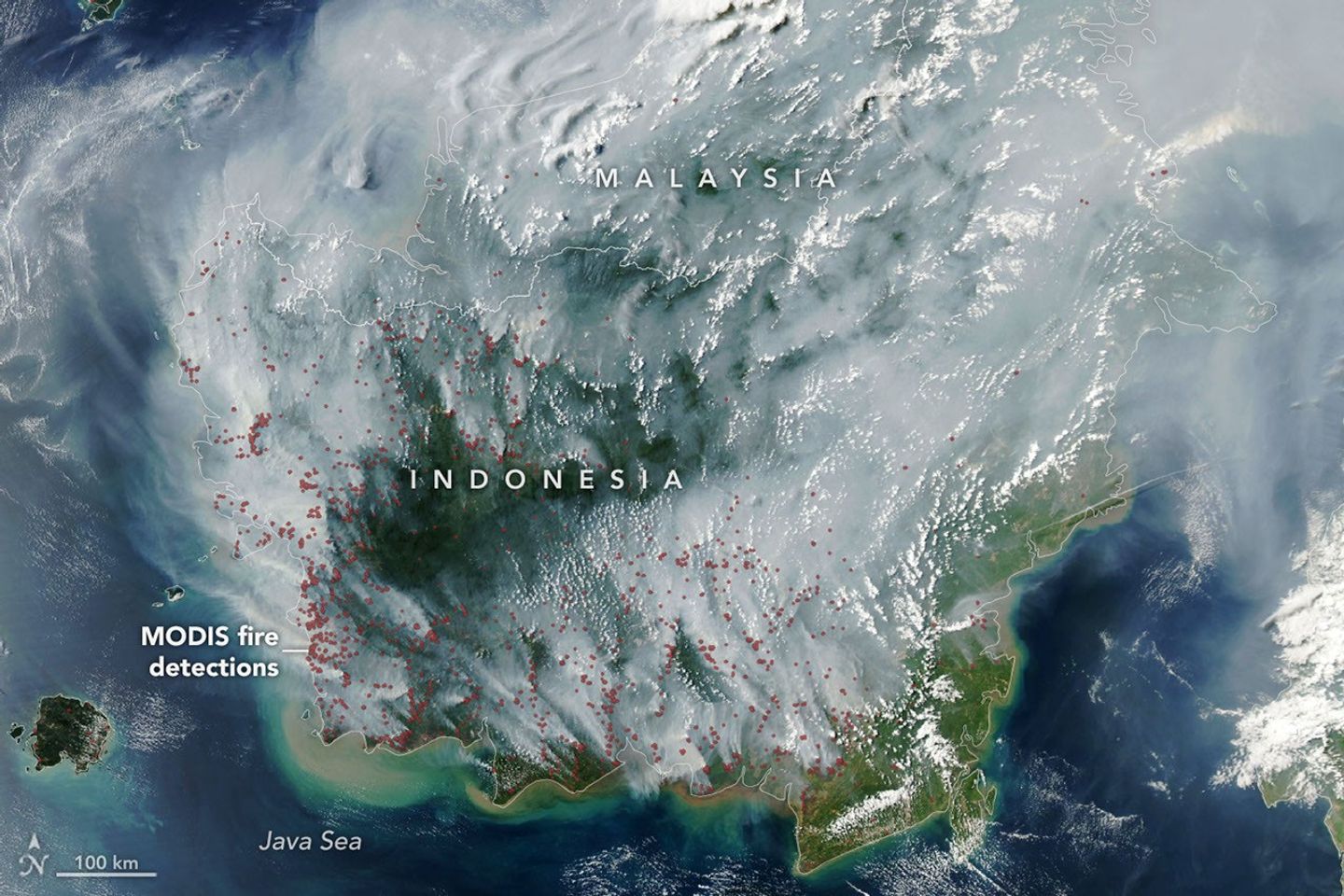
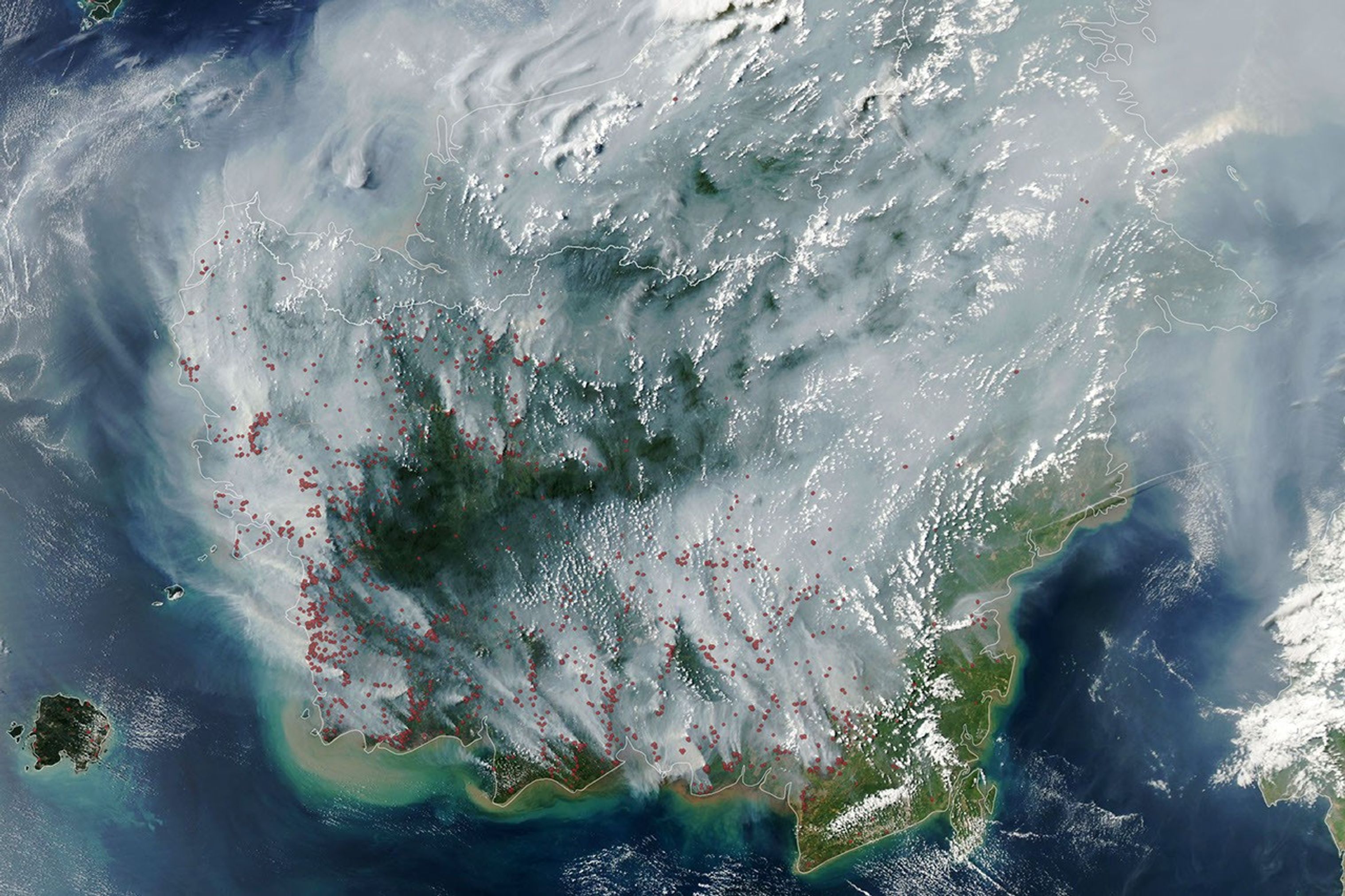
航天图片资料 · Smoke covers much of the southern third of New Guinea, while clouds and east-west-running mountain ranges are visible in the northern part of the island.
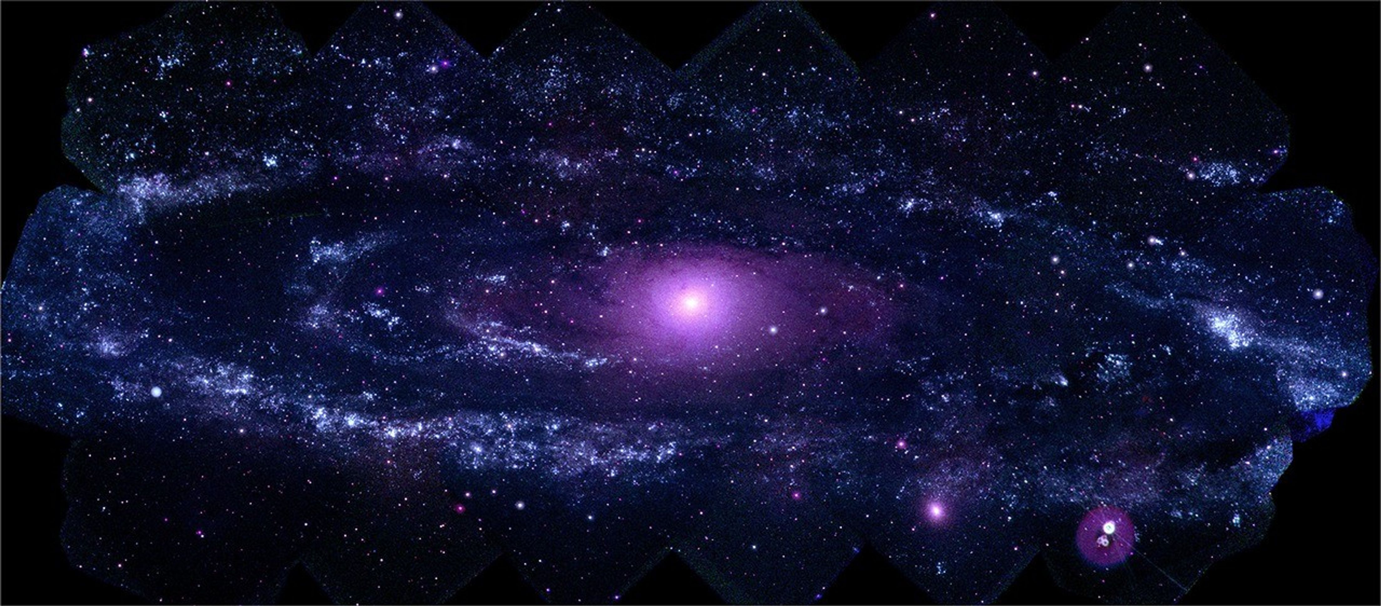
航天图片资料 · Mosaic of Swift ultraviolet images of the Andromeda galaxy
航天图片资料 · 575b5f34c8da1185
航天图片资料 · 581f1b768f70a6cd
航天图片资料 · The locations of MODIS fire detections are depicted with small red circles. Most are visible on the southern side of the island.
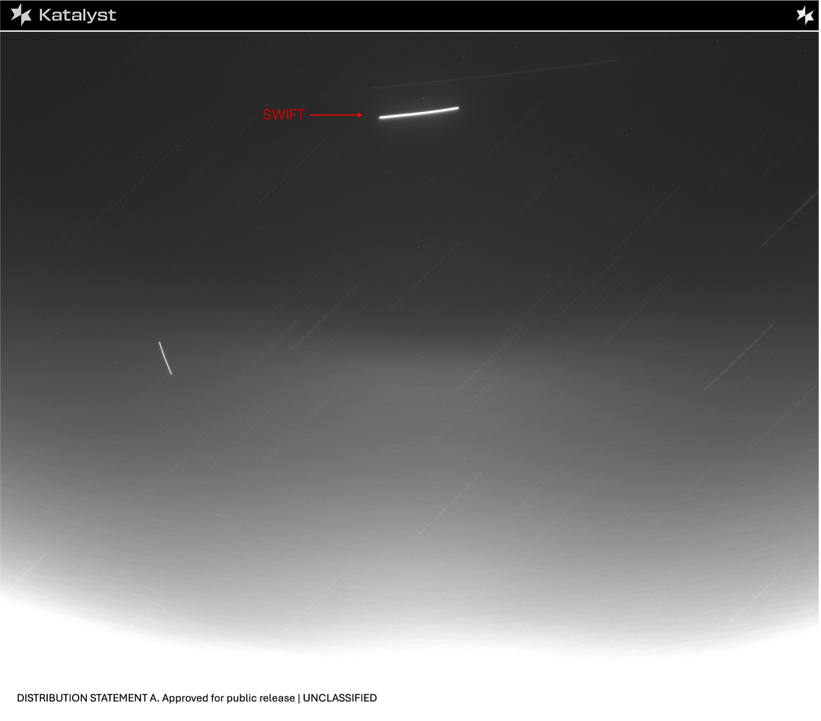
航天图片资料 · LINK image of Swift, which is a bright streak against black of space
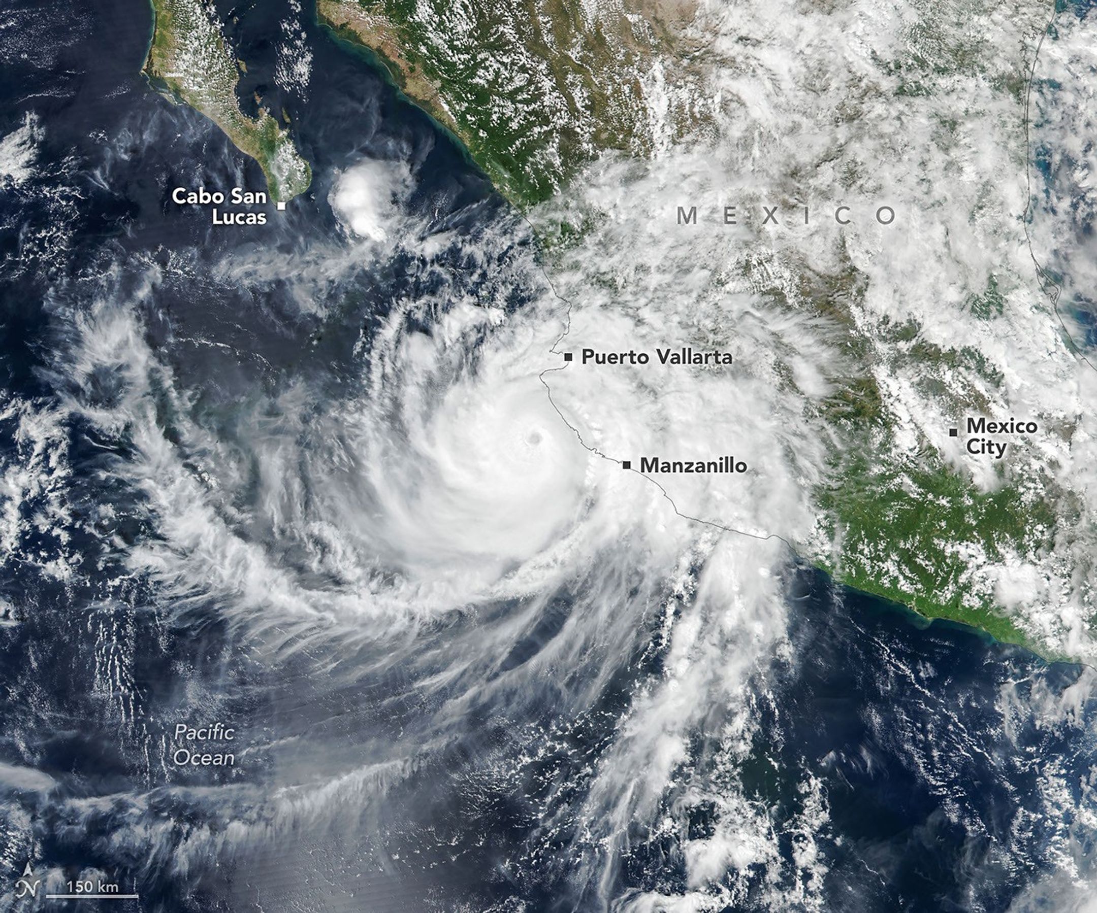
航天图片资料 · The well-defined eye of Hurricane Simon lies just off Mexico’s Pacific coast. Some outer cloud bands of the spiraling storm extend over land.
航天图片资料 · 59c4137f4c8a1c98
航天图片资料 · 5d3f92d6d1f42549
航天图片资料 · A map shows white Antarctic sea ice on September 14, 2026, the day it reached its annual maximum extent. The 1981–2010 median is outlined in yellow.
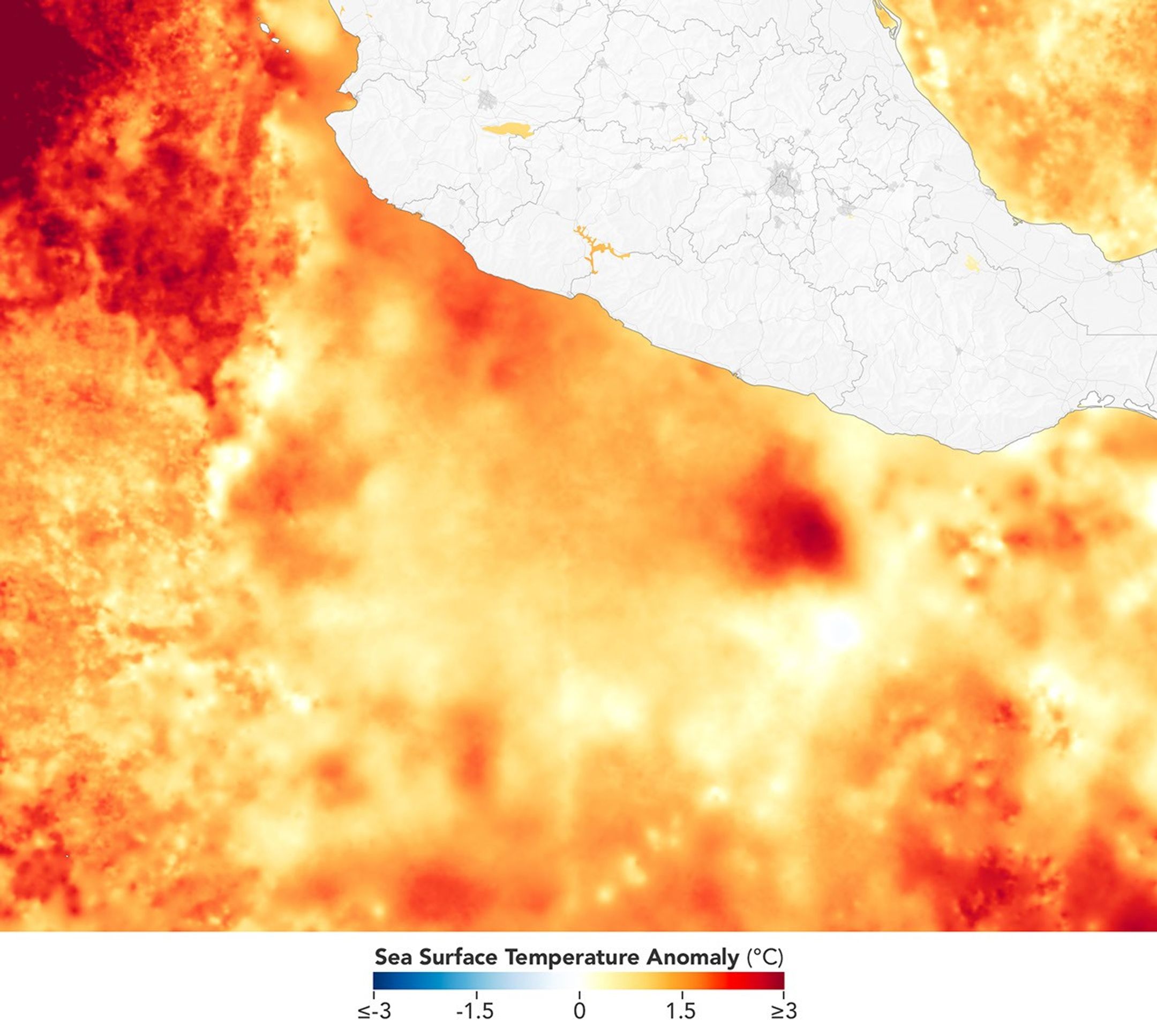
航天图片资料 · A map depicts sea surface temperature anomalies off Mexico's Pacific coast on September 23. Deep red areas highlight areas 3°C above the norm for that date. A dotted line traces the storm's path from September 20 to September 23 as it moved through the unusually warm waters.
航天图片资料 · Hurricane Polo, with a well-defined eye, swirls over the Pacific Ocean off the coast of Mexico. The storm was positioned just south of Acapulco, with its outer cloud bands extending inland toward Mexico City.
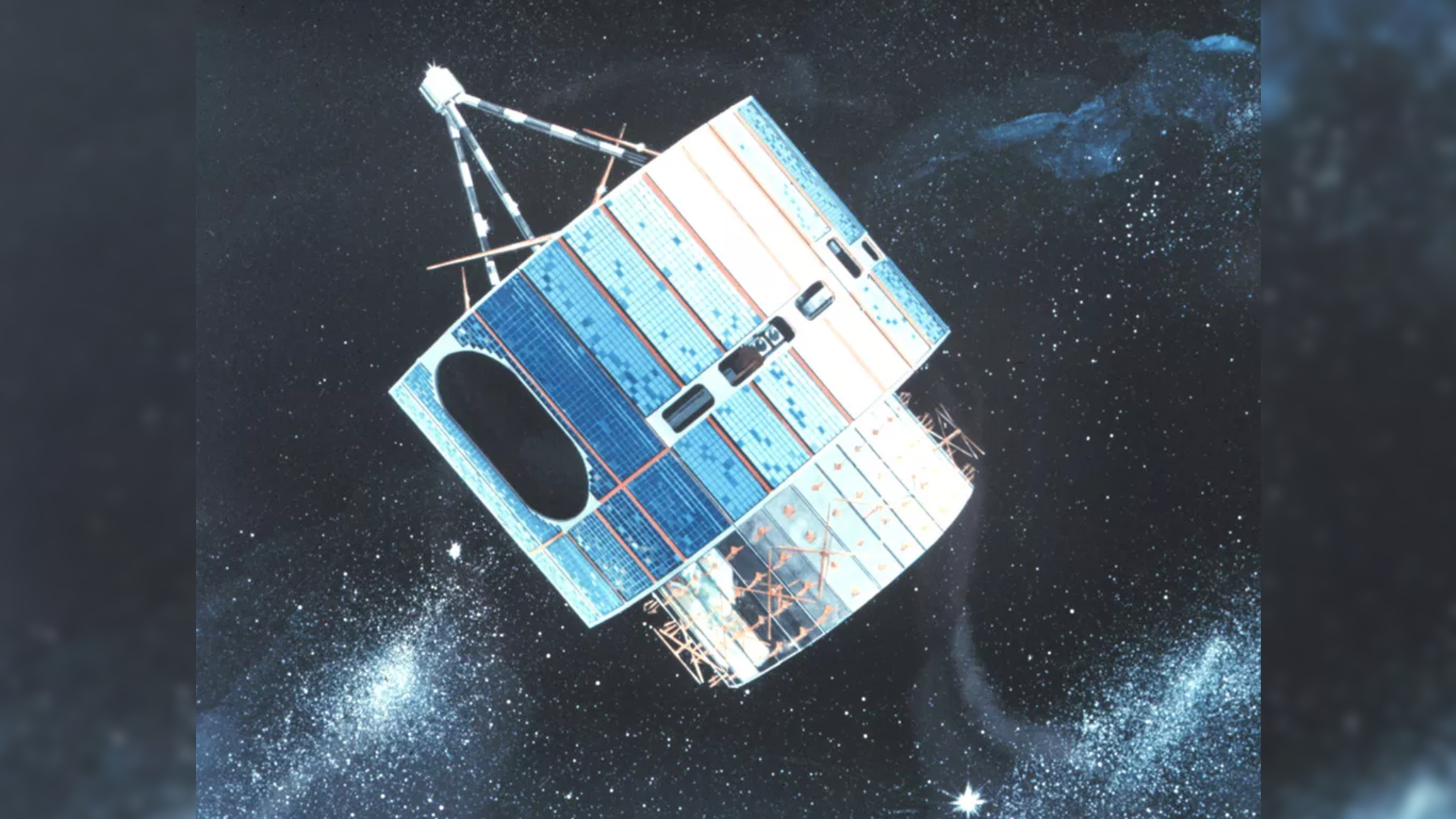
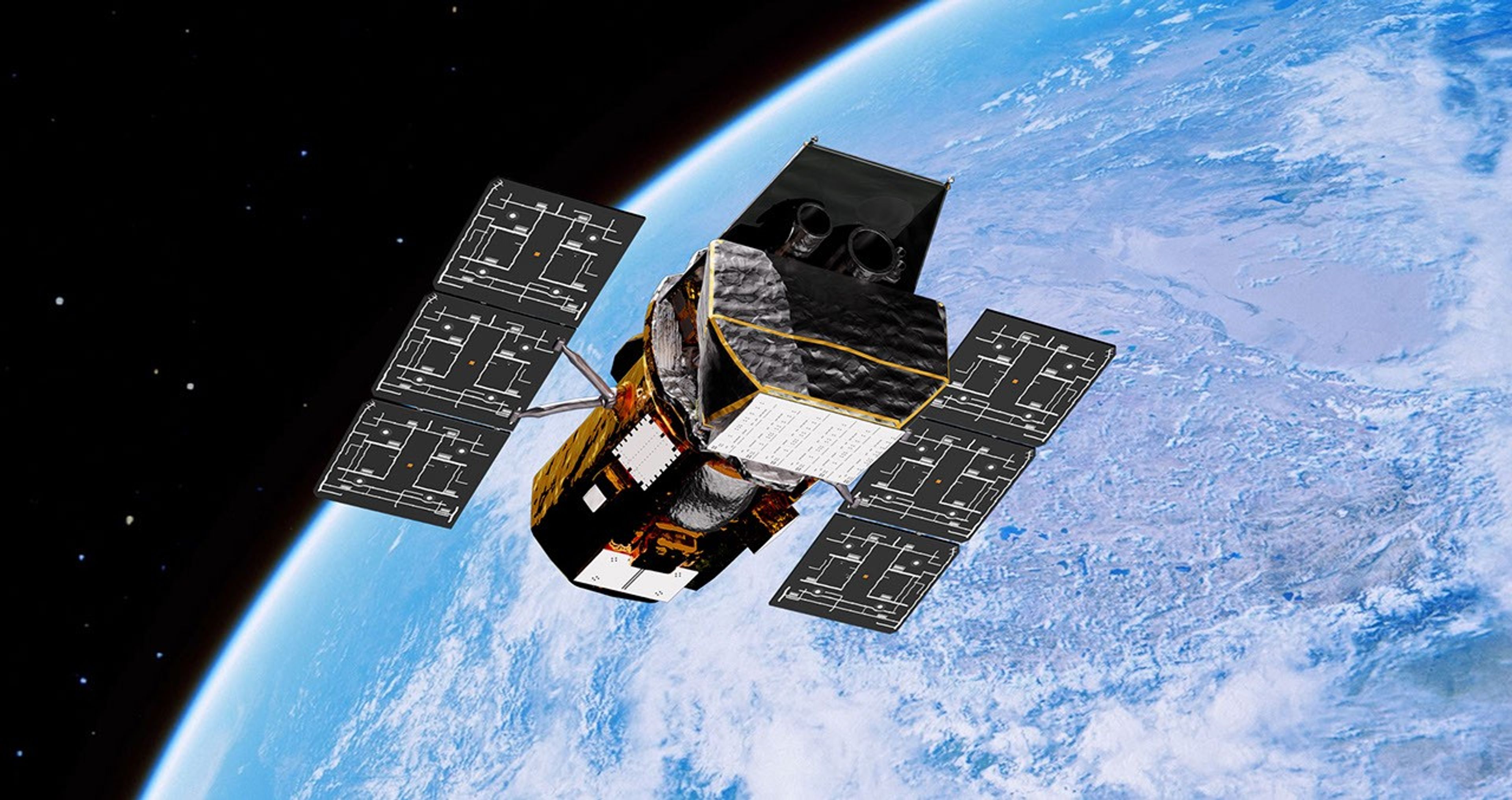
航天图片资料 · An artist's illustration of the GOES-1 weather satellite.
航天图片资料 · The well-defined eye of Hurricane Simon lies just off Mexico’s Pacific coast. Some outer cloud bands of the spiraling storm extend over land.
航天图片资料 · A view of a wildfire with smoke from a satellite's point of view.
航天图片资料 · Storm clouds in an expanding spiral are centered near southern Iceland. The system extends across the North Atlantic from Greenland to the UK.
航天图片资料 · The locations of MODIS fire detections are depicted with small red circles. Most are visible on the southern side of the island.
航天图片资料 · 755262ade27e5d89
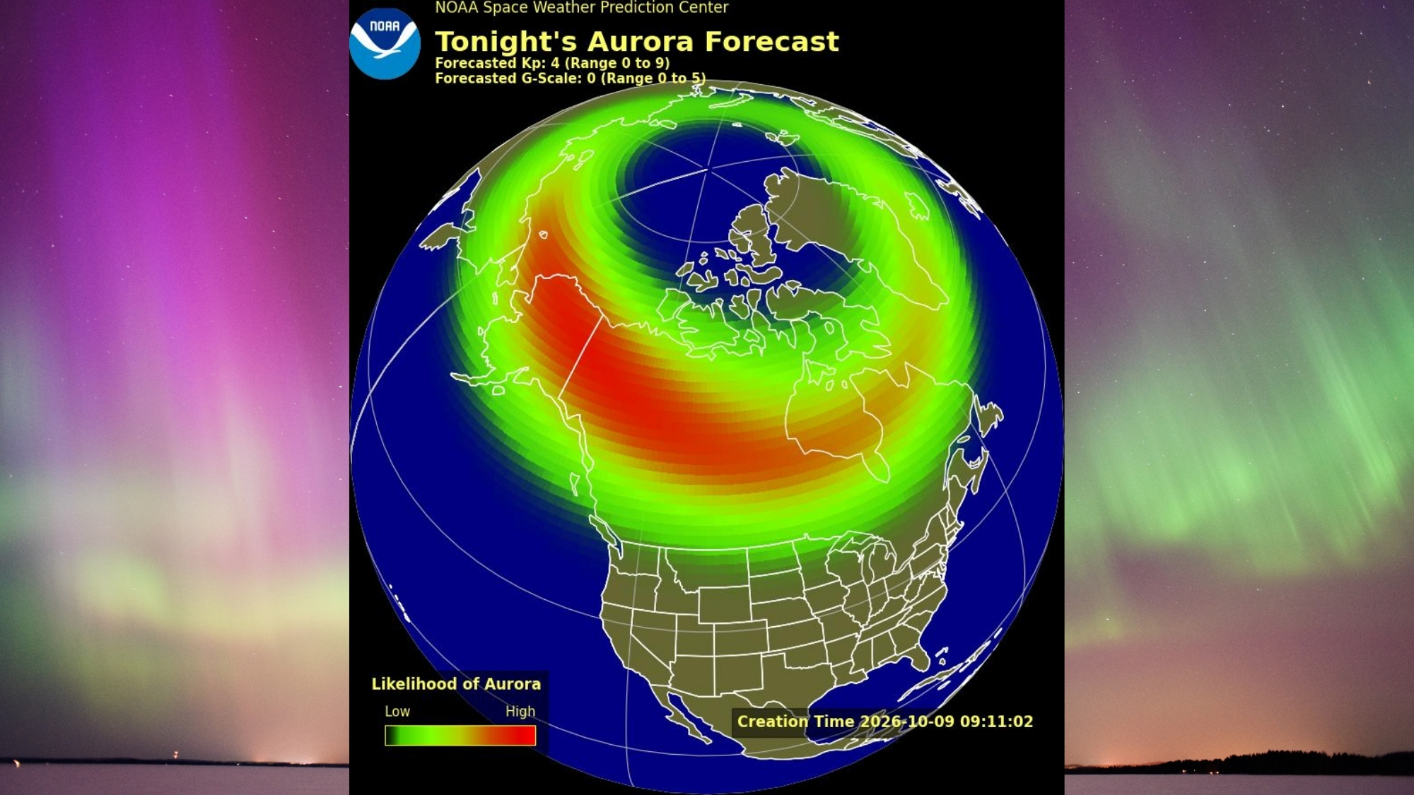
航天图片资料 · map showing the possible visibility of the northern lights over the US. in the background are vivid green and magenta auroras.
航天图片资料 · Artist’s concept of Swift in orbit above Earth
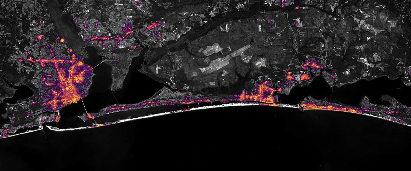
航天图片资料 · Nighttime lights along the Florida Panhandle coast in August 2026, brightest in Pensacola and Destin and along the road between them.
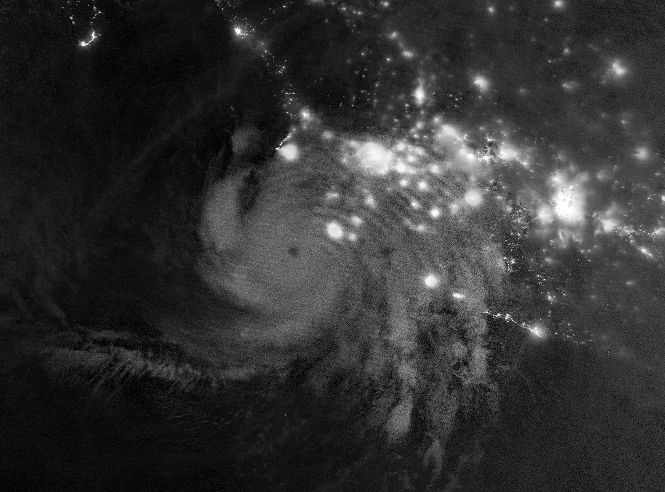
航天图片资料 · Gravity waves in the upper atmosphere appear as a semicircle of ripples in a nighttime, grayscale satellite image. Hurricane clouds and city lights in Mexico are also visible.