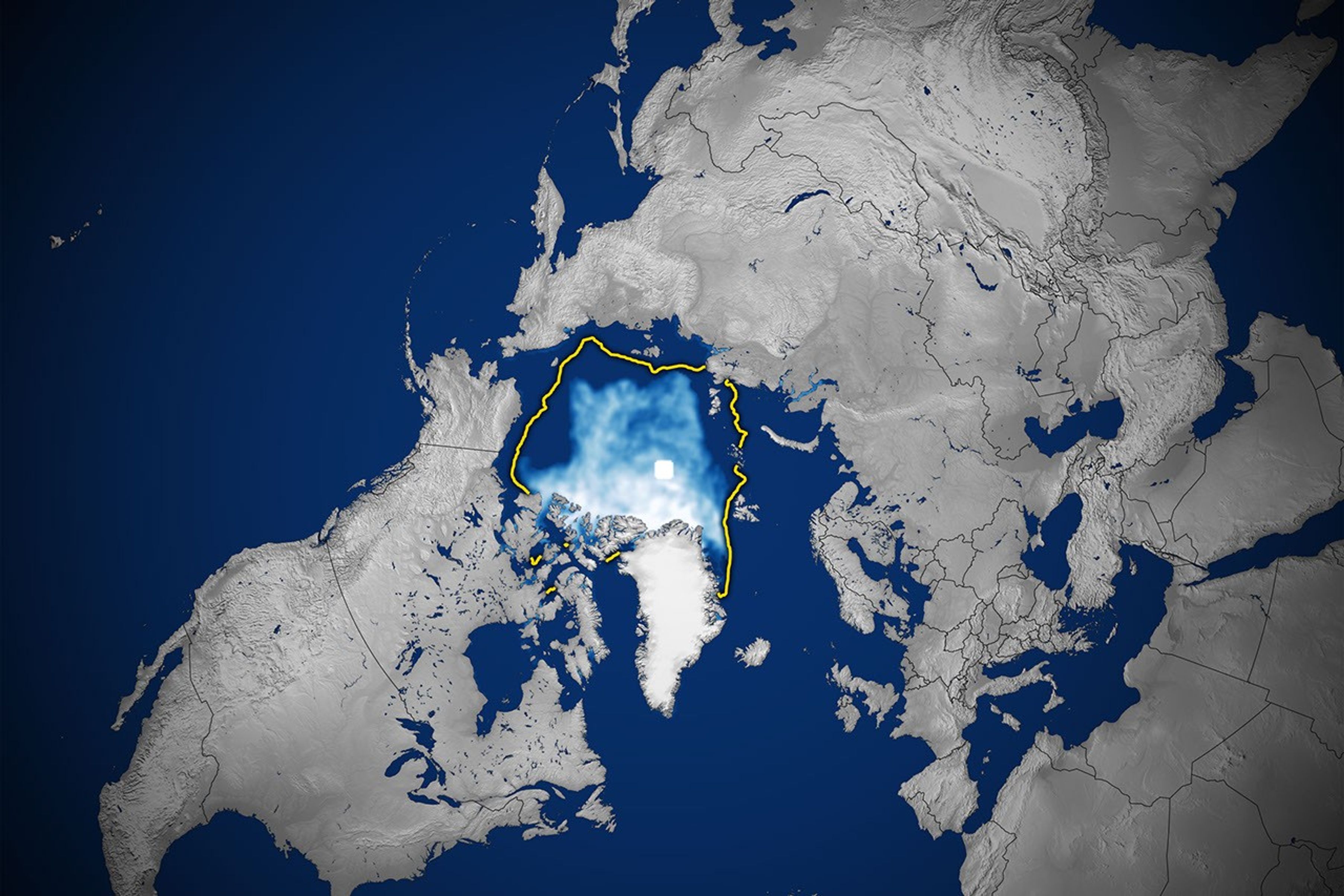
航天图片资料 · A map of the shows sea ice in September 2026 covering a smaller area than the 1981–2010 median, which is outlined in yellow.
A map of the shows sea ice in September 2026 covering a smaller area than the 1981–2010 median, which is outlined in yellow.
资料最后更新时间:
- 图像 SHA-256 校验编号
- 1e1255e032ba4b566d33729dfbe1d10afb4cb7154049765e30516afb66a8bdff
- 来源署名
- NASA
- 原始许可标注
- NASA Image and Media Guidelines
- 图像宽度(像素)
- 3610
- 图像高度(像素)
- 2406
- 原始许可链接
- https://www.nasa.gov/nasa-brand-center/images-and-media/
原始图注:
A map of the shows sea ice in September 2026 covering a smaller area than the 1981–2010 median, which is outlined in yellow.

图像 SHA-256 校验编号:1e1255e032ba4b566d33729dfbe1d10afb4cb7154049765e30516afb66a8bdff
来源署名:NASA
原始许可标注:NASA Image and Media Guidelines
图像宽度(像素):3610
图像高度(像素):2406
原始许可链接:https://www.nasa.gov/nasa-brand-center/images-and-media/